Oak Island (North Carolina)
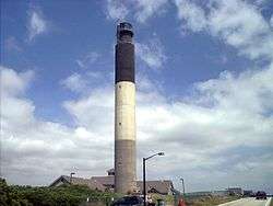
Oak Island is a barrier island on the Atlantic coast of southeastern North Carolina in Smithville Township, Brunswick County. The island contains the towns of Oak Island and Caswell Beach as well as the North Carolina Baptist Assembly and a United States Coast Guard station, which is home to the Oak Island Lighthouse. Although the area has been called Oak Island since colonial times, it only became a true island with the construction of the Intracoastal Waterway. It is about 12 miles long and averages about one mile wide; roughly 8000 people live on the island year-round, which can balloon up to 40,000 during the summer.
History
It is believed that Native American tribes used Oak Island as fishing grounds before the arrival of Europeans. The first permanent buildings on the island were at Fort Caswell, which was built in the 1830s.[1] The site was occupied by Confederate troops in the Civil War, and later by both the U.S. Army and U.S. Navy until the end of World War II; this property would later become the N.C. Baptist Assembly. In the 1930s, the commercial development of the rest of the island began; the towns of Long Beach and Yaupon Beach were incorporated in 1955 (Caswell Beach incorporated 20 years later). One year earlier, Hurricane Hazel struck the town with a direct hit; most of the vacation homes along the beach were destroyed. The island quickly recovered and tourism remains the main industry; construction continues on the island at a rapid rate, in spite of facing other hardships such as hurricanes like Fran and Floyd, and being cut off from the mainland for a short time after a barge destroyed the island's original pontoon bridge.
Communities
Italics denote former communities consolidated into the town of Oak Island in 1999.
References
- ↑ "History of Oak Island" in Oak Island, North Carolina website. Retrieved May 9, 2008.
External links
Coordinates: 33°54′49″N 78°06′40″W / 33.9137°N 78.1111°W