Nylsvley Nature Reserve
| Nylsvley Nature Reserve | |
|---|---|
|
IUCN category IV (habitat/species management area) | |
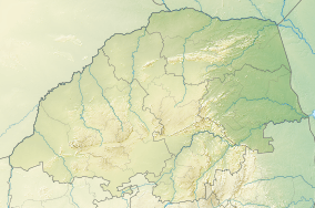 Location within Limpopo | |
| Location | Limpopo Province, South Africa |
| Nearest city | Mookgophong |
| Coordinates | 24°39′17″S 28°41′28″E / 24.6548°S 28.691°ECoordinates: 24°39′17″S 28°41′28″E / 24.6548°S 28.691°E[1] |
| Area | 40 km2 (15 sq mi) |
Nylsvley Nature Reserve is a 40 km2 (15 sq mi) protected area, lying on the seasonally-inundated floodplain of the Nyl River, the uppermost section of the Mogalakwena River which has a very shallow gradient. It is located near Mookgophong in the Limpopo Province of South Africa. This area has been declared a Ramsar wetland site because of its international conservation importance. The floodplain is made up of extensive reedbeds and grassveld surrounded by open woodland.
Situated in the upper catchment area of the Nyl River, and covering about 20% of the floodplain, the area boasts some 370 bird species - of which more than 100 are waterfowl - and during peak floods, over 80,000 birds are to be seen. The reserve is also home to roan antelope and tsessebe. The only stands of wild rice in South Africa, Oryza longistaminata, are to be found here.
The name 'Nylsvley' originated in vlei, a pan or seasonally flooded area, and in the word for "Nile". In the 1860s, a Voortrekker group of farmers saw a large flooded plain and a river flowing northwards and thought it might be the Nylrivier (Nile river).[2]
Pictures
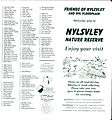 Nylsvley Brochure pg 1
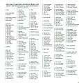 Nylsvley Brochure pg 2
 Nylsvley Brochure pg 3
 Nylsvley Brochure pg 4
References
- ↑ "Nylsvley Nature Reserve". protectedplanet.net.
- ↑ Nylsvlei Nature Reserve