Numata, Gunma
| Numata 沼田市 | |||
|---|---|---|---|
| City | |||
|
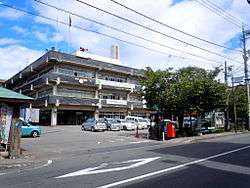
Numata city hall | |||
| |||
 Location of Numata in Gunma Prefecture | |||
 Numata
| |||
| Coordinates: 36°38′45.7″N 139°2′39″E / 36.646028°N 139.04417°ECoordinates: 36°38′45.7″N 139°2′39″E / 36.646028°N 139.04417°E | |||
| Country | Japan | ||
| Region | Kantō | ||
| Prefecture | Gunma Prefecture | ||
| Area | |||
| • Total | 443.46 km2 (171.22 sq mi) | ||
| Population (February 2015) | |||
| • Total | 48,840 | ||
| • Density | 110/km2 (300/sq mi) | ||
| Time zone | Japan Standard Time (UTC+9) | ||
| - Tree | Sakura | ||
| - Flower | Chinese bellflower | ||
| Phone number | 0278-23-2111 | ||
| Address | Nishikurauchi-machi 780, Numata-shi, Gunma-ken 378-8501 | ||
| Website | Official website | ||


Numata (沼田市 Numata-shi) is a city located in northern Gunma Prefecture in the northern Kantō region of Japan. As of February 2015, the city had an estimated population of 48,840 and a population density of 110 persons per km². Its total area was 443.46 km², making it the largest city in terms of area within Gunma Prefecture. (The neighboring town of Minakami is the largest municipality in terms of area within Gunma.)
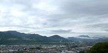
Geography
Numata is located in northern of Gunma Prefecture.
- Mountains: Kesamaruyama (1961m), Mount Akagi (1828m)
- Rivers: Tone River, Katashina River
Surrounding municipalities
History
Numata developed during the Sengoku period as a castle town surrounding Numata Castle, a stronghold in Kōzuke Province contested by the Uesugi, Takeda, Late Hōjō and Sanada clans. During the Edo period, the area of present-day Numata was the center of the Numata Domain, a feudal domain under the Tokugawa shogunate.
Modern Numata Town was created within Tone District, Gunma Prefecture on April 1, 1889 with the creation of the municipalities system after the Meiji Restoration. On March 1, 1954, Numata merged with neighboring Tonami, Ikeda, Usune and Kawada villages, and was raised to city status. On February 13 2005 the villages of Shirasawa and Tone were incorporated into Numata. [1]
Economy
Numata is a regional commercial center and transportation hub, but was traditionally known for lumber production.
Education
Elementary schools
- Numata Elementary School
- Numata Higashi Elementary School
- Numata Kita Elementary School
- Masugata Elementary School
- Tonami Higashi Elementary School
- Ikeda Elementary School
- Usune Elementary School
- Kawada Elementary School
- Shirasawa Elementary School
- Tone Azuma Elementary School
- Hiragawa Elementary School
- Tone Nishi Elementary School
- Tana Elementary School
Middle schools
- Numata Middle School
- Numata Minami Middle School
- Numata Nishi Middle School
- Numata Higashi Middle School
- Ikeda Middle School
- Usune Middle School
- Shirasawa Middle School
- Tone Middle School
- Tana Middle School
High schools
Transportation
Railway
Highway
- Kan-Etsu Expressway – Numata IC
- Japan National Route 17
- Japan National Route 120
- Japan National Route 145
- Japan National Route 291
Local attractions
- Site of Numata Castle
- Fukiware Falls
- Oigami Onsen
- Tambara Ski Park
- Tamahara Dam
Sister-city relations
-
 Shimoda, Shizuoka, Japan, since May 1966
 -
 Füssen, Bavaria, Germany since September 1995
Noted people from Numata
- Koji Omi – politician
- Tochiakagi Takanori – sumo wrestler
References
- ↑ "The Outline of City Numata". Retrieved 2006-12-22.
External links
![]() Media related to Numata, Gunma at Wikimedia Commons
Media related to Numata, Gunma at Wikimedia Commons
-
 Numata travel guide from Wikivoyage
 - Official website (Japanese)
| Core cities | ||
|---|---|---|
| Special cities | ||
| Cities | ||
| Agatsuma District | ||
| Kanra District | ||
| Kitagunma District | ||
| Ōra District | ||
| Sawa District | ||
| Tano District | ||
| Tone District | ||