Nowshera (Srinagar)
| Nowshera | |
|---|---|
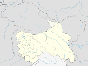 Nowshera  Nowshera Location in Jammu and Kashmir, India | |
| Coordinates: 34°07′48″N 74°48′19″E / 34.129977°N 74.805308°ECoordinates: 34°07′48″N 74°48′19″E / 34.129977°N 74.805308°E | |
| District | Srinagar district |
| Settled | Ancient |
| Elevation | 1,592 m (5,223 ft) |
| Languages | |
| • Official | Urdu, Kashmiri |
| Time zone | IST (UTC+5:30) |
| PIN | 190011 |
| Distance from Delhi | 857 kilometres (533 mi)[1] |
| Distance from Mumbai | 2,182.4 kilometres (1,356.1 mi)[2] |
Nowshera is the notified area in the municipal committee of Srinagar, in the Indian administered state of Jammu and Kashmir. It is one of the oldest resedential places in Srinagar founded by Zain-ul-Abidin. It is located about 9.9 km towards North from the commercial center of Kashmir.[3][4]
History
The history of Nowshera dates back to the time of Zainul Abideen who established and settled the area as the capital of Kashmir Valley.[5] The ruins of that capital city can be still traced today. Most of the residential places are quite old fashioned and date back to the time when people at the first place settled here similar to one's in Downtown Srinagar.
Geography
Nowshera is located 34°07′48″N 74°48′19″E / 34.129977°N 74.805308°E 9.9 km towards North from District headquarters in Srinagar. The area is bounded by Soura towards North, Zadibal towards South, Lal Bazar towards East and Zanimar towards West.[6]
See also
References
- ↑ "distance between Nowshera and New Delhi". Retrieved 12 December 2014.
- ↑ "distance between Nowshera and Mumbai". Retrieved 12 December 2014.
- ↑ "srinagar.nic.in". Retrieved 12 December 2014.
- ↑ "google maps". Retrieved 12 December 2014.
- ↑ "srinagar.nic.in". Retrieved 12 December 2014.
- ↑ "googlemaps". Retrieved 12 December 2014.