Novoslobidka
| Novoslobidka Новослобідка | |
|---|---|
| Village | |
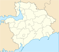 Novoslobidka Location of Novoslobidka in Zaporizhia Oblast | |
| Coordinates: UA 47°48′42″N 35°00′25″E / 47.81167°N 35.00694°ECoordinates: UA 47°48′42″N 35°00′25″E / 47.81167°N 35.00694°E | |
| Country |
|
| Province | Zaporizhia Oblast |
| District | Zaporizhia Raion |
| Council | Dolynske Rural Council |
| Founded | 1859 |
| Area | |
| • Total | 19.26 km2 (7.44 sq mi) |
| Elevation[1] | 57 m (187 ft) |
| Population (2001) | |
| • Total | 548 |
| • Density | 28/km2 (74/sq mi) |
| Time zone | EET (UTC+2) |
| • Summer (DST) | EEST (UTC+3) |
| Postal code | 70423 |
| Area code | +380 612 |
| Website | http://rada.gov.ua/ |
Novoslobidka (Ukrainian: Новослобідка; literally, New Sloboda) is a village (a selo) in the Zaporizhia Raion (district) of Zaporizhia Oblast in southern Ukraine. Its population was 548 in the 2001 Ukrainian Census.[2]
The settlement was first founded in 1859 as Rosengarten (Ukrainian: Розенгартен) by German-speaking Mennonites settling the Chortitza Colony;[3] it was renamed to Novoslobidka in 1920.[2] Administratively, it belongs to the Dolynske Rural Council, a local government area.[2] It is located west of the Khortytskyi District of the city of Zaporizhia, the oblast's administrative center.
See also
References
- ↑ "Novoslobidka (Zaporizhia Oblast, Zaporizhia Raion)". weather.in.ua. Retrieved 1 April 2015.
- 1 2 3 "Novoslobidka, Zaporizhia Oblast, Zaporizhia Raion". Regions of Ukraine and their Structure (in Ukrainian). Verkhovna Rada of Ukraine. Retrieved 1 April 2015.
- ↑ "Chortitza Kolonie (1789-1943)". Mennonitische Geschichte und Ahnenforschung (in German). 2008. Retrieved 1 April 2015.
| Urban-type settlements | ||
|---|---|---|
| Villages |
| |
| Rural settlements | ||
This article is issued from Wikipedia - version of the 5/6/2016. The text is available under the Creative Commons Attribution/Share Alike but additional terms may apply for the media files.