Norwood Park Township, Cook County, Illinois
| Norwood Park Township | |
|---|---|
| Township | |
 Location in Cook County | |
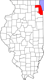 Cook County's location in Illinois | |
| Coordinates: 41°58′06″N 87°49′04″W / 41.96833°N 87.81778°WCoordinates: 41°58′06″N 87°49′04″W / 41.96833°N 87.81778°W | |
| Country | United States |
| State | Illinois |
| County | Cook |
| Area | |
| • Total | 3.67 sq mi (9.51 km2) |
| • Land | 3.67 sq mi (9.51 km2) |
| • Water | 0 sq mi (0 km2) 0% |
| Elevation | 650 ft (198 m) |
| Population (2010) | |
| • Total | 26,385 |
| • Density | 7,186/sq mi (2,774.4/km2) |
| Time zone | CST (UTC-6) |
| • Summer (DST) | CDT (UTC-5) |
| ZIP codes | 60068, 60631, 60656, 60706 |
| GNIS feature ID | 0429467 |
Norwood Park Township is one of 29 townships in Cook County, Illinois, USA. As of the 2010 census, its population was 26,385.[1]
Geography
According to the United States Census Bureau, Norwood Park Township covers an area of 3.67 square miles (9.5 km2).
Zip code is 60631
Cities, towns, villages
- Harwood Heights
- Norridge
- Park Ridge (southeast edge)
Adjacent townships
- Leyden Township (southwest)
- Maine Township (northwest)
Cemeteries
The township contains these two cemeteries: Acacia Park and Westlawn Jewish.
Major highways
Political districts
- Illinois's 5th congressional district
- Illinois's 9th congressional district
- State House District 19
- State House District 20
- State House District 65
- State Senate District 10
- State Senate District 33
References
- "Norwood Park Township, Cook County, Illinois". Geographic Names Information System. United States Geological Survey. Retrieved 2010-01-10.
- United States Census Bureau 2007 TIGER/Line Shapefiles
- United States National Atlas
- ↑ "Geographic Identifiers: 2010 Demographic Profile Data (DP-1): Norwood Park township, Cook County, Illinois". U.S. Census Bureau, American Factfinder. Retrieved March 21, 2013.
External links
This article is issued from Wikipedia - version of the 11/17/2016. The text is available under the Creative Commons Attribution/Share Alike but additional terms may apply for the media files.