Northumberland Coalfield
The Northumberland Coalfield is a coalfield in north-east England. It is continuous with the Durham Coalfield to its south.[1] It extends from Shilbottle in the north to the boundary with County Durham along the River Tyne in the south, beyond which is the Durham Coalfield.[2]
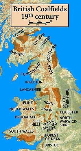
The two contiguous coalfield areas were often referred to as the Durham and Northumberland Coalfield(s) or as the Great Northern Coalfield.[3]
Coal seams
The following coal seams are recorded from the Northumberland Coalfield. They are listed here in stratigraphic order with the youngest at the top and the oldest/deepest at the bottom.[4] Not all seams are named and not all occur at any one locality.
Pennine Coal Measures Group
Upper Coal Measures
- Killingworth
- West Moor
- Top Hebburn Fell
- Bottom Hebburn Fell
- Usworth
Middle Coal Measures
- Burradon
- Rowlington
- Top Ryhope Five-Quarter
- Bottom Ryhope Five-Quarter
- Ryhope Little
- Top Moorland
- Bottom Moorland
- Ashington
- High Main
- Metal
- Five-Quarter
- Bentinck
- Yard
- Top Bensham
- Bottom Bensham
- Top Durham Low Main
- Bottom Durham Low Main
- Northumberland Low Main
- Broomhill Main
- Top Plessey
- Plessey
- Bottom Plessey
Lower Coal Measures
- Beaumont
- Bottom Beaumont
- Top Tilley
- Tilley
- Bottom Tilley
- Top Busty
- Bottom Busty
- Three-Quarter
- Stobswood New
- Brockwell
- Victoria
- Stobswood
- Marshall Green
- Ganister Clay
- Gubeon
- Saltwick
Yoredale Group
Stainmore Formation (Namurian)
- Stanton
- Top Netherwitton
- Bottom Netherwitton
- Top Coatyards
- Bottom Coatyards
- Little Limestone
Alston Formation (Visean)
- Parrot
- Townhead
- Shilbottle (Acre)
- Beadnell
- Greenses
- Blackhill
- Main
References
- ↑ The NorthumberlandCoalfield, Coalmining History Research Centre, retrieved 2010-12-05
- ↑ British Geological Survey 2007 Bedrock geology: UK North 1:625,000 scale geological map, BGS, Keyworth, Notts
- ↑ http://www.northumbria.ac.uk/sd/central/its/uni_press/catalogue/hist/gnc_bm/
- ↑ British Geological Survey 1:50,000 scale geological map sheet nos 6, 9, 10, 14 (England & Wales series) Alnwick, Rothbury, Newbiggin & Morpeth
Coordinates: 55°09′32″N 1°36′09″W / 55.1589°N 1.6026°W