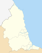
Northumberland
| Northumberland | |||||
|---|---|---|---|---|---|
| County | |||||
| |||||
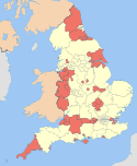
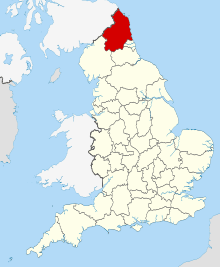 Northumberland in England | |||||
| Coordinates: 55°10′N 2°00′W / 55.167°N 2.000°WCoordinates: 55°10′N 2°00′W / 55.167°N 2.000°W | |||||
| Sovereign state | United Kingdom | ||||
| Country | England | ||||
| Region | North East | ||||
| Established | Ancient | ||||
| Ceremonial county | |||||
| Lord Lieutenant | Jane Percy | ||||
| High Sheriff | Peter Loyd | ||||
| Area | 5,013 km2 (1,936 sq mi) | ||||
| • Ranked | 6th of 48 | ||||
| Population (mid-2014 est.) | 316,300 | ||||
| • Ranked | 44th of 48 | ||||
| Density | 63/km2 (160/sq mi) | ||||
| Ethnicity | 95.4% White British | ||||
| Unitary authority | |||||
| Council | Northumberland County Council | ||||
| Executive | Liberal Democrat (council NOC) | ||||
| Admin HQ | Morpeth | ||||
| Area | 5,014 km2 (1,936 sq mi) | ||||
| • Ranked | 1st of 326 | ||||
| Population | 315,987 | ||||
| • Ranked | 29th of 326 | ||||
| Density | 63/km2 (160/sq mi) | ||||
| ISO 3166-2 | GB-NBL | ||||
| ONS code | 00EM | ||||
| GSS code | E06000048 | ||||
| NUTS | UKC21 | ||||
| Website |
www | ||||
| Members of Parliament | List of MPs | ||||
| Police | Northumbria Police | ||||
| Time zone | GMT (UTC) | ||||
| • Summer (DST) | BST (UTC+1) | ||||
Northumberland (RP pronunciation /nɔːˈθʌmbələnd/[1] local /nɔːˈθʊmbələnd/) is a county in North East England. The northernmost county of England, it borders Cumbria to the west, County Durham and Tyne and Wear to the south and Scotland to the north. To the east is the North Sea coastline with a 64-mile (103 km) long distance path.[2] The county town is Alnwick[3] although the county council is in Morpeth[4] (for the moment, as there are plans to move it to nearby Ashington[5]). The northernmost point of Northumberland and England is at Marshall Meadows Bay.
The county of Northumberland included Newcastle upon Tyne until 1400, when the city became a county of itself.[6] Northumberland expanded greatly in the Tudor period, annexing Berwick-upon-Tweed in 1482, Tynedale in 1495, Tynemouth in 1536, Redesdale around 1542 and Hexhamshire in 1572.[7] Islandshire, Bedlingtonshire and Norhamshire were incorporated into Northumberland in 1844.[8] Tynemouth and other settlements in North Tyneside were transferred to Tyne and Wear in 1974 under the Local Government Act 1972.
Lying on the Anglo-Scottish border, Northumberland has been the site of a number of battles. The county is noted for its undeveloped landscape of high moorland, now largely protected as the Northumberland National Park. Northumberland is the most sparsely populated county in England, with only 62 people per square kilometre.
History
The area now constituting the county once formed part of the Roman Empire; later, as Northumberland, it witnessed much conflict between England and Scotland. As evidence of its violent history, Northumberland has more castles than any other county in England,[9] including those of Alnwick, Bamburgh, Dunstanburgh, Newcastle and Warkworth.
Northumberland has a rich prehistory with many instances of rock art, hillforts such as Yeavering Bell and stone circles like the Goatstones and Duddo Five Stones. Most of the area was occupied by the Brythonic-Celtic Votadini people, with another large tribe, the Brigantes to the south.
Later, the region of present-day Northumberland formed the core of the Anglian kingdom of Bernicia (from ca. 547), which united with Deira (south of the River Tees) to form the kingdom of Northumbria in the 7th century. The historical boundaries of Northumbria under King Edwin (reigned 616–633) stretched from the Humber in the south to the Forth in the north, although in 1018 its northern part, between the Tweed and the Forth (including Lothian, the region which contains Edinburgh), was ceded to the Kingdom of Scotland.
Northumberland is often called the "cradle of Christianity" in England, because Christianity flourished on Lindisfarne—a tidal island north of Bamburgh, also called Holy Island—after King Oswald of Northumbria (reigned 634–642) invited monks from Iona to come to convert the English. Lindisfarne saw the production of the Lindisfarne Gospels (ca. 700) and it became the home of St Cuthbert (ca. 634–687, abbot from ca. 665), who is buried in Durham Cathedral.
Bamburgh is the historic capital of Northumberland, the "royal" castle from before the unification of the Kingdoms of England under the monarchs of the House of Wessex in the 10th century.
The Earldom of Northumberland was briefly held by the Scottish royal family by marriage between 1139–1157 and 1215–1217. Scotland relinquished all claims to the region as part of the Treaty of York (1237). The Earls of Northumberland once wielded significant power in English affairs because, as powerful and militaristic Marcher Lords, they had the task of protecting England from Scottish invasion.
Northumberland has a history of revolt and rebellion against the government, as seen in the Rising of the North (1569–1570) against Elizabeth I of England. These revolts were usually led by the Earls of Northumberland, the Percy family. Shakespeare makes one of the Percys, the dashing Harry Hotspur (1364–1403), the hero of his Henry IV, Part 1. The Percys were often aided in conflict by other powerful Northern families such as the Nevilles and the Patchetts; the latter were stripped of all power and titles after the English Civil War of 1642–1651.
After the Restoration of 1660, the county was a centre for Roman Catholicism in England, as well as a focus of Jacobite support. Northumberland was long a wild county, where outlaws and Border Reivers hid from the law. However, the frequent cross-border skirmishes and accompanying local lawlessness largely subsided after the Union of the Crowns of Scotland and England under King James I and VI in 1603.
Northumberland played a key role in the Industrial Revolution from the 18th century on. Many coal mines operated in Northumberland until the widespread closures in the 1970s and 1980s. Collieries operated at Ashington, Bedlington, Blyth, Choppington, Netherton, Ellington and Pegswood. The region's coalfields fuelled industrial expansion in other areas of Britain, and the need to transport the coal from the collieries to the Tyne led to the development of the first railways. Shipbuilding and armaments manufacture were other important industries before the deindustrialisation of the 1980s.
As of 2015 Northumberland remains largely rural. As the least-densely populated county in England, it commands much less influence in British affairs than in times past. In recent years the county has had considerable growth in tourism due to its scenic beauty and the abundant evidence of its historical significance.
Physical geography


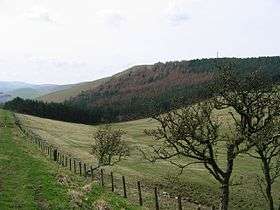
Northumberland has a diverse physical geography. It is low and flat near the North Sea coast and increasingly mountainous toward the northwest. The Cheviot Hills, in the northwest of the county, consist mainly of resistant Devonian granite and andesite lava. A second area of igneous rock underlies the Whin Sill (on which Hadrian's Wall runs), an intrusion of Carboniferous dolerite. Both ridges support a rather bare moorland landscape. Either side of the Whin Sill the county lies on Carboniferous Limestone, giving some areas of karst landscape.[10] Lying off the coast of Northumberland are the Farne Islands, another dolerite outcrop, famous for their bird life.
There are coal fields in the southeast corner of the county, extending along the coastal region north of the river Tyne. The term 'sea coal' likely originated from chunks of coal, found washed up on beaches, that wave action had broken from coastal outcroppings.

Being in the far north of England, above 55° latitude, and having many areas of high land, Northumberland is one of the coldest areas of the country. It has an average annual temperature of 7.1 to 9.3 °C, with the coldest temperatures inland.[11] However, the county lies on the east coast, and has relatively low rainfall, between 466 and 1060 mm annually, with the highest amounts falling on the high land in the west.[12] Between 1971 and 2000 the county averaged 1321 to 1390 hours of sunshine per year.[13]
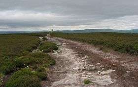
Approximately a quarter of the county is protected as the Northumberland National Park, an area of outstanding landscape that has largely been protected from development and agriculture. The park stretches south from the Scottish border and includes Hadrian's Wall. Most of the park is over 240 metres (800 feet) above sea level. The Northumberland Coast is also a designated Area of Outstanding Natural Beauty.
Natural England recognises the following natural regions, or national character areas, that lie wholly or partially within Northumberland:[14]
- North Northumberland Coastal Plain
- South East Northumberland Coastal Plain
- Cheviot Fringe
- Cheviot Hills
- Northumberland Sandstone Hills
- Mid Northumberland
- Tyne Gap & Hadrian's Wall
- Border Moors & Forests
- Tyne & Wear Lowlands
Ecology
There is a variety of notable habitats and species in Northumberland including: Chillingham Cattle herd; Holy Island; Farne Islands; and Staple Island. Moreover, 50% of England's red squirrel population lives in the Kielder Water and Forest Park along with a large variety of other species including roe deer and wildfowl.
Economy and industry
This is a chart of trend of regional gross value added of Northumberland at current basic prices published (pp. 240–253) by Office for National Statistics with figures in millions of British Pounds Sterling.
| Year | Regional Gross value added[15] | Agriculture[16] | Industry[17] | Services[18] |
|---|---|---|---|---|
| 1995 | 2,585 | 130 | 943 | 1,512 |
| 2000 | 2,773 | 108 | 831 | 1,833 |
| 2003 | 3,470 | 109 | 868 | 2,494 |
Northumberland has a relatively weak economy amongst the counties and other local government areas of the United Kingdom.[19] The county is ranked sixth lowest amongst these 63 council areas. In 2003, 23% of males and 60% of females were earning less than the Council of Europe's decency threshold. As of May 2005 unemployment was at 2.3%, in line with the national average. Between 1999 and 2003 the number of businesses in the county grew 4.4% to 8,225, making 0.45% of registered businesses in Great Britain.
Coal mining in the county goes back to Tudor times. Coal mines continue to operate today; many of them are open cast mines. Planning approval was given in January 2014 for an open cast mine at Halton Lea Gate near Lambley, Northumberland.[20]
A major source of employment and income in the county is tourism. In the early 2000s the county annually received 1.1 million British visitors and 50,000 foreign tourists, who spent a total of £162 million there.
Pharmaceuticals, healthcare and biotechnology
Northumberland's industry is dominated by some world class companies: Coca-Cola, MSD, GE and Drager all have significant facilities in the region.[21] Pharmaceutical, healthcare and emerging medical biotechnology companies form a very significant part of the county's economy.[22] Many of these companies are part of the approx. 11,000 worker[23] Northeast of England Process Industry Cluster (NEPIC) and include Aesica Pharmaceuticals,[24] Covance, MSD, Piramal Healthcare, Procter & Gamble, SCM Pharma,[25] Shasun Pharma Solutions,[26] Specials Laboratory,[27] and Thermo Fisher Scientific. The cluster also includes Cambridge Bioresearch, GlaxoSmithKline, Fujifilm Dyosynth Biotech, Leica Bio, Data Trial, High Force Research, Non-Linear Dynamics, and Immuno Diagnostic Systems (IDS). Newcastle University and Northumbria University are the leading academic institutions nearby. The local industry includes commercial or academic activity in pre-clinical research and development, clinical research and development, pilot-scale manufacturing, full-scale active pharmaceutical ingredient/intermediate manufacturing, formulation, packaging, and distribution.[28] The towns of Alnwick, Cramlington, Morpeth, Prudhoe all have significant pharmaceutical factories and laboratories.[29]
Education
Northumberland has a completely comprehensive education system, with 15 state schools, two academies and one independent school. Like Bedfordshire, it embraced the comprehensive ideal with the three tier system of lower/middle/upper schools with large school year sizes (often around 300). This eliminated choice of school in most areas: instead of having two secondary schools in one town, one school became a middle school and another became an upper school. A programme introduced in 2006 known as Putting the Learner First has eliminated this structure in the former areas of Blyth Valley and Wansbeck, where two-tier education has been introduced. Although the two processes are not officially connected, the introduction of two tiers has coincided with the move to build academy schools in Blyth, with Bede Academy and in Ashington at Hirst. One response to these changes has been the decision of Ponteland High School to apply for Trust status.
Cramlington Learning Village has almost 400 pupils in each school year; making it one of the largest schools in England. The Blyth Academy in south east Northumberland can hold 1500 students throughout the building. Astley Community High School in Seaton Delaval, which accepts students from Seaton Deleval, Seaton Sluice and Blyth, has been the subject of controversial remarks from politicians claiming it would no longer be viable once Bede Academy opened in Blyth, a claim strongly disputed by the headteacher. Haydon Bridge High School, in rural Northumberland, is claimed to have the largest catchment area of any school in England, reputedly covering an area larger than that encompassed by the M25 motorway around London.
The county of Northumberland is served by one Catholic high school, St Benet Biscop Catholic Academy, which is attended by students from all over the area. Students from Northumberland also attend independent schools such as the Royal Grammar School in Newcastle.
Demographics
At the Census 2001 Northumberland registered a population of 307,190,[30] estimated to be 309,237 in 2003,[31] The 2011 census gave a population of 316,028.[32]
In 2001 there were 130,780 households, 10% of which were all retired, and one third were rented. Northumberland has a very low ethnic minority population at 0.985% of the population, compared to 9.1% for England as a whole. In the 2001 census, 81% of the population reported their religion as Christianity, 0.8% as "other religion", and 12% as having no religion.[33]
Being primarily rural with significant areas of upland, the population density of Northumberland is only 62 persons per square kilometre, giving it the lowest population density in England.
Politics
Northumberland is a unitary authority area and is the largest unitary area in England. The County Council is based in Morpeth.
Like most English shire counties Northumberland had until April 2009 a two-tier system of local government, with one county council and six districts, each with their own district council, responsible for different aspects of local government. These districts were, Blyth Valley, Wansbeck, Castle Morpeth, Tynedale, Alnwick and Berwick-upon-Tweed. The districts were abolished on 1 April 2009, the county council becoming a unitary authority.
Elections for the new unitary authority council took place on 1 May 2008.
Northumberland is included within the North East England European Parliament constituency which is represented by three Members of the European Parliament.
| General Election 2010 : Northumberland | ||||||||
|---|---|---|---|---|---|---|---|---|
| Liberal Democrats | Labour | Conservative | BNP | UKIP | Others | Green | English Democrats | Turnout |
| 50,818 +227 |
48,018 −11,159 |
46,037 +7,515 |
5,598 N/A |
3,882 N/A |
3,401 N/A |
601 −644 |
327 N/A |
158,824 +9,289 |
| Overall Number of seats as of 2010 | ||||||||
|---|---|---|---|---|---|---|---|---|
| Labour | Conservative | Liberal Democrats | BNP | UKIP | Others | Green | English Democrats | |
| 2 | 1 | 1 | 0 | 0 | 0 | 0 | 0 | |
Culture
Northumberland has traditions not found elsewhere in England. These include the rapper sword dance, the Clog dance and the Northumbrian smallpipe, a sweet chamber instrument, quite unlike the Scottish bagpipe. Northumberland also has its own tartan or check, sometimes referred to in Scotland as the Shepherd's Tartan. Traditional Northumberland music has more similarity to Lowland Scottish and Irish music than it does to that of other parts of England, reflecting the strong historical links between Northumbria and the Lowlands of Scotland, and the large Irish population on Tyneside.
The Border ballads of the region have been famous since late mediaeval times. Thomas Percy, whose celebrated Reliques of Ancient English Poetry appeared in 1765, states that most of the minstrels who sang the Border ballads in London and elsewhere in the 15th and 16th centuries belonged to the North. The activities of Sir Walter Scott and others in the 19th century gave the ballads an even wider popularity. William Morris considered them to be the greatest poems in the language, while Algernon Charles Swinburne knew virtually all of them by heart.
One of the best-known is the stirring Chevy Chase, which tells of the Earl of Northumberland's vow to hunt for three days across the Border 'maugre the doughty Douglas'. Of it, the Elizabethan courtier, soldier and poet Sir Philip Sidney famously said: 'I never heard the old song of Percy and Douglas that I found not my heart moved more than with a trumpet'. Ben Jonson said that he would give all his works to have written Chevy Chase.
Overall the culture of Northumberland, as with the north east of England in general, has much more in common with Scottish Lowland and Northern English culture than with that of Southern England. One reason is that both regions have their cultural origins in the old Anglian Kingdom of Northumbria, a fact borne out by the linguistic links between the two regions. These include many Old English words not found in other forms of Modern English, such as bairn for child (see Scots language and Northumbria).[34][35] The other reason for the close cultural links is the clear pattern of net southward migration. There are more Scots in England than English people north of the border. Much of this movement is cross-county rather than distant migration, and the incomers thus bring aspects of their culture as well as reinforce shared cultural traits from both sides of the Anglo-Scottish border.
Whatever the case, the lands just north or south of the border have long shared certain aspects of history and heritage; it is thus thought by some that the Anglo-Scottish border is largely political rather than cultural.[35][36]
Attempts to raise the level of awareness of Northumberland culture have also started, with the formation of a Northumbrian Language Society to preserve the unique dialects (Pitmatic and other Northumbrian dialects) of this region, as well as to promote home-grown talent.[34][35]
Northumberland's county flower is the Bloody Cranesbill (Geranium sanguineum) and her affiliated Royal Navy ship is her namesake, HMS Northumberland.
Flag
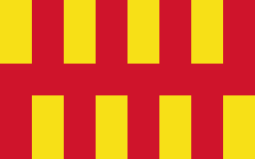
Northumberland has its own flag, which is a banner of the arms of Northumberland County Council. The shield of arms is in turn based on the arms medieval heralds had attributed to the Kingdom of Bernicia (which the first County Council used until was granted its own arms). The Bernician arms were fictional but inspired by Bede's brief description of a flag used on the tomb of St Oswald in the 7th century.[37]
The current arms were granted to the county council in 1951, and adopted as the flag of Northumberland in 1995.[38]
Media
Having no large population centres, the county's mainstream media outlets are served from nearby Tyne and Wear, including radio stations and television channels (such as BBC Look North, BBC Radio Newcastle, Tyne Tees Television and Metro Radio), along with the majority of daily newspapers covering the area (The Journal, Evening Chronicle). It is worth remembering however that although Northumberland, like many administrative areas in England, has been shorn of its geographical regional centre, that centre – Newcastle upon Tyne – remains an essential element within the entity we know as Northumberland. Newcastle's newspapers are as widely read in its Northumbrian hinterland as any of those of the wider county: the Northumberland Gazette, Morpeth Herald, Berwick Advertiser, Hexham Courant and the News Post Leader.
Lionheart Radio, a community radio station based in Alnwick, has recently been awarded a five-year community broadcasting licence by OFCOM. Radio Borders covers Berwick and the rural north of the county.
People
Famous people born in Northumberland
Ashington was the birthplace of the three famous footballers Bobby and Jack Charlton in 1937 and 1935 respectively; and Jackie Milburn previously in 1924. In 1978 Steve Harmison, an international cricketer was born here.
Mickley was the birthplace of Thomas Bewick, an artist, wood engraver and naturalist in 1753 and Bob Stokoe, a footballer and F.A. Cup winning manager (with Sunderland in 1973) born 1930.
Other notable births include:
- Thomas Addison, a physician born at Longbenton in 1793
- George Airy, an astronomer and geophysicist born at Alnwick in 1802
- Alexander Armstrong, a comedy actor born at Rothbury in 1970
- Lancelot 'Capability' Brown, landscape and garden designer born at Kirkharle in 1715
- Josephine Butler, social reformer born at Milfield in 1828
- Basil Bunting, a poet born at Scotswood-on-Tyne in 1900
- Eric Burdon, singer and leader of The Animals and War born at Walker-on-Tyne in 1941
- Cuthbert Collingwood, Ist Baron Collingwood born at Newcastle upon Tyne in 1748
- Grace Darling, a heroine born at Bamburgh in 1815
- Pete Doherty, a musician born at Hexham in 1979
- Bryan Donkin, an engineer and industrialist born at Sandhoe in 1768
- Wilfrid Wilson Gibson, a poet born at Hexham in 1878
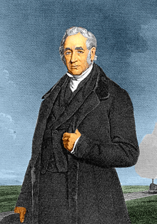
- Daniel Gooch, an engineer and politician born at Bedlington in 1816
- Sir Alistair Graham (1942–), noted public figure
- Tom Graveney, former England cricketer and President of the Marylebone Cricket Club 2004/5, born in Riding Mill in 1927.
- Robson Green, an actor and singer born at Hexham in 1964
- Charles Grey, 2nd Earl Grey, British Prime Minister born at the family seat of Howick Hall in 1764
- Jean Heywood actress born at Blyth best known for Our Day Out and All Creatures Great and Small.
- Marie Lebour (1876–1971), British marine biologist
- Matt Ridley, a journalist, writer, and businessman, and son of Viscount Ridley
- John Rushworth (1793–1860), an historian born at Acklington Park, Warkworth
- George Stephenson, an engineer born at Wylam in 1781
- Trevor Steven, footballer born in Berwick-upon-Tweed in 1963
- Percival Stockdale, poet and abolitionist
- Ross Noble, a stand-up comedian born and raised in Cramlington in the 1970s and 1980s
- Hugh Trevor-Roper (1914–2003), an historian, born at Glanton
- William Turner, ornithologist and botanist born at Morpeth in 1508
- Sid Waddell, a sports commentator and children's television screenwriter born at Alnwick in 1940
- Veronica Wedgwood (1910–1997), an historian, usually published as C. V. Wedgwood
- The Rt Rev Dr N. T. Wright, Anglican theologian and author, born in Morpeth in 1948
- Gordon Dodds (1941–2010), Provincial Archivist of Manitoba and author, born in Wideopen
- Kevin Whately, actor born in Humshaugh, near Hexham in 1951.
- Richard Pattison, climber born in Ashington in 1975.
Famous people linked with Northumberland
- Charles Algernon Parsons, inventor of the steam turbine while living in Wylam, Northumberland
- Thomas Burt, one of the first working-class members of parliament and was secretary of the Northumberland Miners' Association in 1863
- Matthew Festing, 79th Grand Master, the Order of Malta.
- Mark Knopfler, guitarist and frontman of Dire Straits, was raised in his mother's hometown of Blyth, Northumberland.
- Gordon Sumner, better known by his stage name of Sting, a schoolteacher turned musician was born in Newcastle upon Tyne in 1951
- Henry 'Hotspur' Percy (1365–1403), borders warlord and rebel
- Billy Pigg, a 20th-century musician who was vice-President of the Northumbrian Pipers Society
- Alan Shearer footballer, lives in Ponteland.
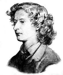
- Algernon Charles Swinburne, a poet raised at Capheaton Hall
- Kathryn Tickell, a modern-day player of the Northumbrian smallpipes
- Turner, Thomas Girtin and John Cotman all painted memorable pictures of Northumberland. Turner always tipped his hat towards Norham Castle as the foundation of his fame and fortune.
- Jonny Wilkinson, English rugby player, currently lives in rural Northumberland.
- Ragnar Lodbrok, Legendary Viking leader
- Allan Holdsworth, guitarist, originated from Newcastle upon Tyne before moving to California.
The site contains exhaustive detailed entries for famous deceased Northumbrians.
Settlements
Parishes
NOTE: New parishes have been added since 2001. These are missing from the list.
Although not on this list, the population of Cramlington is estimated at 39,000.
Historic areas
Some settlements which were historically part of the county now fall under the county of Tyne and Wear:
| Tyne and Wear | Killingworth, Longbenton, Newcastle upon Tyne, North Shields, Tynemouth, Wallsend, Whitley Bay |
|---|
Surnames
Most common surnames in Northumberland at the time of the United Kingdom Census of 1881,[40] by order of incidence:
See also
- Northumbria
- Duke of Northumberland
- List of Lord Lieutenants of Northumberland
- List of High Sheriffs of Northumberland
- Custos Rotulorum of Northumberland – List of Keepers of the Rolls
- Northumberland (UK Parliament constituency) – Historical list of MPs for the Northumberland constituency
- List of people from Northumberland by occupation
- List of Parliamentary constituencies in Northumberland
- List of places of interest and tourist attractions in Northumberland
- Northumberland Street, Newcastle upon Tyne, Tyne and Wear
- Anglo-Scottish border
Notes and references
- ↑ Collins English Dictionary
- ↑ "Northumberland Coast Path – LDWA Long Distance Paths". Ldwa.org.uk. Retrieved 15 December 2012.
- ↑ "Alnwick". Northumberland County Council. Retrieved 14 June 2014.
- ↑ Northumberland County Hall moved from Newcastle upon Tyne to Morpeth on 21 April 1981 (see notice in The London Gazette: no. 48579. p. 5337. 10 April 1981.)
- ↑ "Morpeth Town Council hits out at plans to move council headquarters to Ashington". chroniclelive.co.uk. 6 April 2015.
- ↑ "History of Newcastle upon Tyne" (PDF). Local Studies Factsheet No. 6. Newcastle City Council. 2009. p. 2. Retrieved 14 June 2014.
- ↑ Daniell, Christopher (2013). "Tudor Expansion of the County of Northumberland". Atlas of Early Modern Britain, 1485–1715. London: Routledge. p. 5. ISBN 0415729246.
- ↑ "The palatinate of Durham". Durham University Library Special Collections Catalogue. Durham University. Retrieved 14 June 2014.
- ↑ Long, B. (1967). Castles of Northumberland. Newcastle, UK: Harold Hill.
- ↑ Northumberland National Park Authority, n.d. "The topology and climate of Northumberland National Park."
- ↑ Met Office, 2000. "Annual average temperature for the United Kingdom."
- ↑ Met Office, 2000. "Annual average rainfall for the United Kingdom."
- ↑ Met Office, 2000. "Annual average sunshine for the United Kingdom."
- ↑ North East National Character Area map at http://www.naturalengland.org.uk. Accessed on 7 April 2013.
- ↑ Components may not sum to totals due to rounding
- ↑ includes hunting and forestry
- ↑ includes energy and construction
- ↑ includes financial intermediation services indirectly measured
- ↑ Northumberland County Council, 2003 "Northumberland in context.". MS Word, HTML (Google)
- ↑ Hexham Courant 10 January 2014 'Villagers admit defeat after 15 years battling opencast'
- ↑ "The leading companies shaping Northumberland's business landscape". Arch. Archived from the original on 14 December 2012. Retrieved 19 September 2013.
- ↑ "Invest in Northumberland: Key sectors". ARCH. Archived from the original on 14 December 2012. Retrieved 19 September 2013.
- ↑ NEPIC Directory 2013 Pharmaceuticals: Manufacturing Creates Value. Northeast of England Process Industry Cluster. May 2013. p. 33.
- ↑ Aesica Pharmaceuticals
- ↑ SCM Pharma
- ↑ Shasun Pharma Solutions
- ↑ Specials Laboratory
- ↑ "Pharmaceuticals Brochure" (PDF). Northeast of England Process Industry Cluster. Retrieved 19 September 2013.
- ↑ "Invest in the Northumberland business landscape". Arch. Archived from the original on 14 December 2012. Retrieved 19 September 2013.
- ↑ Office for National Statistics, 2003. "Update on 2001 Census figures." (PDF)
- ↑ Office of the Deputy Prime Minister, 2003. "Local Government Finance Settlement 2005/06." (PDF)
- ↑ "Local Authority population 2011". Retrieved 1 July 2015.
- ↑ Office for National Statistics, 2001. "KS07 Religion: Census 2001, Key Statistics for local Authorities."
- 1 2 "North East England History Pages". Northeastengland.talktalk.net. Retrieved 25 September 2010.
- 1 2 3 "Northumbrian Language Society". Northumbriana.org.uk. Retrieved 25 September 2010.
- ↑ "Lowlands-L • a discussion group for people who share an interest in languages and cultures of the Lowlands". Lowlands-l.net. Retrieved 25 September 2010.
- ↑ Bede's Ecclesiastical History of the English People, Book III, Ch. 11: "And to furnish a lasting memorial of the royal saint, they hung the King's banner of purple and gold over his tomb."
- ↑ "The Northumberland Flag Northumberland Northumbria England UK GB (page 113)". Web.archive.org. 24 June 2005. Archived from the original on 24 June 2005. Retrieved 25 September 2010.
- ↑ Neighbourhood Statistics. "Office for National Statistics". Neighbourhood Statistics. Retrieved 25 September 2010.
- ↑ Most Common Surnames in Northumberland
Bibliography
- Sharp, Thomas (1937). Northumberland and Durham – a Shell Guide. B.T. Batsford.
- Tomlinson, W.W. (1968) [1888]. Comprehensive guide to the county of Northumberland. Trowbridge: Redwood.
- Thompson, Barbara; Norderhaug, Jennifer (2006). Walking the Northumberland Dales: Hadrian's Wall Country. Sigma Press. ISBN 1-85058-838-4.
External links
| Wikimedia Commons has media related to Northumberland. |
- Northumberland at DMOZ
- Northumberland County Council
- Visit Northumberland – The Official Visitor Site
- Enjoy Northumberland
- Images of Northumberland at the English Heritage Archive
North East England Portal | |
| Unitary authorities | |
| Major settlements | |
| Topics | |