Line Islands
Coordinates: 2°00′S 156°30′W / 2°S 156.5°W
| Geography | |
|---|---|
| Location | Pacific Ocean |
| Administration | |
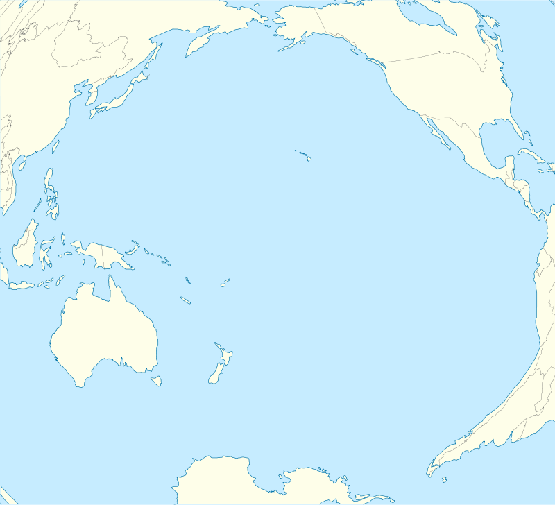

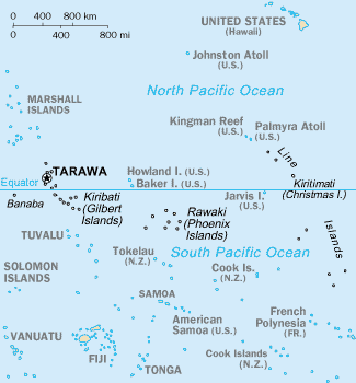
The Line Islands, Teraina Islands or Equatorial Islands, is a chain of eleven atolls and low coral islands in the central Pacific Ocean, south of the Hawaiian Islands, that stretches for 2,350 kilometres (1,460 miles) in a northwest–southeast direction, making it one of the longest island chains of the world. Eight of the islands form part of Kiribati, while the remaining three are United States territories grouped with the United States Minor Outlying Islands.
Overview
Those that are part of Kiribati are in the world's farthest forward time zone, UTC+14:00. The time of day is the same as in the U.S. state of Hawaiʻi, but the date is one day ahead. The time is 1 day and 2 hours ahead of some other islands in Oceania like Baker Island, which uses UTC−12:00.
The islands of Fanning and Washington were annexed as part of the British Colony of the Gilbert and Ellice Islands in 1916,[1] followed in 1919 by the similar annexation of Christmas Island.[2] However, these annexations were contested by the government of the United States, citing its Guano Islands Act of 1856, which allowed for very wide-ranging territorial claims. The latter claims persisted until relinquished under the Treaty of Tarawa, which recognised Kiribati's sovereignty over the majority of the Line Islands chain. In the meantime, the Line Islands featured briefly in biennial reports furnished by the Colony's resident commissioner to the Colonial Office and Parliament in London (e.g., see the 1966 and 1967 report[3]).
The group is geographically divided into three subgroups; The Northern, Central, and Southern Line Islands. The Central Line Islands are sometimes grouped with the Southern Line Islands. The table below lists the islands from North to South.
List of atolls, islands and reefs
* The lagoon areas marked with an asterisk are contained within the island areas of the previous column because they are, unlike in the case of a typical atoll, inland waters completely sealed off from the sea.
Kiritimati is the largest atoll in the world in terms of land area. The islands were annexed by the UK in 1888 with a view to laying the Pacific cable, with Tabuaeran (then Fanning Island) as a relay station. The cable was laid and was operational between 1902 and 1963 except for a short period in 1914.
Copra and "Petfish" are the main export products (with seaweed).
References
- ↑ Order in Council Annexing the Ocean, Fanning, and Washington islands to the Gilbert and Ellice Islands Colony, 1916
- ↑ Order in Council under the Colonial Boundaries Act, 1895, Annexing Christmas Island to the Gilbert and Ellice Islands Colony, 1919
- ↑ Gilbert and Ellice Islands Colony. (1969). Report for the Years 1966 and 1967. London: Her Majesty’s Stationery Office.
- 1 2 3 4 "Australia-Oceania :: United States Pacific Island Wildlife Refuges". CIA - The World Factbook. US CIA. Retrieved 2012-09-16.
- ↑ "22. Teeraina" (PDF). Office of Te Beretitent - Republic of Kiribati Island Report Series. 2012. Retrieved 28 April 2015.
- 1 2 3 4 5 6 7 "Kiribati 2005 Census of Population and Housing: Provisional Tables" (PDF). Kiribati National Statistics Office. Retrieved 2012-09-16.
- ↑ "21. Tabuaeran" (PDF). Office of Te Beretitent - Republic of Kiribati Island Report Series. 2012. Retrieved 28 April 2015.
- ↑ "20. Kiritimati" (PDF). Office of Te Beretitent - Republic of Kiribati Island Report Series. 2012. Retrieved 28 April 2015.
- ↑ "CIA - The World Factbook -- Kiribati". The World Factbook. US CIA. Retrieved 2012-09-16.
External links
-
 Media related to Line Islands at Wikimedia Commons
| Gilbert Islands |  | |
|---|---|---|
| Phoenix Islands | ||
| Line Islands | ||
| West of Gilberts | ||
| Reefs | ||
| ||