North-Western Province, Zambia
| North-Western | |
|---|---|
| Province | |
 Map of Zambia showing the North-Western Province | |
| Country |
|
| Capital | Solwezi |
| Area | |
| • Total | 125,826 km2 (48,582 sq mi) |
| Population (2015) | |
| • Total | 833,818 |
| • Density | 6.6/km2 (17/sq mi) |
North-Western Province is one of ten Provinces of Zambia. It covers an area of 125,826 km2 (48,582 sq mi), has a population of 727,044 and a population density was 5.80 per square kilometre as of 2010. It is the most sparsely populated province in the country. The provincial capital is Solwezi. The literacy rate stood at 63 per cent against a national average of 70.2 per cent. The rural population constituted 77.45%, while the urban population was 22.55%. North-Western Province is bordered along Angola in the west, the Democratic Republic of Congo (DR Congo) in the north, Copperbelt Province in the southeast, Central in the south, Western Province in the west and Eastern Province in the north east.
Agriculture was the major profession and Sorghum was the major crop in the province with 1,038 metric tonnes, constituting 8.98% of the national output. The unemployment rate was 14 per cent and the general unemployment rate for youth stood at 31 per cent as of 2008. Zambezi Airport is the only airport in the province.
Busanga Swamps and plains in Kafue National Park, West Lunga National Park and Zambezi grasslands in the far west of the state are the major national parks in the Province. The Kufukwila festival celebrated in Solwezi District by Kaonde tribe during May, Insakwa yaba Kaonde festival celebrated in Solwezi District by Kaonde tribe during May and Nsomo festival celebrated in Kasempa District by Kaonde tribe during June are the major festivals of the province.
Geography

North-Western Province is bordered along Angola in the west, DR Congo in the north, Copperbelt Province in the southeast, Central in the south, Western Province in the west and Eastern Province in the north east. The general topography of the province is characterized by uplifted plantation surfaces. The general elevation of the nation as a whole is tended towards West to East from the Kalahari Basin. The level of land falls from the upper Congo towards the Zambezi depression in the South forming a plateau.[1]
The province lies in the watershed between DR Congo and Zambezi river systems. The province along with some of the othe provinces in the country lies in the frontier formed between the continental divide separating the Atlantic Ocean and the Indian Ocean, which traverses from DR Congo to the south of Tanzania. There are three major seasons: a cool dry season from April to August, a hot dry season from August to November and a warm wet season from November to April. The maximum heat is experienced during October, while the maximum rainfall is received during December. The annual rainfall is more than 1,200 mm (47 in) in the region. The region has usually Savannah vegetation and small areas of dry evergreen forests.[2]
| Climate data for North-Western (Zambia) | |||||||||||||
|---|---|---|---|---|---|---|---|---|---|---|---|---|---|
| Month | Jan | Feb | Mar | Apr | May | Jun | Jul | Aug | Sep | Oct | Nov | Dec | Year |
| Record high °C (°F) | 26.3 (79.3) |
26.7 (80.1) |
26.8 (80.2) |
26.9 (80.4) |
26.1 (79) |
25 (77) |
25.2 (77.4) |
27.6 (81.7) |
30.4 (86.7) |
30.6 (87.1) |
28 (82) |
26.4 (79.5) |
30.6 (87.1) |
| Average high °C (°F) | 20 (68) |
20.4 (68.7) |
20.3 (68.5) |
19.8 (67.6) |
17.8 (64) |
15.7 (60.3) |
15.9 (60.6) |
18.5 (65.3) |
21.5 (70.7) |
22.3 (72.1) |
21.1 (70) |
20.2 (68.4) |
22.3 (72.1) |
| Average low °C (°F) | 16.1 (61) |
16 (61) |
15.6 (60.1) |
13.5 (56.3) |
9.2 (48.6) |
5.9 (42.6) |
5.5 (41.9) |
8.2 (46.8) |
11.2 (52.2) |
14.3 (57.7) |
15.7 (60.3) |
16 (61) |
5.5 (41.9) |
| Average precipitation mm (inches) | 24 (0.94) |
21 (0.83) |
19 (0.75) |
8 (0.31) |
1 (0.04) |
0 (0) |
0 (0) |
0 (0) |
1 (0.04) |
6 (0.24) |
17 (0.67) |
24 (0.94) |
121 (4.76) |
| Source: [3] | |||||||||||||
Demographics
| Historical population | ||
|---|---|---|
| Year | Pop. | ±% |
| 1964 | 211,000 | — |
| 1969 | 232,000 | +10.0% |
| 1980 | 544,908 | +134.9% |
| 1990 | 566,433 | +4.0% |
| 2000 | 583,350 | +3.0% |
| 2010 | 727,044 | +24.6% |
| Sources: | ||
As per the 2010 Zambian census, North-Western Province had a population of 727,044 accounting to 5.55% of the total Zambian population of 13,092,666. There were 358,141 males and 368,903 females, making the sex ratio to 1,030 for every 1,000 males, compared to the national average of 1,028.[6] The literacy rate stood at 63.00% against a national average of 70.2%.[7] The rural population constituted 77.45%, while the urban population was 22.55%. The total area of the province was 125,826 sq. km and the population density was 5.80 per sq. km. The population density during 2000 Zambian census stood at 5.80.[8] The decadal population growth of the province was 2.20%. The median age in the province at the time of marriage was 20.5.[9] The average household size was 5.6, with the families headed by females being 4.5 and 5.9 for families headed by men.[10] The total eligible voters in the province was 72.20%.[11] The unemployment rate of the province was 10.30%. The total fertility rate was 6.8, complete birth rate was 6.3, crude birth rate was 38.0, child women population at birth was 870, general fertility rate was 169, gross reproduction rate was 2.7 and net reproduction rate was 1.9.[12] The total labour force constituted 55.50% of the total population. Out of the labour force,60.9% were men and 50.4% women. The annual growth rate of labour force was 1.8%.[13] Bemba was the most spoken language with 49.00% speaking it.[14] Albinism is a condition where the victims do not have any pigment in their skin, hair or eyes. The total population in the province with the condition stood at 1,387.[15] The life expectancy at birth stood at 56 compared to the national average of 51.[16]
National Parks and culture
Busanga Swamps and plains in Kafue National Park, West Lunga National Park and Zambezi grasslands in the far west of the state are the major national parks in the Province. The Kufukwila festival celebrated in Solwezi District by Kaonde tribe during May, Insakwa yaba Kaonde festival celebrated in Solwezi District by Kaonde tribe during May, Nsomo festival celebrated in Kasempa District by Kaonde tribe during June, Ntongo festival celebrated in Mufumbwe District by Kaonde tribe during June, Ukupupa festival celebrated in Solwezi District by Lamba tribe during July, Chivweka festival celebrated in Kabompo District by Luchazi tribe during July, Kunyata Ntanda festival celebrated in Solwezi District by Kaonde tribe during July, Likumbi Lya Mize festival celebrated in Zambezi District by Luvale tribe during August, Lunda Lubanza festival celebrated in Zambezi District by Lunda tribe during August, Lubinda Ntongo festival celebrated in Solwezi District by Kaonde tribe during August, Chisemwa Cha Lunda festival celebrated in Mwinilunga District by Lunda tribe during September, Makundu festival celebrated in Mufumbwe District by Kaonde tribe during September, Mbunda Liyoyelo festival celebrated in Kabompo District by Mbunda tribe during September, Kuvuluka Kishakulu festival celebrated in Solwezi District by Kaonde tribe during September, Lukwakwa festival celebrated in Kabompo District by Mbunda tribe during October, Chidika Cha Mvula festival celebrated in Mwinilunga District by Lunda tribe during October and Lwendela festival celebrated in Kasempa District by Kaonde tribe during October are the major festivals in the Province.[17]
Administration
| Profession[18] | % of working population |
| Agriculture, Forestry & Fishing (by Industry) | 7.30 |
| Community, Social and Personnel | 3.30 |
| Construction | 3.30 |
| Electricity, Gas, and water | 1.30 |
| Financial & Insurance activities | 0.60 |
| Hotels and Restaurants | 4.00 |
| Manufacturing | 2.60 |
| Mining & Quarrying | 3.80 |
| Transportation and Storage | 3.00 |
| Wholesale & Retail Trade | 2.40 |
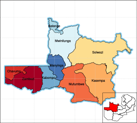
Provincial administration is setup purely for administrative purposes. The province is headed by a minister appointed by the President and there are ministries of central government for each province. The administrative head of the province is the Permanent Secretary, appointed by the President. There are Deputy Premanent Secretary, heads of government departments and civil servants at the provincial level. North-Western Province is divided into nine districts, namely, Chavuma District, Ikelenge District, Kabompo District, Kasempa District, Manyinga District, Mufumbwe District, Mwinilunga District, Solwezi District and Zambezi District. All the district headquarters are the same as the district names. There are nine councils in the province, each of which is headed by a an elected representative, called councilor. Each councilor holds office for three years.[19] The administrative staff of the council is selected based on Local Government Service Commission from within or outside the district. The office of the provincial government is located in each of the district headquarters and has provincial local government officers and auditors. Each council is responsible for raising and collecting local taxes and the budgets of the council are audited and submitted every year after the annual budget. The elected members of the council do not draw salaries, but are paid allowances from the council. North-Western is a predominantly rural province and hence there are no city or municipal councils. The government stipulates 63 different functions for the councils with the majority of them being infrastructure management and local administration. Councils are mandated to maintain each of their community centres, zoos, local parks, drainage system, playgrounds, cemeteries, caravan sites, libraries, museums and art galleries. They also work along with specific government departments for helping in agriculture, conservation of natural resources, postal service, establishing and maintaining hospitals, schools and colleges. The councils prepare schemes that encourage community participation.[20]
Education and economy
| HIV infected & AIDS deaths[21] | ||
|---|---|---|
| Year | HIV infected | AIDS deaths |
| 1985 | 250 | 107 |
| 1990 | 3,104 | 087 |
| 1995 | 15,855 | 655 |
| 2000 | 25,735 | 1,848 |
| 2005 | 27,676 | 2,792 |
| 2010 | 27,815 | 2,859 |
As of 2004, the province had 536 basic schools, 23 high schools and the number of school children out of school in ages between 7 and 15 stood at 536 . The unemployment rate was 14 per cent and the general unemployment rate for youth stood at 31 per cent as of 2008. The province had 25 doctors as of 2005. There were 439 Malaria incidence for every 1,000 people in the province as of 2005 and there were 2,859 AIDS death as of 2010.[22] The total area of crops planted during the year 2014 in the province was 79,528.80 hectares which constituted 4.19% of the total area cultivated in Zambia. The net production stood at 175,592 metric tonnes, which formed 4.31% of the total agricultural production in the country. Sorghum was the major crop in the province with 1,038 metric tonnes, constituting 8.98% of the national output.[23] Zambezi Airport is the only airport in the province.[24][25]
Notes
- ↑ "Geography of Zambia". Zambia Tourism Board. 2011. Retrieved 19 October 2016.
- ↑ Williams, Geoffery J. (2003). "Physical and social geography of Zambia". Africa South of the Sahara 2004. Psychology Press. p. 1995. ISBN 9781857431834.
- ↑ "Weather statistics for North-Western (Zambia)". Norway: Norwegian Meteorological Institute and Norwegian Broadcasting Corporation. 2007. Retrieved 20 October 2016.
- ↑ Census of population and housing, 1969 (PDF) (Report). Lusaka: Central Statistical Office, Republic of Zambia. 1970. pp. A6–7.
- ↑ Summary report for the 2000 Census of population (Report). Lusaka: Central Statistical Office, Republic of Zambia. 2003. p. 6.
- 1 2 Census 2012, p. 7
- ↑ Census 2012, p. 24
- ↑ Census 2012, p. 17
- ↑ Census 2012, pp. 12-13
- ↑ Census 2012, p. 19
- ↑ Census 2012, p. 21
- ↑ Census 2012, p. 44
- ↑ Census 2012, p. 93
- ↑ Census 2012, p. 99
- ↑ Census 2012, p. 78
- ↑ Census 2012, p. 74
- ↑ "Traditional Ceremonies". Ministry of Tourism and Arts, Republic of Zambia. 2011. Retrieved 20 October 2016.
- ↑ "Labour force survey". Central Stastistical Office of Zambia. 2008. Retrieved 17 October 2016.
- ↑ Zambi Public administration Country profile (PDF) (Report). Division for Public Administration and Development Management (DPADM), Department of Economic and Social Affairs (DESA), United Nations. 2004. p. 7. Retrieved 16 October 2016.
- ↑ The local government system in Zambia (PDF) (Report). Common Wealth Local Government Forum. pp. 218–220. Retrieved 16 October 2016.
- ↑ "AIDS and HIV statistics". Central Stastistical Office of Zambia. 2011. Retrieved 17 October 2016.
- ↑ "Atlas Home". Zambia data portal, Central statistical Office of Zambia. 2011. Retrieved 16 October 2016.
- ↑ "Agriculture statistics of Zambia 2014". Central Stastistical Office of Zambia. 2016. Retrieved 17 October 2016.
- ↑ "Airports in Zamiba". The Great Circle Mapper. 2012. Retrieved 18 October 2016.
- ↑ "Code for Trade and Transport Locations". United Nations. 2012. Retrieved 18 October 2016.
References
- Summary report for the 2010 Census of population (PDF) (Report). Lusaka: Central Statistical Office, Republic of Zambia. 2012.
External links
- Paul David Wilkin's Professional and Personal Reflections of the NorthWestern Province of Zambia: 1963-1983
Coordinates: 13°00′S 25°00′E / 13.000°S 25.000°E