North Queensland
| North Queensland Queensland | |
|---|---|
 Queensland's regions | |
| Population | 231,628 (2011)[1] |
| • Density | 2.893849/km2 (7.495034/sq mi) |
| Area | 80,041.5 km2 (30,904.2 sq mi) |
| LGA(s) | Burdekin, Charters Towers, Hinchinbrook, Mackay, Palm Island, Townsville, Cairns |
| State electorate(s) | Whitsunday, Burdekin, Hinchinbrook, Mackay |
| Federal Division(s) | Dawson, Kennedy |
North Queensland or the Northern Region is the northern part of the Australian state of Queensland that lies just south of Far North Queensland. Queensland is a massive state, larger than many countries, and the tropical northern part of it has been historically remote and undeveloped, resulting in a distinctive regional character and identity.
Townsville is the largest urban centre in North Queensland, leading it to be regarded as an unofficial capital. The region has a population of 231,628 and covers 80,041.5 km2 (30,904.2 sq mi).[1]
Geography

There is no official boundary that separates North Queensland from the rest of the state. Unofficially it is usually considered to have a southern border beginning south of the Mackay Region southern boundary, but historically it has been as far south as Rockhampton. To the north is the Far North Queensland region, centred on Cairns and out west is the Gulf Country.
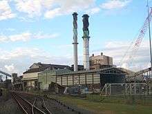
A coastal region centred on its largest settlement is the city of Townsville. The city is the location of a major seaport handling exports from mines in Mount Isa and cattle exports from coastal and inland areas. The region also contains a bulk sugar exporting terminal at Lucinda in the region's north. Mackay is Australia's sugar capital and produces the most sugar in Australia and is shipped at Mackay Harbour. Mackay is also one of Australia's biggest coal exporters as it is close to Queensland's major mines. Dalrymple Bay, south of Mackay is another port where coal and sugar is exported. It also contains the inland city of Charters Towers and the coastal towns of Ayr and Ingham.
Other communities in North Queensland include Home Hill, Sarina, Bowen, Airlie Beach and Proserpine. Abbot Point, north of Bowen, is a large, coal exporting port undergoing significant expansion.
Tourism
The region has a number of significant tourist attractions including the Great Barrier Reef and reef islands, rainforests in the Wet Tropics of Queensland, Eungella, Magnetic Island, the Whitsunday Islands and coastal resort towns such as Airlie Beach. The region has 36 national parks.
History
Captain James Cook passed by the region in 1770, naming several places including Magnetic Island and Cape Cleveland.[2] Alan Cunningham was the first European to explore parts of the region. John Mackay explored the Pioneer Valley near Mackay in 1860.[3]
The first settlement in the region was established at Port Denison in 1861, at what is now known as Bowen.[2] In 1865, the first surveys of what was to become Townsville were conducted.[4] In 1871, gold was discovered at Charters Towers. This led to much development for the town and for Townsville which served as a major port and service centre as both the pastoral and sugar industry spread along the coast.[2] Work on the Great Northern Railway from Townsville to Mount Isa began in 1879 with a small section opening the following year.[4]
In July 1942, Japanese naval flying boats conducted air raids on Townsville.[5]
The Perc Tucker Regional Gallery was established at Townsville in 1981 and the TYTO Regional Art Gallery at Ingham opened in 2011.
Transport

The region is serviced by Townsville Airport which is ranked as the 11th busiest airport in Australia. The airport was granted international status in 1980. Along the coast, the Bruce Highway passes from the south through to the north of the region. The Flinders Highway links Townsville with Charters Towers and the Peak Downs Highway extends west from Mackay.
State of North Queensland
Throughout the years, there have been many calls for the formation of a new state. Many proposals have been drawn up, regarding the borders, name and the debate over which city will become the capital.[6]
See also
References
- 1 2 "National Regional Profile: Northern". Australian Bureau of Statistics. 1 November 2011. Retrieved 3 February 2012.
- 1 2 3 "Chronological history of Townsville, 1770 to 1900". Townsville City Council. Retrieved 3 June 2014.
- ↑ "Mackay (entry 20426)". Queensland Place Names. Queensland Government. Retrieved 3 June 2014.
- 1 2 "A Short History of Thuringowa" (PDF). Thuringowa City Council. Retrieved 3 June 2014.
- ↑ "The Japanese bombing of Darwin, Broome and northern Australia". australia.gov.au. Australian Government. 30 June 2012. Retrieved 3 June 2014.
- ↑ "North Queensland State Flag proposals". Retrieved 2008-10-19.
| Topics | ||
|---|---|---|
| Regions | ||
| Cities and towns | ||
| ||
Coordinates: 20°15′40″S 146°01′12″E / 20.26111°S 146.02000°E