North Cheshire Way
| North Cheshire Way | |
|---|---|
|
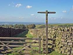
Waymark near Pott Shrigley | |
| Length | 71 mi (114 km) |
| Location | Cheshire, England |
| Trailheads |
Hooton railway station Disley railway station |
| Use | Hiking |
| Elevation | |
| Highest point | Lyme Park 260 m (853 ft)[1] |
The North Cheshire Way is a 71-mile (114 km) long-distance footpath in Cheshire, England. It runs approximately eastwards from Hooton railway station on the Wirral peninsula to Disley railway station on the edge of the Peak District,[2] where it connects with the Gritstone Trail. There is a 6-mile (9.7 km) spur from Chester to Croughton.
The path was developed by the Mid-Cheshire Footpath Society and opened in September 2006. It is Cheshire's longest long-distance footpath[3] and is waymarked with yellow disks marked "NCW".[4]
Route
The North Cheshire Way passes through or near the following places:[2]
Intersections with other long-distance paths include the Wirral Way at Hooton, the Sandstone Trail near Helsby, the Cheshire Ring at Barnton and near Bollington, and the Gritstone Trail at Lyme Park and Disley. The route crosses the Shropshire Union Canal near Stoak and the River Gowy at Bridge Trafford. It follows the River Weaver between Frodsham and Barnton, the Trent and Mersey Canal near Marbury Country Park, the River Bollin from Styal to Wilmslow, and the Macclesfield Canal briefly near Adlington.[5][6][7]
See also
References
- ↑ OL1 Dark Peak area (Map). 1:25000. Explorer. Ordnance Survey. ISBN 0319242404.
- 1 2 The North Cheshire Way. The Mid-Cheshire Footpath Society. 2006. ISBN 978-0955357305.
- ↑ "The North Cheshire Way". Mid-Cheshire Footpath Society. Retrieved 6 June 2016.
- ↑ "North Cheshire Way". Long Distance Walkers Association. Retrieved 6 June 2016.
- ↑ 266 Wirral and Chester (Map). 1:25000. Explorer. Ordnance Survey. ISBN 0319244636.
- ↑ 267 Northwich and Delamere Forest (Map). 1:25000. Explorer. Ordnance Survey. ISBN 0319244644.
- ↑ 268 Wilmslow, Macclesfield and Congleton (Map). 1:25000. Explorer. Ordnance Survey. ISBN 0319244652.
| Wikimedia Commons has media related to North Cheshire Way. |
Coordinates: 53°17′49″N 2°58′37″W / 53.297°N 2.977°W