North Bethesda, Maryland
| North Bethesda, Maryland | |
|---|---|
| Census-designated place | |
.jpg) | |
 Location of North Bethesda, Maryland | |
 Boundaries of the North Bethesda CDP, as of 2003 | |
| Coordinates: 39°2′12″N 77°7′13″W / 39.03667°N 77.12028°WCoordinates: 39°2′12″N 77°7′13″W / 39.03667°N 77.12028°W | |
| Country |
|
| State |
|
| County |
|
| Area | |
| • Total | 8.9 sq mi (23.0 km2) |
| • Land | 8.8 sq mi (22.9 km2) |
| • Water | 0.0 sq mi (0.0 km2) |
| Elevation | 394 ft (120 m) |
| Population (2013[1]) | |
| • Total | 46,646 |
| • Density | 4,281.5/sq mi (1,653.1/km2) |
| Time zone | Eastern (EST) (UTC-5) |
| • Summer (DST) | EDT (UTC-4) |
| ZIP codes | 20814, 20817, 20851, 20852 (shared) |
| Area code(s) | 301 |
| FIPS code | 24-56337 |
| GNIS feature ID | 1867297 |
North Bethesda is a census-designated place and an unincorporated area in Montgomery County, Maryland, United States. It borders the city of Rockville.
Geography
As an unincorporated area four miles northwest of Washington, D.C., North Bethesda's boundaries are not officially defined. North Bethesda is, however, recognized by the United States Census Bureau as a census-designated place for statistical purposes, and by the United States Geological Survey as a populated place located at 39°2′12″N 77°7′13″W / 39.03667°N 77.12028°W (39.036733, -77.120249).[2]
According to the United States Census Bureau, the North Bethesda CDP has a total area of 8.9 square miles (23 km2).
Significant through-roads in North Bethesda include Interstates 270 and 495 and Maryland State Highways 187 (Old Georgetown Road), 355 (Rockville Pike), and 547 (Strathmore Avenue). The Twinbrook, White Flint, and Grosvenor-Strathmore Washington Metro stations all serve the area, as does the Ride On bus system.
The far southern edge of the North Bethesda CDP was originally the country estate of the Grosvenor family, whose lineage includes Alexander Graham Bell and a former President of the National Geographic Society. That region continues to bear the family's name, and is the location of the headquarters of the Renewable Natural Resources Foundation. Also in the southern sector of the census designated area, located in the triangle between the two limbs of I-270 and I-495, is a business district that includes the corporate headquarters of Lockheed Martin, Coventry Healthcare, Host Marriott and Marriott International. The Nuclear Regulatory Commission, a government agency that oversees nuclear regulation and safety in the U.S., is also headquartered here. Major shopping centers include Congressional Plaza, Pike & Rose (formerly Mid-Pike Plaza), Montrose Crossing, Federal Plaza, and Wintergreen Plaza. White Flint Mall, demolished in 2016, was also a major shopping center.
Other landmarks in the area are Walter Johnson High School, the Georgetown Preparatory School, the Charles E. Smith Jewish Day School, the Music Center at Strathmore, the Kennedy-Shriver Aquatic Center, The Jewish Community Center, and North Bethesda Market, the tallest building in Montgomery County, Maryland.[3]
History
North Bethesda shares a common history with most of its Montgomery County neighbors. Archaeological evidence suggests that Paleo, Archaic, and Woodland Native Americans lived nearby, along the banks of the Potomac River. These peoples traveled along an ancient route known as the Seneca Trail (which is today approximately followed in North Bethesda by Old Georgetown Road). Like many ancient roads, the Seneca Trail followed a ridge line – in this case, the high ground between the Potomac River and Rock Creek. Much later, development would spring up along this route.
The recorded history of the area commences with the colonial era. Settlements formed along Rock Creek and the Seneca Trail in the 17th Century, with recorded land grants in this area known originally as “Dan” and “Leeke Forest.”

In the early 19th century, much of the area was part of a 3,700-acre (15 km2) tobacco plantation owned by a slaveowning family with the surname of Riley. One of the Rileys' slaves, Josiah Henson, is thought by historians to be the inspiration for Harriet Beecher Stowe's Uncle Tom's Cabin. In 1806, the Washington Turnpike Company was chartered to improve the old Seneca route, by then known as the Georgetown-Frederick Road. The road was opened in 1828, but had nearly washed away by 1848. The Riley plantation house was located on this road, and the plantation house's kitchen (in which Henson is known to have slept) still stands near the course of this road.
By the late 19th century, the area was privileged with stops along a train route, and by the early 20th century with its own trolley tracks on the line connecting Georgetown and Rockville (along current-day Fleming Avenue). During this time, development bloomed around train and trolley stops, and a number of wealthy families, including those of Captain James Frederick Oyster and Charles I. Corby (who developed methods that revolutionized the baking industry), lived or summered in the area. Nonetheless, the area remained sparsely populated through the 1920s.
The arrival of the automobile eventually transformed the area into a commuter suburb of Washington, D.C. By the 1950s, the area had sprouted a number of developer-conceived neighborhoods with tract houses for the middle-class.
Today, the area remains largely a commuter suburb, with most residents traveling an average of 29 minutes to their workplace.[4] While some traditional neighborhoods remain, other areas have struggled with issues related to suburban sprawl. Like most other suburbs in Montgomery County, the Maryland-National Capital Park and Planning Commission (M-NCPPC) engages in master planning for all development. The White Flint Master Plan is designed to alleviate negative aspects of future high-density development in North Bethesda.[5]
Demographics
| Historical population | |||
|---|---|---|---|
| Census | Pop. | %± | |
| 1980 | 22,671 | — | |
| 1990 | 29,656 | 30.8% | |
| 2000 | 38,610 | 30.2% | |
| 2010 | 43,828 | 13.5% | |
| source:[6] | |||
As of the census[7] of 2000, there were 38,610 people, 17,286 households, and 9,662 families residing in the area. The population density was 4,281.5 people per square mile (1,652.7/km²). There were 18,071 housing units at an average density of 2,003.9/sq mi (773.5/km²). The racial makeup of the area was 77.24% White, 4.96% African American, 0.29% Native American, 11.97% Asian, 0.05% Pacific Islander, 2.61% from other races, and 2.88% from two or more races. Hispanic or Latino of any race were 9.53% of the population.
There were 17,286 households out of which 22.7% had children under the age of 18 living with them, 46.2% were married couples living together, 7.4% had a female householder with no husband present, and 44.1% were non-families. 36.5% of all households were made up of individuals and 11.6% had someone living alone who was 65 years of age or older. The average household size was 2.17 and the average family size was 2.85.
In the area, the population was spread out with 17.9% under the age of 18, 6.1% from 18 to 24, 34.0% from 25 to 44, 24.2% from 45 to 64, and 17.8% who were 65 years of age or older. The median age was 40 years. For every 100 females there were 87.3 males. For every 100 females age 18 and over, there were 83.9 males.
According to survey conducted between 2005 and 2009,[4] the median income for a household in the area was $87,324, and the median income for a family was $113,719. Males had a median income of $79,085 versus $61,793 for females. The per capita income for the area was $51,254. About 2.2% of families and 4.8% of the population were below the poverty line, including 5.1% of those under age 18 and 4.6% of those age 65 or over.
Neighborhoods in North Bethesda
Neighborhoods within the North Bethesda CDP include the following:
- Garrett Park Estates
- Halpine
- Old Georgetown Village
- Luxmanor
- Randolph Hills
- The Crest of Wickford
- Wildwood
- Tilden Woods
- Timberlawn
- Old Farm
- Walnut Woods
- Chase Crossing
- Grosvenor Park
Education
Montgomery County Public Schools serves North Bethesda. Walter Johnson High School is in North Bethesda.[8][9]
The Washington Japanese Language School (WJLS, ワシントン日本語学校 Washinton Nihongo Gakkō), a supplementary weekend Japanese school, has its school office at Quinn Hall of the Holy Cross Church in North Bethesda, adjacent to Garrett Park.[9][10][11] The WJLS holds its classes in Bethesda.[11][12] The institution, giving supplemental education to Japanese-speaking children in the Washington DC area, was founded in 1958,[13] making it the oldest Japanese government-sponsored supplementary school in the U.S.[14] It previously held classes at Holy Cross Church Elementary and Georgetown Preparatory School in North Bethesda.[15]
See also
References
- ↑ "FactFinder". U.S. Census Bureau. U.S. Department of Commerce. Retrieved 2014-11-17.
- ↑ "US Gazetteer files: 2010, 2000, and 1990". United States Census Bureau. 2011-02-12. Retrieved 2011-04-23.
- ↑ "Montgomery Co. To Open Tallest Tower". www.myFoxDC.com. 2010. Retrieved 2010-09-22.
- 1 2 "North Bethesda CDP, Maryland, Selected Economic Characteristics: 2005-2009". United States Census Bureau. Retrieved 2011-06-01.
- ↑ "White Flint - North Bethesda Master Plan". Maryland-National Capital Park and Planning Commission. Retrieved 2012-05-01.
- ↑ "CENSUS OF POPULATION AND HOUSING (1790-2000)". United States Census Bureau. Retrieved 2010-07-17.
- ↑ "American FactFinder". United States Census Bureau. Retrieved 2008-01-31.
- ↑ "Home." Walter Johnson High School. Retrieved on June 19, 2015. "6400 Rock Spring Dr Bethesda, MD 20814"
- 1 2 "2010 CENSUS - CENSUS BLOCK MAP: North Bethesda CDP, MD" (Archive). U.S. Census Bureau. Retrieved on April 30, 2014.
- ↑ "Map" (Archive). Town of Garrett Park. Retrieved on April 30, 2014.
- 1 2 "Home" (Archive). Washington Japanese Language School. Retrieved on April 16, 2015. "学校事務局 Holy Cross Church, Quinn Hall 2F. 4900 Strathmore Avenue, Garrett Park, MD 20896[...]校舎 ストーンリッジ校 Stone Ridge School of the Sacred Heart 9101 Rockville Pike Bethesda, MD 20814"
- ↑ "SRMap2015.pdf." Washington Japanese Language School. Retrieved on April 16, 2015.
- ↑ "English." Washington Japanese Language School. Retrieved on April 30, 2014. "Washington Japanese Language School c/o Holy Cross Church, Quinn Hall, 4900 Strathmore Avenue, Garrett Park, MD 20896"
- ↑ "Andrew M. Saidel" (Archive). Japan-America Society of Greater Philadelphia (JASGP; フィラデルフィア日米協会とは). Retrieved on April 16, 2015.
- ↑ "ワシントン日本語学校概要" (Archive). Washington Japanese Language School. May 6, 2003. Retrieved on April 16, 2015. "学校事務局 Washington Japanese Language School Holy Cross Church, Quinn Hall内. 4900 Strathmore Avenue, Garrett Park, MD 20896" and "ホーリークロス校 Holy Cross Church Elementary School 4900 Strathmore Ave, Garret Park, MD 20896" and "プレプ校 Georgetown Preparatory School 10900 Rockville Pike, North Bethesda, MD 20852" and "セントルーク校 St.Luke Catholic School 7005 Georgetown Pike, McLean, VA 22101"
Municipalities and communities of Montgomery County, Maryland, United States | ||
|---|---|---|
| Cities | 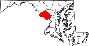 | |
| Towns | ||
| Villages & Special Tax Districts | ||
| CDPs |
| |
| Unincorporated communities | ||
| Footnotes | ‡This populated place also has portions in an adjacent county or counties | |