Nordre Vartdal
| Nordre Vartdal | |
|---|---|
| Village | |
|
View of the local church | |
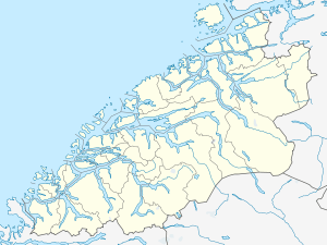
 Nordre Vartdal  Nordre Vartdal Location in Møre og Romsdal | |
| Coordinates: 62°19′29″N 06°08′36″E / 62.32472°N 6.14333°ECoordinates: 62°19′29″N 06°08′36″E / 62.32472°N 6.14333°E | |
| Country | Norway |
| Region | Western Norway |
| County | Møre og Romsdal |
| District | Sunnmøre |
| Municipality | Ørsta Municipality |
| Elevation[1] | 5 m (16 ft) |
| Time zone | CET (UTC+01:00) |
| • Summer (DST) | CEST (UTC+02:00) |
| Post Code | 6170 Vartdal |
Nordre Vartdal is a village in the Vartdal area of Ørsta Municipality in Møre og Romsdal county, Norway. The village is located along the Vartdalsfjorden about 4 kilometres (2.5 mi) northeast of the village of Sætre. The village sits at the entrance to the Ådalen valley, at the mouth of the Storelva river. The European route E39 highway runs through Nordre Vartdal, right past Vartdal Church, which sits on the shore of the fjord.
References
- ↑ "Nordre Vartdal" (in Norwegian). yr.no. Retrieved 2013-08-09.
This article is issued from Wikipedia - version of the 8/1/2016. The text is available under the Creative Commons Attribution/Share Alike but additional terms may apply for the media files.
