Nome-Council Highway
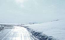
The Nome-Council Highway in May.
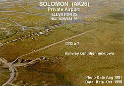
A picture of the airport at Solomon, along the Nome-Council Road.
Nome-Council Highway is the 72-mile (116 km) gravel road running along the Seward Peninsula road system from coastal beaches and wetlands near Nome, Alaska, through tundra meadows and high dwarf tundra, to a river valley at the western edge of the boreal forest near the abandoned townsite of Council.
There are four important landmarks that are listed in the United States National Register of Historic Places within the Nome Census Area.
- This National Park Service list is complete through NPS recent listings posted December 16, 2016.[1]
| [2] | Name on the Register[3] | Image | Date listed[4] | Location | City or town | Description |
|---|---|---|---|---|---|---|
| 1 | Swanberg Dredge |  |
(#01000232) |
Mile 1 of the Nome-Council Highway 64°29′32″N 165°21′37″W / 64.492222°N 165.360278°W |
Nome | |
| 2 | Cape Nome Roadhouse | 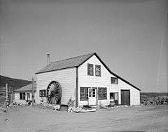 |
(#76000361) |
Mile 14 of the Nome-Council Highway 64°26′37″N 164°58′28″W / 64.443611°N 164.974444°W |
Nome | |
| 3 | Council City and Solomon River Railroad | 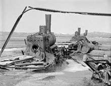 |
(#01000109) |
Mile 31 of the Nome-Council Highway 64°32′46″N 164°25′58″W / 64.546111°N 164.432778°W |
Solomon | |
| 4 | Solomon Roadhouse | 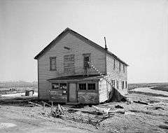 |
(#80000760) |
Mile 32 of the Nome-Council Highway 64°33′34″N 164°26′22″W / 64.559444°N 164.439444°W |
Solomon |
See also
- List of Alaska Routes
- Nome-Taylor Highway
- Nome-Teller Highway
References
- ↑ "National Register of Historic Places: Weekly List Actions". National Park Service, United States Department of the Interior. Retrieved on December 16, 2016.
- ↑ Numbers represent an ordering by significant words. Various colorings, defined here, differentiate National Historic Landmarks and historic districts from other NRHP buildings, structures, sites or objects.
- ↑ National Park Service (2008-04-24). "National Register Information System". National Register of Historic Places. National Park Service.
- ↑ The eight-digit number below each date is the number assigned to each location in the National Register Information System database, which can be viewed by clicking the number.
This article is issued from Wikipedia - version of the 1/11/2016. The text is available under the Creative Commons Attribution/Share Alike but additional terms may apply for the media files.