Nokomis, Florida
| Nokomis, Florida | |
|---|---|
| Census-designated place | |
 Location in Sarasota County and the state of Florida | |
| Coordinates: 27°7′25″N 82°26′20″W / 27.12361°N 82.43889°WCoordinates: 27°7′25″N 82°26′20″W / 27.12361°N 82.43889°W | |
| Country |
|
| State |
|
| County | Sarasota |
| Area | |
| • Total | 1.9 sq mi (5.0 km2) |
| • Land | 1.6 sq mi (4.2 km2) |
| • Water | 0.3 sq mi (0.8 km2) |
| Elevation | 10 ft (3 m) |
| Population (2010) | |
| • Total | 3,167 |
| • Density | 1,951/sq mi (753.4/km2) |
| Time zone | Eastern (EST) (UTC-5) |
| • Summer (DST) | EDT (UTC-4) |
| ZIP codes | 34274-34275 |
| Area code(s) | 941 |
| FIPS code | 12-48875[1] |
| GNIS feature ID | 0287754[2] |

Nokomis is an unincorporated town along the Gulf Coast of Florida, United States, located south of Osprey and just north of Venice. The town has access to the coast through Nokomis Public Beach and Casey Key. The town's population was 3,167 at the 2010 census.[3] It is part of the Bradenton–Sarasota–Venice Metropolitan Statistical Area.
Nokomis includes approximately 2.5 miles of the Legacy Trail, including a water crossing at the Shakett Creek (Dona Bay) bridge.
Casey Key is a barrier island to the northwest of the CDP along the Gulf of Mexico, where there are luxurious beachfront houses lining the key. Casey Key is not part of any CDP.[4]
History
In 1917, Alfred F. Wrede established the first post office with the name of “Nokomis” southwest of the original “Venice” post office. That same year, renowned orthopedic surgeon, Dr. Fred Albee, purchased 112 acres from the Sarasota-Venice Company. With Ellis W. Nash, Dr. Albee created the Nokomis Subdivision, by subdividing the property into 130 lots, with streets radiating from two inner avenue circles and the new asphalt highway, which eventually became U.S. 41. Right there on U.S. 41, Albee and investors built the Pollyanna Inn, a 35-room hotel.
Geography
Nokomis is located at 27°07′25″N 82°26′20″W / 27.123732°N 82.439016°W.[5]
According to the United States Census Bureau, the CDP has a total area of 1.9 square miles (5.0 km2), of which 1.6 square miles (4.2 km2) is land and 0.31 square miles (0.8 km2), or 15.65%, is water.[3]
Demographics
As of the census[1] of 2000, there were 3,334 people, 1,544 households, and 955 families residing in the CDP. The population density was 1,998.5 people per square mile (770.8/km²). There were 1,820 housing units at an average density of 1,091.0/sq mi (420.8/km²). The racial makeup of the CDP was 97.69% White, 0.60% African American, 0.24% Native American, 0.30% Asian, 0.27% from other races, and 0.90% from two or more races. Hispanic or Latino of any race were 1.86% of the population.
There were 1,544 households out of which 19.8% had children under the age of 18 living with them, 49.8% were married couples living together, 8.0% had a female householder with no husband present, and 38.1% were non-families. 30.2% of all households were made up of individuals and 13.7% had someone living alone who was 65 years of age or older. The average household size was 2.15 and the average family size was 2.64.

In the CDP the population was spread out with 17.1% under the age of 18, 5.3% from 18 to 24, 25.5% from 25 to 44, 28.3% from 45 to 64, and 23.8% who were 65 years of age or older. The median age was 46 years. For every 100 females there were 100.6 males. For every 100 females age 18 and over, there were 97.4 males.
The median income for a household in the CDP was $34,699, and the median income for a family was $37,731. Males had a median income of $27,209 versus $21,563 for females. The per capita income for the CDP was $22,077. About 8.6% of families and 12.9% of the population were below the poverty line, including 13.4% of those under age 18 and 10.6% of those age 65 or over.
References
- 1 2 "American FactFinder". United States Census Bureau. Retrieved 2008-01-31.
- ↑ "US Board on Geographic Names". United States Geological Survey. 2007-10-25. Retrieved 2008-01-31.
- 1 2 "Geographic Identifiers: 2010 Demographic Profile Data (G001): Nokomis CDP, Florida". U.S. Census Bureau, American Factfinder. Retrieved April 15, 2013.
- ↑ "P.L. 94-171 County Block Map (2010 Census): Sarasota County, FL". U.S. Census Bureau. Dec 11, 2011. Retrieved April 15, 2013.
- ↑ "US Gazetteer files: 2010, 2000, and 1990". United States Census Bureau. 2011-02-12. Retrieved 2011-04-23.
Municipalities and communities of Sarasota County, Florida, United States | ||
|---|---|---|
| Cities | 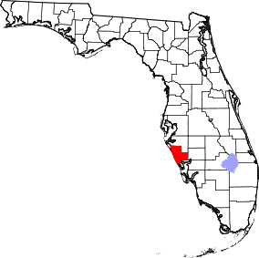 | |
| Town | ||
| CDPs | ||
| Unincorporated community | ||
| Footnotes | ‡This populated place also has portions in an adjacent county or counties | |