Ning'an
| Ning'an 宁安市 | |
|---|---|
| County-level city | |
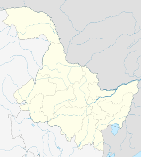 Ning'an Location in Heilongjiang | |
| Coordinates: 44°20′N 129°27′E / 44.333°N 129.450°ECoordinates: 44°20′N 129°27′E / 44.333°N 129.450°E | |
| Country | People's Republic of China |
| Province | Heilongjiang |
| Prefecture-level city | Mudanjiang |
| Time zone | China Standard (UTC+8) |
| Postal code | 157400 |
| Area code(s) | 0453 |
| Climate | Dwb |
| Website | http://www.ningan.gov.cn/ |
Ning’an (Chinese: 宁安; Pinyin: Níng'ān) is a city located approximately 20 km southwest of Mudanjiang, in Heilongjiang province of China. It is located on the Mudanjiang River (formerly known as Hurka River), which flows north, eventually falling into the Sungari River near Sanxing.
Administratively, Ning'an is now a county-level city, and a constituent part of the prefecture-level city of Mudanjiang.
The land area of the entire county-level city of Ning'an is 7,870 km²; the reported population count, as of 2004, stood at 440,000. The government of the "county-level city" is located in the town of the same name (宁安镇, Ningan zhen, Ning'an Town).[1]
Notable geographic features of the county-level city of Ning'an include Lake Jingpo and a crater underground forest (火山口地下森林). Lake Jingpo is a natural reservoir on the Mudanjiang River upstream (about 40 km southwest, straight-line distance) from Ning'an central urban area, result of the volcanic eruptions about 10,000 years ago.
History
Sanggyeong (Chinese: 上京, Shangjing), one of the capitals of the Balhae kingdom (between 756 and 785, and between 793 and 926), was located within today's county-level city of Ning'an.[2] Its site was near today's small towns of Dongjingcheng (东京城镇, Dongjingcheng zhen) and Bohai (渤海镇, Bohai zhen; 44°06′32″N 129°12′54″E / 44.109°N 129.215°E), about 25 km upstream (southwest) from the Ning'an main urban area.

During the early Qing dynasty, the town of Ning'an, known then under the Manchu name Ningguta (transcribed into Chinese as 宁古塔, Ningguta), was one of the most important towns in the entire Manchuria beyond the "Willow Palisade". The name "Ningguta" literally means "six" in Manchu language because it was once guarded by six grandsons of Möngke Temür (猛哥帖木儿).
The Hurka River valley, where Ninguta was located, was the traditional homeland of the Jianzhou Jurchens (who later started calling themselves Manchus), Ninguta and Sanxing being the two oldest centers of the incipient Manchu state.[3] After the Manchus conquered all of China in 1644, the Ninguta area continued to be considered by the Qing dynasty ruling family as the place of its origin.[4]
Already in 1652 the Qing government sent 2000 horsemen, armed with bows, matchlock firearms, and iron cannons, commanded by Sarhuda to set a garrison at Ninguta, which was the first Qing garrison beyond the Willow Palisade.[5] In June 1653 Sarhuda's position became styled "military deputy-lieutenant governor" (昂邦章京, or amban-jianggin in Manchu)[6][7] and a deputy lieutenant general (副都统, fu dutong) were appointed to command the Ninguta garrison.[8]
The suitability of Ninguta as an administrative center was in part due to its location on the Hurka River (or, for the original site, on the Hurka's tributary Hailang), which provided a convenient transportation route connecting Ninguta with the lower Sungari and the lower Amur River. Early on, a great dockyard operated in Ninguta, building boats for the Mudanjiang/Sungari/Amur river system, although it was later relocated to Jilin City.[9]
In 1658 Sarhuda, in charge of a Manchu fleet of several dozen ships, and including also General Shin Ryu's Korean force, sailed from Ninguta down the Hurka and the Sungari, to defeat the smaller fleet of the Russian Cossack Onufriy Stepanov near the fall of the Sungari into the Amur.[10]
After the death of Sarhuda in 1659, his son Bahai (巴海) was appointed to occupy Sarhuda's position.[7]
In 1662, the title of the military deputy-lieutenant governor (amban-jianggin) position was changed to the Ninguta Military Governor (镇守宁古塔等处将军, Zhenshou Ninguta Dengchu Jiangjun), Bahai being the first occupant of this post,[7] while the office of the deputy lieutenant general was relocated to Jilin City.[8]
The early location of the Ninguta fortress was not at today's Ning'an, but some 50 km to the northwest, on the Hailang River (a tributary of Mudanjiang River). That site is located near the present-day Gucheng village (古城村), part of small town of Changting (长汀镇; 44°29′N 128°55′E / 44.48°N 128.92°E). That site is not within the modern County-level city of Ning'an, but in the neighboring County-level city of Hailin.[6]

Growth of the more conveniently located Jilin City resulted in the decrease of the relative importance of Ninguta. Still, Ninguta was the main seat of government of the eastern half of the beyond-the-palisade Manchuria until 1676,[5] when the Military Governor (jiangjun) moved from Ninguta to Jilin City (then called Jilin Ula Cheng, i.e. Jilin River City), and the Deputy Lieutenant-General (副都统, fu dutong) was transferred in the opposite direction (from Jilin City to Ninguta).[7][8]
Although now lower-ranked than Jilin City, Ninguta retained its importance into the 18th and 19th century as one of the few cities existing beyond the Willow Palisade. The Deputy Lieutenant-General stationed there was the top government official for the entire region stretching east to the Sea of Japan and populated primarily by a variety of Tungusic peoples, such as the Nanais.[4][11]
According to the evidence of the Jesuits who visited the area in 1709 along with a government-sponsored ginseng-harvesting expedition,[12] by the early 18th century Ninguta had become an important center of trade in the local forest products, namely ginseng harvested in the region, and the sable pelts, collected as tax from the Nanai natives. Therefore, besides the Manchu garrison and the officials, Ninguta was home to numerous Chinese civilians, some of whom had come to Ninguta from faraway provinces in order to participate in the profitable commerce.[4] There were already numerous peasant villages around the town, some at quite a distance from it, populated both by Manchus and by Han Chinese exiled to this area for various offenses against the law. (Convicts started being sent to Ninguta area as early as 1660; anti-Qing rebels, captured in southern China, followed in 1661[13]) A variety of cereal crops, such as millet and oats were grown there.[4]
See also
References
- ↑ Mudanjiang City info (Chinese)
- ↑ Shangjing Longquanfu, the Capital of the Bohai (Parhae) State
- ↑ Lattimore, Owen (1931). Manchuria - Cradle of Conflict. Modern (2008) reprint by READ BOOKS. pp. 14, 33. ISBN 1-4437-2496-3.
- 1 2 3 4 Du Halde, Jean-Baptiste (1735). Description géographique, historique, chronologique, politique et physique de l'empire de la Chine et de la Tartarie chinoise. Volume IV. Paris: P.G. Lemercier. p. 6.
- 1 2 Reardon-Anderson, James (2005). Reluctant pioneers: China's expansion northward, 1644-1937. Stanford University Press. p. 24. ISBN 0-8047-5167-6.. When quoting Du Halde, Reardon-Anderson implies that the Jesuit went to the region personally in the 1730s. That wasn't actually the case, as du Halde was merely the editor of a report by the Jesuits who had travelled down the Amur in 1709, one of many reports from which his multi-volume work was compiled.
- 1 2 默读宁古塔 ("Silently reading Ninguta) (Chinese)
- 1 2 3 4 吉林省历史沟沉 (An exploration of the history of Jilin Province). There is also same article converted to HTML by Google
- 1 2 3 Edmonds, Richard Louis (1985). Northern Frontiers of Qing China and Tokugawa Japan: A Comparative Study of Frontier Policy. University of Chicago, Department of Geography; Research Paper No. 213. pp. 113, 115–117. ISBN 0-89065-118-3.
- ↑ Lattimore (1931), p. 108
- ↑ Hummel, Arthur William (1970). Eminent Chinese of the Ch'ing period (1644-1912). Ch'eng Wen Publishing Co. p. 632.
- ↑ The Historical Atlas of China (ed. Tan), the Qing dynasty map showing the administrative boundaries as of 1820
- ↑ du Halde (1735), p. 8
- ↑ Reardon-Anderson (2005), p. 26
External links
- Ning'an City Government (Chinese)
Heilongjiang topics | |
|---|---|
| General | |
| Geography | |
| Education | |
| Visitor attractions | |
| |