Nili Airport
| Nili Airport Pashto: د نیلی هوائی ډګر | |||||||||||
|---|---|---|---|---|---|---|---|---|---|---|---|
| IATA: none – ICAO: OANL | |||||||||||
| Summary | |||||||||||
| Airport type | Military/Public | ||||||||||
| Owner |
| ||||||||||
| Operator |
Ministry of Defense Ministry of Transport and Civil Aviation | ||||||||||
| Serves | Nili, Daykundi Province | ||||||||||
| Location | Nili, Daykundi Province, Afghanistan | ||||||||||
| Elevation AMSL | 7,325 ft / 2,233 m | ||||||||||
| Coordinates | 33°44′12″N 066°09′24″E / 33.73667°N 66.15667°ECoordinates: 33°44′12″N 066°09′24″E / 33.73667°N 66.15667°E | ||||||||||
| Map | |||||||||||
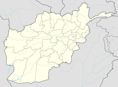
 OANL Location of airport in Afghanistan | |||||||||||
| Runways | |||||||||||
| |||||||||||
Nili Airport (ICAO: OANL) is a military and public use airport located in Nili, Daykundi Province, Afghanistan. It was rebuilt in recent years with support from the International Security Assistance Force (ISAF), and is mainly used by ISAF and the Afghan Air Force for military purposes or delivering emergency aid to people in the area.[3]
See also
References
- ↑ Airport record for Nili Airport at Landings.com. Retrieved 2013-8-1
- ↑ Nili (OANL)
- ↑ http://www.dvidshub.net/image/417559/nili-terminal-construction
External links
- Daykundi: A model for success in southern Afghanistan
- Airport record for Nili Airport at Landings.com.
- Current weather for OANL at NOAA/NWS
This article is issued from Wikipedia - version of the 11/27/2016. The text is available under the Creative Commons Attribution/Share Alike but additional terms may apply for the media files.