Nieuw-Vennep
| Nieuw Vennep | |
|---|---|
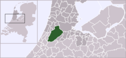
 The town of Nieuw-Vennep in the municipality of Haarlemmermeer | |
 | |
| Country | Netherlands |
| Province | North Holland |
| Municipality | Haarlemmermeer |
| Population (2015) | 31,300 |

Nieuw-Vennep is a town in the Dutch province of North Holland. It is a part of the municipality of Haarlemmermeer, and lies about 10 km southwest of Amsterdam Airport Schiphol. It has about 31,300 inhabitants, half of which live in the newly built district of Getsewoud.[1] The built-up area of the town was 3.71 km2, and contained 7,513 residences.[2] The wider statistical area of Nieuw-Vennep has a population of around 40,000.[3] In 2001, Nieuw-Vennep had 17,886 inhabitants, which later doubled due to the development of Getsewoud.
History
Northwest of present-day Nieuw-Vennep lay the island Vennip or Vennep, to which Nieuw-Vennep owes its name, meaning "New Vennep". Nieuw-Vennep is one of two towns officially founded after the lake Haarlemmermeer was made into a dry land polder in 1852. The other town was Hoofddorp, at the time still named Kruisdorp. Until 1868 Nieuw-Vennep was called Venneperdorp, both towns have used their current name since that time.
The first inhabitants were farm laborers living under poor circumstances. As a result of the conditions the town was nicknamed De Krim, in reference to the Crimea war fought between 1853 and 1856. As Hoofddorp became the governmental and economic center of the municipality, the development of Nieuw-Vennep lagged behind. On 2 November 1862 the Dutch Reformed Church "de Witte Kerk" was initiated.
Transportation
Railway station: Nieuw-Vennep
Trivia
- The town of Nieuw-Vennep is mentioned at the beginning of the Ash song Jack Names the Planets.
- It is the birth place of professional footballer player Mitchell Donald
References
- ↑ "Gemeente Haarlemmermeer: Haarlemmermeer in cijfers". Retrieved 20 October 2016.
- ↑ Statistics Netherlands (CBS), Bevolkingskernen in Nederland 2001 "Archived copy". Archived from the original on 2006-03-19. Retrieved 2007-01-24.. Statistics are for the continuous built-up area.
- ↑ Statistics Netherlands (CBS), Gemeente Op Maat 2004: Haarlemmermeer .
External links
Coordinates: 52°15′52″N 4°38′05″E / 52.2644°N 4.6347°E
Haarlemmermeer Municipality | ||
|---|---|---|
| Settlements |  | |
| ||