Nicollet Island/East Bank, Minneapolis
| Nicollet Island/East Bank | |
|---|---|
| Neighborhood | |
|
Old St. Anthony, including St. Anthony Main, the Pillsbury "A" Mill, cobblestone streets and cranes for condo construction | |
| Nickname(s): Old Saint Anthony | |
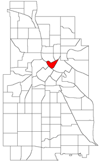 Location of Nicollet Island/East Bank within the U.S. city of Minneapolis | |
| Country | United States |
| State | Minnesota |
| County | Hennepin |
| City | Minneapolis |
| Community | University |
| Area[1] | |
| • Total | 0.247 sq mi (0.64 km2) |
| Population (2010)[2] | |
| • Total | 1,309 |
| • Density | 5,300/sq mi (2,000/km2) |
| Time zone | CST (UTC-6) |
| • Summer (DST) | CDT (UTC-5) |
| ZIP code | 55401, 55413, 55414 |
| Area code(s) | 612 |

| Historical population | |||
|---|---|---|---|
| Census | Pop. | %± | |
| 1980 | 203 | — | |
| 1990 | 666 | 228.1% | |
| 2000 | 828 | 24.3% | |
| 2010 | 1,309 | 58.1% | |
Nicollet Island/East Bank is a neighborhood in Minneapolis, Minnesota, situated just across the Mississippi River from Downtown, one of six in the University community. It comprises Nicollet Island and the portion of the eastern riverbank located between Central Avenue and the Burlington Northern-Santa Fe Railroad line.[3] The "East Bank" portion of the neighborhood is commonly referred to as a part of Northeast or Old St. Anthony, as this area was the location of the town of St. Anthony, which was annexed by Minneapolis in 1872.
East Hennepin Avenue runs through the middle of the neighborhood, which means it is situated in parts of both Northeast and Southeast Minneapolis. The neighborhood is bounded by Central Avenue, 2nd Avenue NE, and the river. Due to its proximity to Downtown, the area has seen a wave of gentrification in recent years; with shopping complexes and upscale condominiums built in the area.
References
- ↑ "Nicollet Island neighborhood in Minneapolis, Minnesota (MN), 55401, 55413, 55414 detailed profile". City-Data. 2011. Retrieved 2013-11-12.
- ↑ "Minneapolis Neighborhood Profile: Nicollet Island - East Bank" (PDF). Minnesota Compass. October 2011. Retrieved 2013-11-12.
- ↑ "Nicollet Island - East Bank neighborhood profile"(PDF). MN Compass, October 2011. Retrieved 2012-02-21.
External links
- Minneapolis Neighborhood Profile - Nicollet Island/East Bank
- Nicollet Island - East Bank Neighborhood Association
 |
St. Anthony West | St. Anthony East | | |
| North Loop | |
Marcy-Holmes | ||
| ||||
| | ||||
| Downtown West |