Niihau
| Nickname: The forbidden isle | |
|---|---|
 Aerial view of Niʻihau looking southwestward from the north | |
 | |
| Geography | |
| Location | 21°54′N 160°10′W / 21.900°N 160.167°W |
| Area | 69.5 sq mi (180 km2) |
| Area rank | 7th largest Hawaiian Island |
| Highest elevation | 1,250 ft (381 m) |
| Highest point | Mt. Pānīʻau |
| Administration | |
|
United States | |
| Symbols | |
| Flower | Pūpū keʻokeʻo (white shell)[1] |
| Color | Keʻokeʻo" (White)[2] |
| Demographics | |
| Population | 130 (2009) |
| Pop. density | 1.9 /sq mi (0.73 /km2) |
Niʻihau (/ˈniːhaʊ/; Hawaiian: [ˈniʔiˈhɐw]) is the westernmost and seventh largest inhabited island in Hawaiʻi. It is 17.5 miles (28.2 km) southwest of Kauaʻi across the Kaulakahi Channel. Its area is 69.5 square miles (180 km2).[3] Several intermittent playa lakes provide wetland habitats for the Hawaiian coot, the black-winged stilt, and the Hawaiian duck. The island is designated as critical habitat for Brighamia insignis, an endemic and endangered species of Hawaiian lobelioid. The United States Census Bureau defines Niʻihau and the neighboring island and State Seabird Sanctuary of Lehua as Census Tract 410 of Kauai County, Hawaii. Its 2000 census population was 160;[4] Its 2010 census population was 170.
Elizabeth Sinclair purchased Niʻihau in 1864 from the Kingdom of Hawaii and private ownership passed on to her descendants, the Robinson family. During World War II, the island was the site of the Niʻihau Incident: A Japanese navy fighter pilot crashed on the island and terrorized its residents for a week after the attack on Pearl Harbor. The people of Niʻihau are known for their gemlike lei pūpū (shell lei) craftsmanship, and speak Hawaiian as a primary language. The island is generally off-limits to all but relatives of the island's owners, U.S. Navy personnel, government officials and invited guests, giving it the nickname "The Forbidden Isle." Beginning in 1987, a limited number of supervised activity tours and hunting safaris have opened to tourists. The island is currently managed by brothers Bruce Robinson and Keith Robinson.
Geography
Niʻihau is located about 18 miles (29 km) west of Kauaʻi, and the tiny, uninhabited island of Lehua lies 0.7 miles (0.61 nmi; 1.1 km) north of Niʻihau. Niʻihau's dimensions are 6.2 miles by 18.6 miles (10 km x 30 km). The maximum elevation (Paniau) is 1,280 feet (390 m).[5] The island is about 4.9 million years old, making it geologically younger than the 5-million-year-old neighboring island of Kauaʻi to the northeast.[6] Niʻihau consists of one extinct volcano that had a large landslide to the east.
Climate
The island is relatively arid because it lies in the rain shadow of Kauaʻi, and lacks the elevation needed to catch significant amounts of trade wind rainfall. Niʻihau therefore, depends for its rain on winter Kona storms, when more northerly weather systems intrude into the region. As such, the island is subject to long periods of drought.[7] Historical droughts on Niʻihau have been recorded several times, one in 1792 by Captain James Cook's former junior officer, George Vancouver, who had been told that the people of Niʻihau had abandoned the island because of a severe drought and had moved to Kauaʻi to escape famine.[8]
Flora and fauna

As an arid island, Niʻihau was barren of trees for centuries — Captain James Cook reported it treeless in 1778. Aubrey Robinson, grandfather of current owners Bruce Robinson and Keith Robinson, planted 10,000 trees per year during much of his ownership of the island; Robinson's afforestation efforts increased rainfall in the dry climate.[9] Island co-owner Keith Robinson, a noted conservationist, preserved and documented many of Niʻihau's natural plant resources. The island is designated as a critical habitat for the ʻōlulu, an endemic and endangered species of Hawaiian lobelioid. Aylmer robinsonii, a Pritchardia palm tree named for Keith Robinson's uncle Aylmer Robinson, is an endangered species native to Niʻihau.
Several bird species thrive on Niʻihau. Intermittent playa lakes on the island provide wetland habitats for the ʻalae keʻokeʻo (Hawaiian coot), the āeʻo (black-winged stilt), and the koloa maoli (Hawaiian duck). The critically endangered Hawaiian monk seal (Monachus schauinslandi) is found in high numbers on Niʻihau's shores. Robinson states that Niʻihau's secluded shoreline offers them a safe haven from habitat encroachments. According to Robinson, conditions there are better than the government refuges of the Northwestern Hawaiian Islands. When the Robinsons originally purchased Niʻihau, no monk seals were present, because they lived in the northwestern part of the Hawaiian island chain, Necker and Midway islands. They have been relocated to the main Hawaiian island chain by NOAA fisheries over the past thirty years, and some have found homes on Niʻihau.[9]
Big game herds, imported from stock on Molokaʻi Ranch in recent years, roam Niʻihau's forests and flatlands. Eland and aoudad are abundant, along with oryxes, wild boars and feral sheep. These big game herds provide income from hunting safari tourism.[9]
History

Prior to the unification of the Kingdom of Hawaii under Kamehameha I, Niʻihau was ruled by the aliʻi. Kahelelani was the first of the Niʻihau aliʻi. His name is now used to refer to the Niʻihau kahelelani, the puka shell of the wart turbans (Leptothyra verruca), used to make exquisite Niʻihau shell jewelry.[10][11] Kāʻeokūlani was a ruler of northern Niʻihau who unified the island after defeating his rival, a chief named Kawaihoa. A stone wall (Pāpōhaku) across a quarter of the island's southern end marked the boundaries of the two chiefs: Kāʻeo's land was identified by black stones and Kawaihoa's by white stones. Eventually, a great battle took place, known as Pali Kamakaui. Kāʻeo's two brothers from the island of Maui, Kaiana and his half-brother Kahekili II, the King of Maui, fought for Kāʻeo and Niʻihau was united under his rule. Kawaihoa was banished to the south end of the island and Kāʻeo moved to the middle of the island to govern. Kāʻeo married the Queen Kamakahelei and a future king of Niʻihau and Kauaʻi named Kaumualiʻi was born in 1790. Kauaʻi and Niʻihau are said to have carried the "highest blood lines" in the Hawaiian Islands.[12]
Kamehameha managed to unify all of the islands by 1795, except for Kauaʻi and Niʻihau:[13] Two attempts to conquer those islands had failed, and Kamehameha lost many men: bodies covered the beaches on Kauaʻi's eastern shores.[14] Finally, in 1810, Kamehameha amassed a great fleet, and Kaumualiʻi, the last independent aliʻi, surrendered rather than risk further bloodshed. Independence again became feasible after Kamehameha's death in 1819, but was put down when Kamehameha's widow Kaʻahumanu kidnapped Kaumualiʻi and forced him to marry her. Thereafter Niʻihau remained part of the unified Kingdom of Hawaiʻi.

Elizabeth McHutchison Sinclair (1800–1892) purchased Niʻihau and parts of Kauaʻi from Kamehameha V in 1864 for $10,000 in gold. Sinclair chose Niʻihau over other options, including Waikīkī and Pearl Harbor. By around 1875, Niʻihau's population consisted of about 350 Native Hawaiians, with 20,000 sheep.[15] This era marked the end of the art of Hawaiian mat–weaving made famous by the people of Niʻihau. Makaloa (Cyperus laevigatus), a native sedge, used to grow on the edges of Niʻihau's three intermittent lakes.[16] The stems were harvested and used to weave moena makaloa (mats), considered the "finest sleeping mats in Polynesia". The mats were valued by aliʻi and foreign visitors alike, but by the end of the 19th century, Hawaiians had stopped weaving makaloa due to changes in population, culture, economics, and the environment.[17]
In 1915, Sinclair's grandson Aubrey Robinson closed the island to most visitors. Even relatives of the inhabitants could visit only by special permission. Upon Aubrey's death in 1939 the island passed to his son Aylmer, and in 1968 to Aylmer's youngest brother Lester. Upon Lester's wife Helen's death, the island passed to his sons Bruce Robinson and Keith Robinson, the current co-owners.[9] (See Owners' family tree)
Niʻihau played a small role during the attack on Pearl Harbor on December 7, 1941. In what has come to be called the Niʻihau Incident (or the Battle of Niʻihau), a Japanese pilot whose Zero had been hit crash-landed[18] on the island hoping to rendezvous with a rescue submarine. The pilot escaped with the assistance of local Japanese residents, but was later recaptured and killed.[19] It was the subject of a popular song, "You Can't Conquer Niihau, Nohow".
Despite its self-imposed isolation, Niʻihau has a long-standing relationship with the U.S. military dating from 1924.[9] There is a small Navy installation on the island. No military personnel are permanently stationed there, but the U.S. military has used the island for training special operations units, which included hiring Hawaiians who live on Ni'ihau as "enemy" trackers.[20]
Society
Politics
The island of Niʻihau was considered as a possible location for the United Nations headquarters in 1944 by Franklin D. Roosevelt. Roosevelt had visited Hawaiʻi in 1934.[21] Under Cordell Hull, Roosevelt's Secretary of State, the State Department seriously studied the proposal.[22]
In 2004 President George W. Bush received all but one of the 40 votes cast on the island. The remaining vote was cast for Green Party nominee David Cobb. 51 registered voters did not cast ballots.[23] In 2006 Dan Akaka received 33 votes in the 2006 Senate election to Cynthia Thielen's 3. In 2008, Niʻihau's precinct was one of only 3 of Hawaiʻi's 538 precincts to vote for John McCain over Barack Obama. McCain received 35 votes, Obama received 4, and Cynthia McKinney received 1.[24]
Population

Niʻihau has approximately 130 permanent inhabitants,[9] nearly all of whom are Native Hawaiians who live in the island's main settlement of Puʻuwai. Some support themselves largely by subsistence fishing and farming, while others depend on welfare.[25] All residents live rent-free, and meat is free.[9] Niʻihau has no telephone services and no paved roads. Horses are the main form of transportation; bicycles are also used. There are no power lines; solar power provides all electricity. There is no plumbing or running water on the island. Water comes from rainwater catchment. The Robinson family established most of these conditions. There is no hotel or general store; barges deliver groceries from Kauaʻi, often purchased by relatives, with free shipping.[9]
Residents generally speak the Niihau dialect of Hawaiian as their first language, in part encouraged by terms in the original purchase contract which obligated the new owners to help preserve Hawaiian culture and tradition. The Niʻihau dialect differs from modern Hawaiian in that, for example, [t] and [ɾ] are the most common realizations of the phonemes /k/ and /l/.[9] Niʻihau is the only island where Hawaiian is spoken as a primary language.[26] Linguistic evidence and oral tradition maintain that the Niʻihau dialect is closer to the Hawaiian register spoken during the time of discovery. English is the second language.
Some residents have radio and television sets, although limited reception effectively limits the latter to watching VHS tapes and DVDs.[27] Niʻihau is subject to regular droughts that occasionally force the population to evacuate to Kauaʻi temporarily, until rainfall replenishes their water supply. Residents commonly also commute to Kauaʻi for work, medical care, or school, and many of them call both islands home. To avoid a long boat ride, the island's owners maintain an Agusta A109 helicopter for emergencies and for transporting Navy contractors and residents to and from Kauaʻi. Helicopter tours and safaris help offset the costs of this service.[28]
A form of ipu art is known to have developed solely on the island of Niʻihau.[29][30] In this method, after a design is carved in the skin of a fresh gourd, it is filled with dye which, after several weeks, changes the color of the uncarved portions of the surface where the skin is intact. Hawaiian music plays a central role on the island, with a cappella singers making use of only two or three tones and changing rhythms. Ukulele and guitar playing is nearly ubiquitous among the islanders, and there are three separate styles of slack-key music, with an older style originating from Kohala.[31]
Education
The Hawaii Department of Education operates the Niʻihau School, a K-12 school. Academic subjects and computer literacy are combined with teaching students to "thrive from the land."[9] The school is powered entirely by solar power.[32] The number of students varies from 25 to 50 since families often travel between Niʻihau and Kauaʻi.[33] Schoolchildren may stay with relatives in west Kauaʻi, where they attend one of two Niʻihau-focused public charter schools. At the Ke Kula Niʻihau o Kekaha school, students speak primarily the Niʻihau dialect through the early elementary grades, and then Hawaiian and English through grade 12. The school has a digital recording and video system, which helps to preserve and teach traditional Niʻihau and Hawaiian culture. At the other west Kauaʻi school, Kula Aupuni Niʻihau a Kahelelani Aloha (KANAKA), English is used in all grades, while still supporting the Niʻihau dialect. Both schools foster the culture, values, and spirituality of Niʻihau.[9]
Economy
Approximately 80% of Niʻihau's income comes from a small Navy installation atop 1,300-foot-high cliffs. Remote-controlled tracking devices are used for testing and training with Kaua'i's Pacific Missile Range Facility. Modern missile defense tests are conducted at the site for the U.S. and its allies. The installation brings in millions of dollars a year, and provides the island with a stable economic base without the complexity of tourism or industrial development.[9] The sale of shells and shell jewelry is an additional source of income.[34] Its beaches are known for their pūpū, tiny shells that wash onto shore during winter months. Species used for shell leis includes momi (Euplica varians), laiki or rice shells (Mitrella margarita) and kahelelani (Leptothyra verruca).[35] The shells and jewelry are so popular that Governor Linda Lingle signed a bill in 2004 to protect lei pūpū o Niʻihau (Niʻihau shell leis) from counterfeiting.[36] A single, intricate Niʻihau shell lei can sell for thousands of dollars.[9]

Many residents of Niʻihau were once employees of Niʻihau Ranch, farming cattle and sheep until the Robinsons shut down the operation in 1999. It had not been profitable for most of the 20th century. Honey cultivation[37] was also no longer viable by 1999.[20] Kiawe charcoal was once a large-scale export, but aggressive Mexican price competition ended that as well.[9] Mullet farming has been popular on Niʻihau, with ponds and lakes stocked with baby mullet, which reach 9–10 pounds (4.1–4.5 kg) apiece before being harvested and sold on Kauaʻi and Oʻahu.[38]
Bruce Robinson, Niʻihau's co-owner, is seeking and considering new forms of non-invasive income generation. Depending on feasibility, impact, and ecological footprint on the ecosystem and culture, possibilities include: JP-8 generation by the lignocellulose process; military, including a possible runway; and windmill energy production. Robinson has declined offers to purchase sand from Niʻihau's beaches, because of adverse environmental effects.[9]
Tourism
Niʻihau's owners have offered half-day helicopter and beach tours of the island since 1987,[39] although contact with residents is avoided and no accommodations exist.[40] Since 1992,[41] hunting safaris provide income via tourists who pay to visit the island to hunt eland, aoudad, and oryx, as well as wild sheep and boars. Any meat the hunters do not take with them is given to the village.
Notes
- ↑ Shearer 2002, p. 99.
- ↑ Shearer 2002, p. 230.
- ↑ "Table 5.08 - Land Area of Islands: 2000" (PDF). 2004 State of Hawaii Data Book. State of Hawaii. 2004. Retrieved 2007-07-23. External link in
|work=(help) - ↑ Census Tract 410, Kaua'i County Archived copy at WebCite (January 17, 2010). United States Census Bureau
- ↑ "Table 5.11 - Elevations of Major Summits" (PDF). 2004 State of Hawaii Data Book. State of Hawaii. 2004. Retrieved 2007-07-23.
- ↑ Juvik, Sonia P.; James O. Juvik; Thomas R. Paradise (1998). Atlas of Hawaii. University of Hawaii Press. pp. 3–6. ISBN 978-0-8248-2125-8.
- ↑ Tabrah 1987, pp. 10–11.
- ↑ Tabrah 1987, p. 49.
- 1 2 3 4 5 6 7 8 9 10 11 12 13 14 15 Mangieri, Gina (22 June 2009). "Niihau: Past, Present and Future" (Television production). KHON-TV (report with video).
Partial transcript/monograph online in 12 parts
- ↑ Tava & Keale 1998, p. 13.
- ↑ Kam, Nadine (2004-05-17). "The real deal: Genuine Niihau shells have lasting quality". Features. Honolulu Star-Bulletin. Retrieved 2007-07-21.
- ↑ Tava & Keale 1998, pp. 13–14.
- ↑ Coulter, John Wesley (1964). "Great Britain in Hawaii: The Captain Cook Monument". The Geographical Journal. 130: 2. doi:10.2307/1794586.
- ↑ Gay, Lawrence Kainoahou (1981). Tales of the forbidden island of NiʻIhau. Topgallant Publishing. p. 17. ISBN 0-914916-43-2.
- ↑ Bird, Isabella L. (2006). The Hawaiian Archipelago. BiblioBazaar. p. 212. ISBN 1-4264-4990-9.
- ↑ Joesting, Edward (1988). Kauai: The Separate Kingdom. University of Hawaii. p. 188. ISBN 0-8248-1162-3.
- ↑ Van Dyke, Peter (June 2001). "Final report for U.S. Geological Survey Grant No. 99CRGR0003". Bishop Museum.
|contribution=ignored (help) - ↑ https://m.warhistoryonline.com/war-articles/pacific-plane-wrecks-amazing-pictures-of-abandoned-wwii-planes.html/attachment/4789904038_81ca14b47a_b
- ↑ The Niʻihau Incident serves as the backdrop for Caroline Paul's 2006 novel East Wind, Rain (ISBN 0-06-078075-4) and the opening chapter of Michelle Malkin's In Defense of Internment.
- 1 2 Sommer, Anthony. "Niihau: Opening Up." Honolulu Star-Bulletin. May 14, 1999.
- ↑ Tabrah 1987, p. 1.
- ↑ Bemis, Samuel Flagg (December 1949). "The Memoirs of Cordell Hull". The Journal of Modern History. University of Chicago Press. 21 (4): 317–320. doi:10.1086/237294.
- ↑ Hawaii 2004 election results for precinct 16-09. Hawaii.gov. Retrieved April 21, 2006.
- ↑ 2008 Election: Final Results (Hawaii)
- ↑ Langlas, Charles and Kehaulani Shintani. "Mälama ka ‘Äina: To Care For The Land" [review]. CRM: The Journal of Heritage Stewardship. Vol. 3 No. 1 (Winter 2006).
- ↑ Olsen, Eric P. (October 2001). "Paradise Preserved". World & I. 16 (10): 108.
- ↑ Enomoto, Catherine Kekoa (1997). "Niihau: Island at a Crossroad". Honolulu Star-Bulletin.
- ↑ "Niihau - Hawaii's "Forbidden Island"". Kauai Visitor Magazine. Archived from the original on 2006-12-30. Retrieved 2007-06-19.
- ↑ Crites, Jennifer (October–November 2007). "The Ipu Guy". Hana Hou!. 10 (5). Retrieved 2007-10-18.
This method developed [circa AD 1600] only on Niʻihau—- nowhere else in the world—- and then vanished at the end of the 19th century," explains Harburg. "It was lost until Dr. Bruce Kaʻimiloa Chrisman figured out how it was done.
- ↑ Bordessa, Kris (2007). "The Lost Ipu Art of Niʻihau". Craft:. 4.
- ↑ Tava & Keale 1998, p. 105.
- ↑ Gehrlein, Rachel (2007-12-15). "Niʻihau school first in state on solar power". The Garden Island.
- ↑ Hawaii State Department of Education. "Niʻihau School".
- ↑ Tava & Keale 1998, pp. 36–37.
- ↑ Moriarty, Linda Paik (1986). Niʻihau Shell Leis. University of Hawaii Press. ISBN 0-8248-0998-X.
- ↑ H.B. No. 2569. See also: "Governor signs Niihau shell bill". Pacific Business News. 2004-05-24. Retrieved 2007-06-05.
- ↑ Tava & Keale 1998, p. XV
- ↑ Tava & Keale 1998, pp. 66–67.
- ↑ "Flying visitors can catch glimpse of "The Forbidden Isle"". The Globe and Mail. 1987-08-15.
- ↑ Niihau Island
- ↑ Christine, Rodrigo (1992-04-06). "Safaris debut on Forbidden Island". Pacific Business News.
References
- Beekman, Allan (1995) [1982]. The Niihau Incident. Honolulu, HI: Heritage Press of Pacific. ISBN 0-9609132-0-3.
- Fisher, Harvey I. (Jan–Feb 1951). "The Avifauna of Niihau Island, Hawaiian Archipelago". The Condor. Cooper Ornithological Society. 53 (1): 31–42. doi:10.2307/1364585. ISSN 0010-5422. JSTOR 1364585.
- Macdonald, Gordon A.; Agatin T. Abbott; Frank L. Peterson (1983) [1970]. Volcanoes in the Sea: The Geology of Hawaii (2nd ed.). Honolulu: University of Hawaii Press. ISBN 0-8248-0832-0.
- Mitchell, C.; C. Ogura; D.W. Meadows; A. Kane; L. Strommer; S. Fretz; D. Leonard; A. McClung (2005-10-01). "Hawaii's Comprehensive Wildlife Conservation Strategy. Chapter 6: Island Conservation Needs - Niʻihau" (PDF). Final. Department of Land and Natural Resources. Retrieved 2009-03-23.
- Morgan, Joseph R. (1996). "Kaua'i and Ni'ihau". Hawai'i: A Unique Geography. The Bess Press. ISBN 1-57306-021-6.
- Nordyke, Eleanor C. (1989). The Peopling of Hawaiʻi. University of Hawaii Press. ISBN 0-8248-1191-7.
- Shearer, Barbara Smith (2002). State Names, Seals, Flags, and Symbols: a Historical Guide (3 ed.). Greenwood Publishing Group. ISBN 978-0-313-31534-3.
- Sommer, Anthony (1999-05-14). "Niihau: Opening Up". News. Honolulu Star-Bulletin. Retrieved 2009-07-23.
- Tabrah, Ruth M. (1987). Niʻihau, the last Hawaiian island. Press Pacifica. ISBN 0-916630-59-5.
- Tava, Rerioterai; Keale, Moses K. (1998). Niihau, the traditions of a Hawaiian island. Mutual Publishing. ISBN 0-935180-80-X.
- Wichman, Juliet Rice; St. John, Harold (1990). A Chronicle and Flora of Niihau. National Tropical Botanical Garden. ISBN 0-915809-14-1.
Further reading
| Wikimedia Commons has media related to Niihau. |
- Barnhart, Sky (July 2008). "The Flowers of Niihau". Maui Nō Ka ʻOi Magazine. 12 (4). Retrieved 2009-08-17.
- Clark, John R. K. (1990). Beaches of Kauaʻi and Niʻihau. Honolulu, Hawaii: University of Hawaii Press. pp. 79–102. ISBN 0-8248-1260-3.
- Conover, Adele; Gary Braasch (November 1996). "A Onetime Rancher Wages Lonely War to Save Rare Plants". Smithsonian. Smithsonian Institution. 27 (8): 114.
- Daws, Gavan; Timothy Heap (October 1962). "Niihau a shoal of time". American Heritage. American Heritage Publishing Company. 14 (6). Retrieved 2008-05-06.
- Laracy, Hugh (September 2001). "The Sinclairs of Pigeon bay and the Romantic 'Pre-history' of the Robinsons of Niihau". Journal of Pacific History. Routledge. 36 (2): 183–199. doi:10.1080/00223340120075560.
- Licayan, Emalia; Nizo, Virginia; Kanahele, Elama (2007). Kanahele, Elama; Armitage, Kimo; NeSmith, Keao, eds. Aloha Niihau: Oral Histories. Waipahu, Hawaii: Island Heritage Publishing. ISBN 1-59700-209-7.
- May, Ernest R (1946-11-02). "They Never Leave This Real Shangri-La". The Saturday Evening Post. 219 (18): 28–67. ISSN 0048-9239.
- Meyer, Philip A. (1998). "Niihau - Present Circumstances and Future Requirement in an Evolving Hawaiian Community". Ni'ihau, Hawai'i: Hoomana Ia Iesu Church.
- Paul, Caroline (2007). East Wind, Rain. Harper Perennial. ISBN 0-06-078076-2.
- Stepien, Edward R. (1988) [1984]. Niʻihau, A Brief History. 1. Honolulu: Center for Pacific Islands Studies, School of Hawaiian, Asian, & Pacific Studies, University of Hawaii at Manoa. pp. 1–134. hdl:10125/15544.
- Stepien, Edward R. (1988) [1984]. Niʻihau, A Brief History. 2. Honolulu: Center for Pacific Islands Studies, School of Hawaiian, Asian, & Pacific Studies, University of Hawaii at Manoa. pp. 135–268. hdl:10125/15544.
Honolulu (capital) | ||
| Topics | ||
| Society | ||
| Main Islands | ||
| Northwestern Islands | ||
| Communities | ||
| Counties | ||
| Sovereignty Movement | ||
Islands, municipalities, and communities of Kauai County, Hawaii, United States | ||
|---|---|---|
| CDPs | 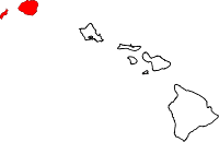 | |
| Unincorporated communities | ||
Hawaiian volcanism topics (list) | ||
|---|---|---|
| Windward Isles | 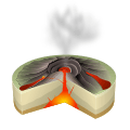 | |
| Leeward Isles | ||
| Emperor Seamounts | ||
| Topics | ||
Coordinates: 21°54′N 160°10′W / 21.900°N 160.167°W