Newport, Washington
| Newport | |
|---|---|
| City | |
| Newport, Washington | |
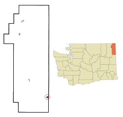 Location of Newport, Washington | |
| Coordinates: 48°10′50″N 117°2′51″W / 48.18056°N 117.04750°WCoordinates: 48°10′50″N 117°2′51″W / 48.18056°N 117.04750°W | |
| Country | United States |
| State | Washington |
| County | Pend Oreille |
| Area[1] | |
| • City | 1.07 sq mi (2.77 km2) |
| • Land | 1.07 sq mi (2.77 km2) |
| • Water | 0 sq mi (0 km2) |
| Elevation | 2,142 ft (653 m) |
| Population (2010)[2] | |
| • City | 2,126 |
| • Estimate (2015)[3] | 2,137 |
| • Density | 1,986.9/sq mi (767.1/km2) |
| • Metro | 547,924 (US: 100th) |
| • CSA | 698,170 (US: 69th) |
| Time zone | Pacific (PST) (UTC-8) |
| • Summer (DST) | PDT (UTC-7) |
| ZIP code | 99156 |
| Area code(s) | 509 Exchange: 447 |
| FIPS code | 53-48820 |
| GNIS feature ID | 1512505[4] |
| Website | City of Newport |

Newport is a city in, and the county seat of, Pend Oreille County,[5] Washington. The population was 2,126 at the 2010 census.[6] Newport is part of the Spokane Metropolitan Area
History
Newport was given its name in 1890 because it was selected as a landing site for the first steamboat on the Pend Oreille River.[7] Newport was officially incorporated on April 16, 1903. The first river bridge was built in 1906, and was replaced in 1926,[7] and again in 1988.[8]
On July 14, 2015, an explosion took place at Zodiac Aerospace.[9] Five people were injured,[10] and people were urged to stay at least 2000 feet from the facility.[11][12]
Geography
Newport is located at 48°10′50″N 117°2′51″W / 48.18056°N 117.04750°W (48.180634, -117.047407)[13] at an elevation of 2,160 feet (658.5 m).
According to the United States Census Bureau, the city has a total area of 1.07 square miles (2.77 km2), all of it land.[1]
The town of Oldtown, Idaho is just to the east of Newport, and on the Pend Oreille River. There are no natural or physical barriers between the two towns, and it is strictly a political division, separated by the straight-line state boundary.
About one-half mile north of Newport, the Pend Oreille River enters Washington State and flows north to Canada. The watershed of the Pend Oreille in the Newport-Oldtown area west of the river is extremely limited. This is due to a small depression of no more than 50 feet (15 m), which begins about one-half mile from the river. Unable to flow uphill, the waters (from natural springs, rainfall runoff, etc.) eventually form the Little Spokane River, and flow southwest towards Spokane.
Diamond Lake, WA (elevation 2,345 ft.) is about 7 miles (11 km) to the southwest, and is also part of the Little Spokane River watershed (outflow only) via a creek runoff from the uninhabited far west end of the lake.
Demographics
| Historical population | |||
|---|---|---|---|
| Census | Pop. | %± | |
| 1910 | 1,199 | — | |
| 1920 | 950 | −20.8% | |
| 1930 | 1,080 | 13.7% | |
| 1940 | 1,174 | 8.7% | |
| 1950 | 1,385 | 18.0% | |
| 1960 | 1,513 | 9.2% | |
| 1970 | 1,418 | −6.3% | |
| 1980 | 1,665 | 17.4% | |
| 1990 | 1,691 | 1.6% | |
| 2000 | 1,921 | 13.6% | |
| 2010 | 2,126 | 10.7% | |
| Est. 2015 | 2,137 | [14] | 0.5% |
| U.S. Decennial Census[15] 2015 Estimate[3] | |||
2010 census
As of the census[2] of 2010, there were 2,126 people, 874 households, and 506 families residing in the city. The population density was 1,986.9 inhabitants per square mile (767.1/km2). There were 954 housing units at an average density of 891.6 per square mile (344.2/km2). The racial makeup of the city was 92.3% White, 0.3% African American, 1.0% Native American, 1.1% Asian, 0.4% Pacific Islander, 1.2% from other races, and 3.7% from two or more races. Hispanic or Latino of any race were 4.5% of the population.
There were 874 households of which 34.0% had children under the age of 18 living with them, 35.7% were married couples living together, 17.6% had a female householder with no husband present, 4.6% had a male householder with no wife present, and 42.1% were non-families. 38.4% of all households were made up of individuals and 18.9% had someone living alone who was 65 years of age or older. The average household size was 2.32 and the average family size was 3.04.
The median age in the city was 38.8 years. 27.6% of residents were under the age of 18; 7.6% were between the ages of 18 and 24; 21.4% were from 25 to 44; 22.7% were from 45 to 64; and 20.7% were 65 years of age or older. The gender makeup of the city was 46.6% male and 53.4% female.
2000 census
As of the census of 2000, there were 1,921 people, 760 households, and 471 families residing in the city. The population density was 1,814.7 people per square mile (699.7/km²). There were 820 housing units at an average density of 774.6 per square mile (298.7/km²). The racial makeup of the city was 94.64% White, 0.57% Native American, 0.88% Asian, 0.10% Pacific Islander, 1.15% from other races, and 2.65% from two or more races. Hispanic or Latino of any race were 2.97% of the population.
There were 760 households out of which 32.5% had children under the age of 18 living with them, 41.8% were married couples living together, 15.3% had a female householder with no husband present, and 37.9% were non-families. 33.4% of all households were made up of individuals and 18.2% had someone living alone who was 65 years of age or older. The average household size was 2.42 and the average family size was 3.09.
In the city, the population was spread out with 29.1% under the age of 18, 8.5% from 18 to 24, 23.8% from 25 to 44, 20.1% from 45 to 64, and 18.4% who were 65 years of age or older. The median age was 37 years. For every 100 females there were 86.0 males. For every 100 females age 18 and over, there were 80.9 males.
The median income for a household in the city was $25,709, and the median income for a family was $30,898. Males had a median income of $31,597 versus $20,469 for females. The per capita income for the city was $13,900. About 22.0% of families and 23.6% of the population were below the poverty line, including 34.4% of those under age 18 and 12.5% of those age 65 or over.
Climate
Newport experiences a humid continental climate (Köppen Dsb/Dfb) with cold, moist winters and warm, drier summers. Compared to Spokane (the largest city in the area), on average, summer and winter temperatures are cooler at night, but very slightly warmer in daytime. The precipitation, however, is substantially heavier than Spokane, and snow depth during winter typically three-and-half times as high at around 11 inches (0.28 m) versus Spokane’s 3 inches (0.08 m). The wettest month was November 2006 with 8.34 inches (211.8 mm), and the wettest calendar year 1950 with 37.40 inches (950.0 mm), whilst the driest has been 1985 with 17.59 inches (446.8 mm). The most snowfall in a season has been from July 1955 to June 1956 with over 135.7 inches (344.7 cm) (several days were missing) and the least snowy year from July 1935 to June 1936 with only 10.0 inches (25.4 cm).[16]
| Climate data for Newport, Washington (1971–2000) | |||||||||||||
|---|---|---|---|---|---|---|---|---|---|---|---|---|---|
| Month | Jan | Feb | Mar | Apr | May | Jun | Jul | Aug | Sep | Oct | Nov | Dec | Year |
| Record high °F (°C) | 56 (13) |
61 (16) |
75 (24) |
93 (34) |
96 (36) |
103 (39) |
107 (42) |
106 (41) |
99 (37) |
85 (29) |
62 (17) |
60 (16) |
107 (42) |
| Average high °F (°C) | 33.1 (0.6) |
39.5 (4.2) |
49.8 (9.9) |
60.5 (15.8) |
69.4 (20.8) |
76.3 (24.6) |
83.9 (28.8) |
83.9 (28.8) |
73.6 (23.1) |
58.1 (14.5) |
40.5 (4.7) |
33.0 (0.6) |
58.47 (14.7) |
| Daily mean °F (°C) | 26.6 (−3) |
31.2 (−0.4) |
38.2 (3.4) |
46.0 (7.8) |
54.0 (12.2) |
60.5 (15.8) |
66.0 (18.9) |
65.3 (18.5) |
56.4 (13.6) |
45.3 (7.4) |
34.2 (1.2) |
27.1 (−2.7) |
45.9 (7.72) |
| Average low °F (°C) | 20.0 (−6.7) |
22.8 (−5.1) |
26.5 (−3.1) |
31.4 (−0.3) |
38.6 (3.7) |
44.7 (7.1) |
48.1 (8.9) |
46.7 (8.2) |
39.2 (4) |
32.5 (0.3) |
27.9 (−2.3) |
21.2 (−6) |
33.3 (0.73) |
| Record low °F (°C) | −41 (−41) |
−39 (−39) |
−14 (−26) |
6 (−14) |
17 (−8) |
26 (−3) |
29 (−2) |
27 (−3) |
11 (−12) |
−1 (−18) |
−14 (−26) |
−37 (−38) |
−41 (−41) |
| Average precipitation inches (mm) | 2.89 (73.4) |
2.44 (62) |
2.20 (55.9) |
1.90 (48.3) |
2.30 (58.4) |
1.94 (49.3) |
1.34 (34) |
1.16 (29.5) |
1.17 (29.7) |
1.64 (41.7) |
3.41 (86.6) |
4.02 (102.1) |
26.41 (670.9) |
| Average snowfall inches (cm) | 15.4 (39.1) |
11.9 (30.2) |
2.2 (5.6) |
0.2 (0.5) |
0.0 (0) |
0.0 (0) |
0.0 (0) |
0.0 (0) |
0.0 (0) |
0.1 (0.3) |
6.9 (17.5) |
20.0 (50.8) |
56.7 (144) |
| Average precipitation days (≥ 0.01 inch) | 12.4 | 10.3 | 10.6 | 9.5 | 11.2 | 9.7 | 6.1 | 5.3 | 5.9 | 8.0 | 13.1 | 13.9 | 116 |
| Average snowy days (≥ 0.1 inch) | 7.2 | 4.9 | 1.7 | 0.2 | 0.0 | 0.0 | 0.0 | 0.0 | 0.0 | 0.1 | 2.7 | 8.0 | 24.8 |
| Source: NOAA (normals, 1971–2000; extremes 1927-2001) [17] | |||||||||||||
References
- 1 2 "US Gazetteer files 2010". United States Census Bureau. Retrieved 2012-12-19.
- 1 2 "American FactFinder". United States Census Bureau. Retrieved 2012-12-19.
- 1 2 "Population Estimates". United States Census Bureau. Retrieved July 10, 2016.
- ↑ "Newport". Geographic Names Information System. United States Geological Survey.
- ↑ "Find a County". National Association of Counties. Retrieved 2011-06-07.
- ↑ "2010 Census Redistricting Data (Public Law 94-171) Summary File". American FactFinder. United States Census Bureau. Retrieved 17 September 2012.
- 1 2 Majors, Harry M. (1975). Exploring Washington. Van Winkle Publishing Co. p. 59. ISBN 978-0-918664-00-6.
- ↑ http://bridgehunter.com/category/city/oldtown-idaho/
- ↑ http://news.yahoo.com/zodiac-aerospace-says-u-factory-blast-only-affects-170655932--finance.html
- ↑ http://www.foxnews.com/us/2015/07/15/five-hurt-in-explosion-at-washington-state-aerospace-plant/
- ↑ http://www.usatoday.com/story/news/local/pend-oreille/2015/07/15/explosion-at-the-zodiac-aerospace-in-newport-hurts-multiple/30175157/
- ↑ http://www.nbcnews.com/news/us-news/explosion-washingtons-zodiac-aerospace-plant-causes-injuries-n392341
- ↑ "US Gazetteer files: 2010, 2000, and 1990". United States Census Bureau. 2011-02-12. Retrieved 2011-04-23.
- ↑ "Annual Estimates of the Resident Population for Incorporated Places: April 1, 2010 to July 1, 2015". Retrieved July 2, 2016.
- ↑ United States Census Bureau. "Census of Population and Housing". Retrieved October 4, 2013.
- ↑ NEWPORT, WA Monthly Snowfall Listings
- ↑ "Climatography of the United States NO.81" (PDF). National Oceanic and Atmospheric Administration. Retrieved September 8, 2014.
Municipalities and communities of Pend Oreille County, Washington, United States | ||
|---|---|---|
| City | 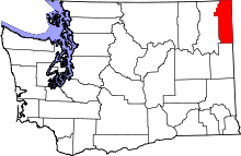 | |
| Towns | ||
| Unincorporated communities | ||