Newington Junction
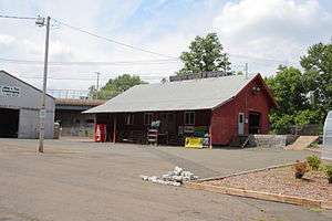
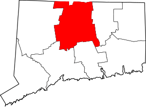
Newington Junction is a section of the town of Newington, Connecticut. It is centered at the intersection of Willard Avenue (Route 173) and West Hill Road in the northwestern part of the town, in the area generally just south of the Hartford city line. The name of the area refers to the railroad junction where the railroad line from New Haven meets with the railroad line from Bristol and Waterbury. The development of Newington Junction as a result of the railroad was instrumental in the separation of the town of Newington from its mother town of Wethersfield.
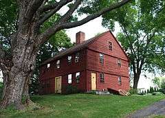
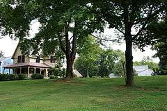
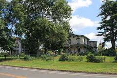
The area is also architecturally significant for the range of styles used in houses built during the period of significance of the area. The neighborhood contains houses with architectural styles from the late 18th century to the early 20th century. For reasons of both historical and architectural significance, a significant portion of the neighborhood has been listed on the National Register of Historic Places as historic districts. The architectural centerpiece of Newington Junction is the Willard Homestead and the Newington Junction Railroad Depot located in the center of the neighborhood. Both properties are separately listed on the National Register. Because the central area is now surrounded by incompatible modern structures, the architecturally significant areas of the neighborhood have been grouped into three clusters, each designated as a separate historic district, namely, Newington Junction South, North, and West Historic Districts.
Historic districts
Newington Junction South Historic District
|
Newington Junction South Historic District | |
|
Part of the Newington Junction South Historic District | |
  | |
| Location | 268--319 Willard Ave., Newington, Connecticut |
|---|---|
| Area | 10 acres (4.0 ha) |
| Architectural style | Late Victorian, Colonial, Gothic Revival |
| MPS | Newington Junction MRA |
| NRHP Reference # | 86003462[1] |
| Added to NRHP | June 2, 1987 |
The South district is located along Willard Avenue south of the intersection with West Hill Road (268-319 Willard Avenue). It consists of 9 contributing and 2 non-contributing properties over an area of 10 acres (4.0 ha). The houses here include examples of Late Victorian, Colonial, Gothic Revival styles, showcasing architecture from the period 1800-1924.[2]
Newington Junction North Historic District
|
Newington Junction North Historic District | |
|
Part of the Newington Junction North Historic District | |
|
| |
| Location | 55--108 Willard Ave., Newington, Connecticut |
|---|---|
| Area | 10 acres (4.0 ha) |
| Architectural style | Colonial Revival, Late Victorian, Queen Anne |
| MPS | Newington Junction MRA |
| NRHP Reference # | 86003465[1] |
| Added to NRHP | June 2, 1987 |
The North district is located along Willard Avenue north of the intersection with West Hill Road (55-108 Willard Avenue). It consists of 13 contributing and 3 non-contributing properties over an area of 10 acres (40,000 m2). The houses here include examples of Colonial Revival, Late Victorian, and Queen Anne styles, showcasing architecture from the period 1850-1949.
Newington Junction West Historic District
|
Newington Junction West Historic District | |
|
269 West Hill Road | |
|
| |
| Location | 175 and 181--183 Willard Ave. and 269--303 W. Hill Rd., Newington, Connecticut |
|---|---|
| Area | 8 acres (3.2 ha) |
| Architectural style | Colonial Revival, Late Victorian, Colonial |
| MPS | Newington Junction MRA |
| NRHP Reference # | 86003464[1] |
| Added to NRHP | June 2, 1987 |

The West district is primarily located along West Hill Road (269-303 West Hill Road) but also includes two additional properties on Willard Avenue near the intersection of Willard Avenue and West Hill Road. The district consists of 13 contributing and 3 non-contributing properties over an area of 8 acres (32,000 m2). The houses include examples of Colonial, Colonial Revival, and Late Victorian styles, showcasing architecture from the period 1650-1949.
References
- 1 2 3 National Park Service (2010-07-09). "National Register Information System". National Register of Historic Places. National Park Service.
- ↑ "NRHP nomination for Newington Junction South Historic District" (PDF). National Park Service. Retrieved 2014-12-16.
See also
- Newington (CDOT station)
- National Register of Historic Places listings in Hartford County, Connecticut
| Topics | |
|---|---|
| Lists by states |
|
| Lists by insular areas | |
| Lists by associated states | |
| Other areas | |
| |
Coordinates: 41°42′52″N 72°44′07″W / 41.7144°N 72.7352°W