New York State Route 456
| ||||
|---|---|---|---|---|
|
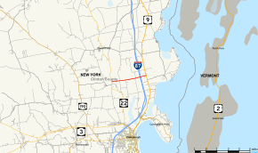
Map of Clinton County in northeastern New York with NY 456 highlighted in red | ||||
| Route information | ||||
| Maintained by Clinton County | ||||
| Length: | 3.24 mi[1] (5.21 km) | |||
| Existed: | early 1970s[2][3] – c. July 2014[4] | |||
| Major junctions | ||||
| West end: |
| |||
|
| ||||
| East end: |
| |||
| Location | ||||
| Counties: | Clinton | |||
| Highway system | ||||
| ||||

New York State Route 456 (NY 456) was a short state highway located entirely within the town of Beekmantown in Clinton County, New York, in the United States. The western terminus of the route was at an intersection with NY 22 by the community of Beekmantown (also called Beekmantown Corners) and the eastern terminus was at a junction with U.S. Route 9 (US 9) east of Interstate 87 (I-87) and west of Point Au Roche State Park. NY 456 was assigned in the early 1970s and is maintained by the Clinton County Highway Department as County Route 58 (CR 58). The route was decommissioned by July 2014.
Route description

NY 456 began at an intersection with NY 22 in the town of Beekmantown.[5] Maintained by the county as CR 58 and known locally as Spellman Road,[6] NY 456 proceeded east through a residential section of Beekmantown and past the Cumberland Head Library. Just after crossing the junction with Ashley Road, the route crossed over tracks owned by the Canadian Pacific Railway and used by Amtrak on its Adirondack service. Remaining a two-lane residential road through Beekmantown, NY 456 continued past a junction with Ron-Cathy Road and into an interchange with the Adirondack Northway (I-87) (exit 40). Two blocks after the interchange with the Northway, NY 456 reached a junction with US 9 just northwest of Point Au Roche State Park.[5]
History
NY 456 was assigned in the early 1970s to its current alignment.[2][3] Although the route is signed as a state highway, it has been maintained by Clinton County since its inception. The route was originally concurrent with the unsigned CR 32;[7] however, it is now inventoried by the county as CR 58.[6] The route was decommissioned by July 2014 and removed from the state traffic logs.[4]
Major intersections
The entire route was in Beekmantown, Clinton County.
| mi[1] | km | Destinations | Notes | ||
|---|---|---|---|---|---|
| 0.00 | 0.00 | ||||
| 2.69 | 4.33 | Exit 40 (I-87) | |||
| 3.24 | 5.21 | ||||
| 1.000 mi = 1.609 km; 1.000 km = 0.621 mi | |||||
See also
References
- 1 2 "2008 Traffic Data Report for New York State" (PDF). New York State Department of Transportation. June 16, 2009. p. 317. Retrieved January 10, 2010.
- 1 2 State of New York Department of Transportation (January 1, 1970). Official Description of Touring Routes in New York State (PDF). Retrieved June 24, 2010.
- 1 2 New York and New Jersey Tourgide Map (Map) (1972 ed.). Cartography by Rand McNally and Company. Gulf Oil Company. 1972.
- 1 2 "2014 Traffic Data Report for New York State" (PDF). New York State Department of Transportation. July 22, 2015. p. 313. Retrieved April 18, 2016.
- 1 2 Microsoft; Nokia (January 4, 2013). "overview map of NY 456" (Map). Bing Maps. Microsoft. Retrieved January 4, 2013.
- 1 2 "County Roads Listing – Clinton County" (PDF). New York State Department of Transportation. July 26, 2011. Retrieved March 28, 2012.
- ↑ Beekmantown Digital Raster Quadrangle (Map). 1:24,000. New York State Department of Transportation. 1979. Retrieved June 24, 2010.
External links
| Wikimedia Commons has media related to New York State Route 456. |
- New York State Route 456 at New York Routes • New York State Highway Termini