New Mexico State Road 126
| ||||
|---|---|---|---|---|
| Route information | ||||
| Maintained by NMDOT | ||||
| Length: | 39.654 mi[1] (63.817 km) | |||
| Tourist routes: | Part of Jemez Mountain Trail National Scenic Byway | |||
| Major junctions | ||||
| West end: |
| |||
| East end: |
| |||
| Location | ||||
| Counties: | Sandoval | |||
| Highway system | ||||
| ||||

New Mexico State Road 126 is a state highway in New Mexico, United States of America. Its total length is approximately 40 miles (64 km). New Mexico Route 126's western terminus is in the small town of Cuba, at U.S. Route 550. The route passes through the Nacimiento Mountains and Jemez Mountains, along the southern boundary of the San Pedro Parks Wilderness, then descends past Fenton Lake to the small, unincorporated community of La Cueva (east of Jemez Springs), where it ends at New Mexico State Road 4.
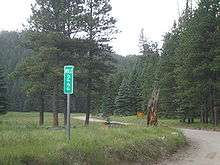
The highway is a part of the Jemez Mountain Trail National Scenic Byway.[2] It is paved near Cuba and La Cueva, but is a graded dirt road for much of its middle section. This section is usually closed during the winter months, and may be impassable for a few days at other times because of muddy conditions resulting from rainstorms.
Major intersections
The entire route is in Sandoval County.
| Location | mi[3] | km | Destinations | Notes | |
|---|---|---|---|---|---|
| Cuba | 0.000 | 0.000 | Western terminus | ||
| | 39.654 | 63.817 | Eastern terminus | ||
| 1.000 mi = 1.609 km; 1.000 km = 0.621 mi | |||||
See also
 U.S. Roads portal
 New Mexico portal
References
- ↑ "Posted Route–Legal Description" (PDF). New Mexico Department of Transportation. March 16, 2010. p. 31. Retrieved December 26, 2013.
- ↑ State of New Mexico, Tourism Department. "Jemez Mountain Trail National Scenic Byway". Retrieved December 16, 2013.
- ↑ "TIMS Road Segments by Posted Route/Point with AADT Info; NM, NMX-Routes" (PDF). New Mexico Department of Transportation. April 3, 2013. p. 29. Retrieved December 26, 2013.
External links
![]() Geographic data related to New Mexico State Road 126 at OpenStreetMap
Geographic data related to New Mexico State Road 126 at OpenStreetMap