New Brunswick Route 15
| ||||
|---|---|---|---|---|
| Route information | ||||
| Maintained by New Brunswick Department of Transportation | ||||
| Length: | 79.0 km[1] (49.1 mi) | |||
| Existed: | 1920s – present | |||
| Major junctions | ||||
| West end: |
| |||
|
| ||||
| East end: |
| |||
| Location | ||||
| Major cities: | Moncton, Dieppe, Shediac, Cap-Pelé | |||
| Highway system | ||||
|
Provincial highways in New Brunswick
| ||||

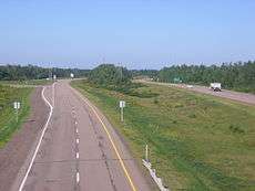
Route 15 is 79 km long and is in the southeastern corner of the province of New Brunswick. Starting at the north end of the Petitcodiac River Causeway, it loops around the city of Moncton on Wheeler Boulevard, then turns northeast from Dieppe to Shediac. From there, it turns east and bypasses Cap-Pelé crossing the Scoudouc River, then southeast to meet the Trans-Canada Highway at Port Elgin. The highway is a divided freeway from Moncton to just east of Shediac, where it remains a controlled-access highway until east of Cap-Pele.
History
Route 15 only extended from Shediac to Port Elgin until the early 1970s, when the Shediac Four-Lane Highway (the first rural expressway in New Brunswick) was built from Dieppe to Shediac. Its construction was controversial, with critics alleging that it was only built to give Moncton-area politicians better access to their summer cottages in the Shediac area. A two-lane bypass of Shediac itself was built shortly afterward.
The Wheeler Boulevard was developed and constructed through the 1970s and 1980s, and was fully complete by 1989.
A two-lane bypass of Cap-Pele opened to traffic in 1998. Since then it has proven itself to be a very dangerous highway artery in southeastern New Brunswick.
In 2012, a section of this highway between Moncton and Shediac was designated "Veteran's Memorial Highway".[2]
Major intersections
The entire route is in Westmorland County.
| Location | km[3] | mi | Exit | Destinations | Notes | |
|---|---|---|---|---|---|---|
| Moncton | 0.0 | 0.0 | Roundabout; eastern terminus of Route 114 | |||
| 0.3 | 0.19 | 0 | Baig Boulevard | At-grade intersection; no access from Baig Boulevard to eastbound Route 15 | ||
| Western end of freeway | ||||||
| 1.4 | 0.87 | 1 | St. George Boulevard | |||
| 3.0 | 1.9 | 3 | ||||
| 5.4 | 3.4 | 5 | No access from westbound Route 15 to southbound Route 126 | |||
| 6.1 | 3.8 | 6 | Mapleton Road to | No access to westbound Route 15 | ||
| 9.0 | 5.6 | 7 | Morton Avenue / Connaught Avenue – Université de Moncton | |||
| 9.9 | 6.2 | 8 | Université Avenue – Université de Moncton | |||
| Eastern end of freeway | ||||||
| 10.6 | 6.6 | |||||
| 11.3– 11.8 | 7.0– 7.3 | Roundabout | ||||
| Western end of freeway | ||||||
| 12.2 | 7.6 | 10 | Paul Street | |||
| 16.3 | 10.1 | 16 | Harrisville Boulevard / Dieppe Boulevard to | |||
| 18.0 | 11.2 | 17 | Eastbound exit / entrance only | |||
| | 19.4 | 12.1 | 19 | |||
| Scoudouc | 26.7 | 16.6 | 26 | Industrial Drive | ||
| Shediac | 32.2 | 20.0 | 31 | Northern terminus of Route 132 / southern terminus of Route 11; exit 0 (Route 11) | ||
| 37.6 | 23.4 | 37 | Southern terminus of Route 140 | |||
| Grand-Barachois | 43.4 | 27.0 | 43 | |||
| Robichaud | 46.0 | 28.6 | 46 | |||
| Cap-Pelé | 52.6 | 32.7 | 53 | |||
| Eastern end of freeway | ||||||
| 57.1 | 35.5 | Eastern terminus of Route 133 | ||||
| Shemogue | 64.2 | 39.9 | Northern terminus of Route 940 | |||
| 64.8 | 40.3 | Eastern terminus of Route 950 | ||||
| Mates Corner | 69.0 | 42.9 | Western terminus of Route 955 | |||
| Port Elgin | 78.8 | 49.0 | Roundabout | |||
| 1.000 mi = 1.609 km; 1.000 km = 0.621 mi | ||||||
See also
References
- ↑ New Brunswick Department of Transportation: Designated Provincial Highways, 2003
- ↑ Highway of Heroes planned for New Brunswick, Highway Renaming for Veterans.
- ↑ Google (July 9, 2014). "New Brunswick Route 15" (Map). Google Maps. Google. Retrieved July 9, 2014.