Neuvy-Bouin
| Neuvy-Bouin | |
|---|---|
|
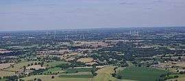
An aerial view of the wind farm | |
 Neuvy-Bouin | |
|
Location within Nouvelle-Aquitaine region  Neuvy-Bouin | |
| Coordinates: 46°40′34″N 0°27′38″W / 46.676°N 0.4606°WCoordinates: 46°40′34″N 0°27′38″W / 46.676°N 0.4606°W | |
| Country | France |
| Region | Nouvelle-Aquitaine |
| Department | Deux-Sèvres |
| Arrondissement | Parthenay |
| Canton | Secondigny |
| Government | |
| • Mayor (2014–2020) | Yolande Sechet |
| Area1 | 25 km2 (10 sq mi) |
| Population (2006)2 | 506 |
| • Density | 20/km2 (52/sq mi) |
| Time zone | CET (UTC+1) |
| • Summer (DST) | CEST (UTC+2) |
| INSEE/Postal code | 79190 / |
| Elevation | 179–231 m (587–758 ft) |
|
1 French Land Register data, which excludes lakes, ponds, glaciers > 1 km² (0.386 sq mi or 247 acres) and river estuaries. 2 Population without double counting: residents of multiple communes (e.g., students and military personnel) only counted once. | |
Neuvy-Bouin is a commune in the Deux-Sèvres department in western France.
Geography
It is situated about 8 km north of Secondigny, 19 km west of Parthenay and 20 km south of Bressuire.
See also
References
| Wikimedia Commons has media related to Neuvy-Bouin. |
This article is issued from Wikipedia - version of the 12/2/2016. The text is available under the Creative Commons Attribution/Share Alike but additional terms may apply for the media files.