Neukölln
| Neukölln | ||
|---|---|---|
| Borough of Berlin | ||
| ||
 Neukölln | ||
Location of Neukölln in Berlin .svg.png) | ||
| Coordinates: 52°29′N 13°27′E / 52.483°N 13.450°ECoordinates: 52°29′N 13°27′E / 52.483°N 13.450°E | ||
| Country | Germany | |
| State | Berlin | |
| City | Berlin | |
| Government | ||
| • Mayor | Heinz Buschkowsky (SPD) | |
| Area | ||
| • Total | 44.93 km2 (17.35 sq mi) | |
| Population (2012-11-30) | ||
| • Total | 322,931 | |
| • Density | 7,200/km2 (19,000/sq mi) | |
| Time zone | CET/CEST (UTC+1/+2) | |
| Vehicle registration | B | |
| Website | Official homepage | |

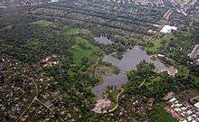
Neukölln is the eighth borough of Berlin, located in the southeastern part of the city and was part of the former American sector under the Four-Power occupation of the city. It features many Gründerzeit buildings and is characterized by having one of the highest percentage of immigrants in Berlin.
History
Neukölln's independence ended in 1920 when it was incorporated into Berlin. See History of Neukölln (locality/Stadtteil Berlins)
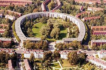
From 1966 to 1975 the Gropiusstadt was built, a "Trabantenstadt" or city-within-a-city housing estate, designed by architect Walter Gropius.
Neukölln is selected as pilot city of the Council of Europe and the European Commission Intercultural cities programme.
Demographics
As of 2010, the borough had a population of 310,283, of whom 121,000 (~40%) were of non-German ethnicity/origin. The percentage is significantly higher in the same-named locality of Neukölln.[1] The borough is known for its large Turkish, Arab and Kurdish communities, which together make up roughly 18% of the borough's population. Recently, there has been an influx of Romani people and Sub-Saharan Africans.[2] Another noticeable trend is the rapid gentrification of certain neighborhoods within the borough, where the influx of students, creatives and other young professionals of mostly Western origin has caused some tension.[3]
| Percentage of people with migration background[4] | ||
|---|---|---|
| Germans without migration background/Ethnic Germans | 60% (189.000) | |
| Germans with migration background, or Foreigners/Ausländer | 40% (121.000) | |
| Muslim/Middle Eastern origin (Turkey, Arab League, Iran etc.) | 18% (55.000) | |
| non-German European origin (Russia, Poland, Greece, Serbia, Spain, France etc.) | 11% (33.000) | |
| African background/Afro-Germans | 4% (12.400) | |
| Others (East Asians, Americans, etc.) | 6.5% (21.000) |
Subdivision

Neukölln is divided into 5 localities:
| Locality |
Area (km²) |
Inhabitants |
Density (Inhabitants/km²) |
| 0801 Neukölln |
11.71 | 155,950 | 13,318 |
| 0802 Britz |
12.40 | 39,029 | 3,148 |
| 0803 Buckow |
6.35 | 38,219 | 6,019 |
| 0804 Rudow |
11.81 | 40,733 | 3,449 |
| 0805 Gropiusstadt |
2.67 | 35,751 | 13,390 |
Politics

.svg.png)
At the 2011 elections for the parliament of the borough (Bezirksverordnetenversammlung) the following parties were elected:
- SPD 27
- CDU 13
- Alliance '90/The Greens 8
- Pirate Party 4
- The Left 3
Personalities
- Leo Arons (1860-1919), physicist, social democrat and supporter of the trade union movement

- Horst Buchholz, actor, (1933-2003)
- Heinz Buschkowsky (born 1948), politician (SPD), former district mayor of Neukölln
- Christiane F., (born 1962), author of the book Wir Kinder vom Bahnhof Zoo
- Alexander Hacke, musician, born 1965 in Neukölln
- Kirsten Heisig, (1961-2010), juvenile magistrate in Neukölln, created the Neuköllner Modell, applying fast procedures to deal with juvenile offenders before they developed a criminal career.
- Jutta Limbach, legal academic, born 1934 in Neukölln
- Inge Meysel, actress, (1910-2004), Seevetal
- Gunnar Möller (born 1928), actor
- Mady Rahl, actress, (1915-2009)
- Lotte Ulbricht, wife of East German leader Walter Ulbricht, (1903-2002)
- Momus, born 1960 in Paisley, Scotland, lives in Neukölln
References in popular culture
- "Neuköln" (deliberately spelt with one 'l') is an instrumental piece by David Bowie, the ninth track on his 1977 album "Heroes".
- The last track of Miss Kittin's first solo album I Com is called "Neukölln 2".
- The German film Knallhart is set in the northern part of Neukölln.
- The German documentary Neukölln Unlimited tells the story of three Lebanese teenagers based in Neukölln, who fight against the deportation out of Germany.
- Electronic music producer Kobosil is a native of the city. With a Bachelor of Arts in audio production, he has released music on the Ostgut Ton and MDT labels.[5]
Twin cities

 Bat Yam, Israel
 Cologne, Germany
- Leonberg, Germany
 Marino, Italy
- Wetzlar, Germany
 Hammersmith and Fulham, UK
See also
- Berlin Neukölln (electoral district)
- Intercultural cities
References
- ↑ http://www.statistik-berlin-brandenburg.de/Publikationen/Stat_Berichte/2011/SB_A1-5_hj02-10_BE.pdf
- ↑ http://www.welt.de/die-welt/politik/article9920445/Die-Roma-von-Berlin-Neukoelln.html
- ↑ http://www.spiegel.de/international/germany/neukoelln-nasties-foreigners-feel-accused-in-berlin-gentrification-row-a-750297.html
- ↑ http://www.statistik-berlin-brandenburg.de/Publikationen/Stat_Berichte/201gnm1/SB_A1-5_hj02-10_BE.pdf
- ↑ "Kobosil". Resident Advisor. Resident Advisor Ltd. 2014. Retrieved 4 June 2014.
External links
| Wikimedia Commons has media related to Neukölln. |
| Wikivoyage has a travel guide for Neukölln. |
- (German) Official homepage
- (German) WebTV from Berlin, Neukoelln
| |
| West boroughs (1920–2000) |  | |
|---|---|---|
| East boroughs (1920–2000) |
| |