Nelson, New Zealand
| Nelson City Whakatū | |||
|---|---|---|---|
| Unitary authority | |||
|
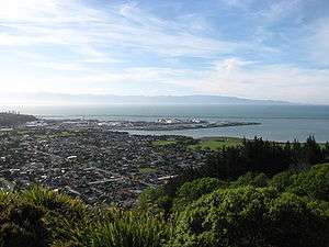
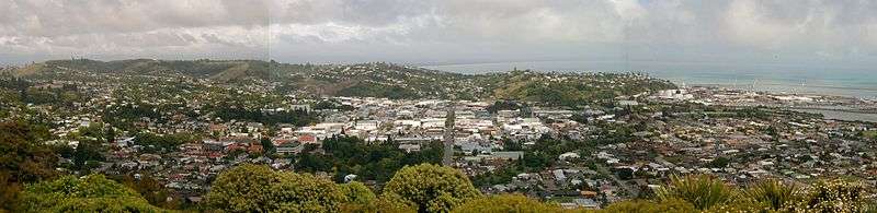
November 2006 view of Nelson from the "Centre of New Zealand" | |||
| |||
| Nickname(s): Top of the South, Sunny Nelson | |||
|
Motto: Palmam qui meruit ferat Latin Let him, who has earned it, bear the palm | |||
 Nelson City | |||
| Coordinates: 41°16′15″S 173°17′2″E / 41.27083°S 173.28389°ECoordinates: 41°16′15″S 173°17′2″E / 41.27083°S 173.28389°E | |||
| Country |
| ||
| Unitary authority | Nelson City | ||
| Settled by Europeans | 1841 | ||
| Founded by | Arthur Wakefield | ||
| Named for | Horatio Nelson | ||
| Electorates |
Nelson Te Tai Tonga | ||
| Government | |||
| • Mayor | Rachel Reese | ||
| Area from Rai Saddle to Stoke | |||
| • Territorial | 445 km2 (172 sq mi) | ||
| Population (June 2016)[1] | |||
| • Territorial | 50,600 | ||
| • Density | 110/km2 (290/sq mi) | ||
| • Urban | 65,700 | ||
| Demonym(s) | Nelsonian | ||
| Time zone | NZST (UTC+12) | ||
| • Summer (DST) | NZDT (UTC+13) | ||
| Postcode | 7010, 7011, 7020 | ||
| Area code(s) | 03 | ||
| Website |
nelsoncitycouncil | ||
Nelson is a city on the eastern shores of Tasman Bay, and is the economic and cultural centre of the region of the same name. Established in 1841, it is the second-oldest settled city in New Zealand and the oldest in the South Island, and was proclaimed a city by royal charter in 1858.
Nelson city is bordered to the west and south-west by the Tasman District Council and the north-east, east and south-east by the Marlborough District Council. The city does not include Richmond, the region's second-largest settlement. Nelson City has a population of around 46,437 ranking it as New Zealand's 12th most populous city and the geographical centre of New Zealand. When combined with the town of Richmond which has close on 14,000 residents, Nelson is ranked as New Zealand's 9th largest urban area by population.
Nelson is well known for its thriving local arts and crafts scene, Each year, the city hosts events popular with locals and tourists alike, such as the Nelson Arts Festival.[2] The annual Wearable Art Awards[3] began near Nelson and a local museum, World of Wearable Art now showcases winning designs alongside a collection of classic cars.
Etymology
Nelson was named in honour of the Admiral Horatio Nelson who defeated both the French and Spanish fleets at the Battle of Trafalgar in 1805. Many roads and public areas around the city are named after people and ships associated with that battle and Trafalgar Street is the main shopping axis of the city. Inhabitants of Nelson are referred to as Nelsonians.
Nelson's Māori name, Whakatū,[4] means 'build', 'raise', or 'establish'.
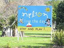
In an article to The Colonist newspaper on 16 July 1867, Francis Stevens described Nelson as "The Naples of the Southern Hemisphere".[5] Today, Nelson has the nicknames of "Sunny Nelson" due to its high sunshine hours per year or the "Top of the South" because of its geographic location.
History

Early settlement
Settlement of Nelson began about 700 years ago by Māori.[6] There is evidence the earliest settlements in New Zealand are around the Nelson-Marlborough regions. The earliest recorded iwi in the Nelson district are the Ngāti Kuia, Ngāti Tumatakokiri, Ngāti Apa and Rangitane tribes.
Raids from northern tribes in the 1820s, led by Te Rauparaha and his Ngāti Toa, soon decimated the local population and quickly displaced them.
Planning
The New Zealand Company in London planned the settlement of Nelson. They intended to buy cheaply from the Māori some 200,000 acres (810 km2) which they planned to divide into one thousand lots and sell (at a considerable profit) to intending settlers. The Company earmarked future profits to finance the free passage of artisans and labourers and their families, and for the construction of public works. However, by September 1841 only about one third of the lots had sold. Despite this the Colony pushed ahead, and land was surveyed by Frederick Tuckett.[7]
Three ships sailed from London under the command of Captain Arthur Wakefield. Arriving in New Zealand, they discovered that the new Governor of the colony, William Hobson, would not give them a free hand to secure vast areas of land from the Māori or indeed to decide where to site the colony. However, after some delay, Hobson allowed the Company to investigate the Tasman Bay area at the north end of the South Island. The Company selected the site now occupied by Nelson City because it had the best harbour in the area. But it had a major drawback: it lacked suitable arable land; Nelson City stands right on the edge of a mountain range while the nearby Waimea Plains amount to only about 60,000 acres (240 km2), less than one third of the area required by the Company plans.
The Company secured a vague and undetermined area from the Māori for £800 that included Nelson, Waimea, Motueka, Riwaka and Whakapuaka. This allowed the settlement to begin, but the lack of definition would prove the source of much future conflict. The three colony ships sailed into Nelson Haven during the first week of November 1841. When the four first immigrant ships – Fifeshire, Mary-Ann, Lord Auckland and Lloyds – arrived three months later, they found the town already laid out with streets, some wooden houses, tents and rough sheds. Within 18 months the Company had sent out 18 ships with 1052 men, 872 women and 1384 children. However, fewer than ninety of the settlers had the capital to start as landowners.
Cultural and religious immigrants
The early settlement of Nelson province included a proportion of German immigrants, who arrived on the ship Sankt Pauli and formed the nucleus of the villages of Sarau (Upper Moutere) and Neudorf. These were mostly Lutheran Protestants with a small number of Bavarian Catholics.[8]
In 1892 the New Zealand Church Mission Society (NZCMS) was formed in a Nelson church hall.[9]
Problems with land
After a brief initial period of prosperity, the lack of land and of capital caught up with the settlement and it entered a prolonged period of relative depression. The labourers had to accept a cut in their wages. Organised immigration ceased (a state of affairs that continued until the 1850s). By the end of 1843, artisans and labourers began leaving Nelson; by 1846, some 25% of the immigrants had moved away.
The pressure to find more arable land became intense. To the south-east of Nelson lay the wide and fertile plains of the Wairau Valley. The New Zealand Company tried to claim that they had purchased the land. The Māori owners stated adamantly that the Wairau Valley had not formed part of the original land sale and made it clear they would resist any attempts by the settlers to occupy the area. The Nelson settlers led by Arthur Wakefield and Henry Thompson attempted to do just that. This resulted in the Wairau Affray, where 22 settlers died. The subsequent Government enquiry exonerated the Māori and found that the Nelson settlers had no legitimate claim to any land outside Tasman Bay. Public fears of a Māori attack on Nelson lead to the formation of the Nelson Battalion of Militia in 1845.
City

Nelson township was managed by the Nelson Provincial Council through a Board of Works constituted by the Provincial Government under the Nelson Improvement Act 1856 until 1874. It was proclaimed a Bishop's See and city under letters patent by Queen Victoria on 27 September 1858,[10] the second New Zealand city proclaimed in this manner after Christchurch. Edmund Hobhouse[11] was the first Bishop. The Municipal Corporations Act 1876 stated that Nelson was constituted a city on 30 March 1874.
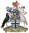
Coat of Arms
Nelson City has a Coat of Arms, obtained in 1958 from the Royal College of Heralds to mark the Centenary of Nelson as a City. The Blazon of the Arms is;
- "Barry wavy Argent and Azure a Cross Flory Sable on a Chief also Azure a Mitre proper And for the Crest on a Wreath of the Colours Issuant from a Mural Crown proper a Lion rampant Gules holding between the fore paws a Sun in splendour or. The supporters on the dexter side a Huia Bird and on the sinister side a Kotuku both proper."
Motto "Palmam qui meruit ferat" (Let him, who has earned it, bear the palm)
Translation of the blazon. The shield is the first thing described. "Barry wavy" means there is an equal number of horizontal bars each of which is in a wave shape. "Argent" means silver and "Azure" means blue which gives the colours of the bars. On these is placed cross. If the cross is not further described then the arms are of equal length. "Flory" means that each arm terminates in a fleur-de-lis. "Sable" means black and this is the colour of the cross. A "Chief" is a broad stripe at the top of the shield and this is coloured blue ("azure".) On the chief is a bishop's mitre and "proper" means that the mitre is shown in its natural colours. The crest is the part above the shield. The "wreath of the colours" is the twisted material on which the crown sits and the colours are those of the shield; that is, silver and blue. The "Mural Crown" which is a crown made from masonry or bricks and represents city walls or towers sits on the wreath. Again "proper" means the crown is in natural colour. This crown is often found on city coats of arms. Standing on the crown is a "lion rampant" which is a heraldic lion standing erect and his colour is red ("gules"). In his front paws he is holding the sun and "in splendour" just means the sun has rays depicted. The colour of the Sun is (naturally) gold ("Or"). The helmet and mantling shown above the shield is not normally part of the blazon and is left to the artist to depict. The same is true for what the supporters stand on.
The Supporters. These are the creatures on either side of the shield. The dexter side is the right side from the shield carrier's point of view but the left side for a viewer and this side has a Huia bird. On the other side is a Kotuku or New Zealand White Heron bird. Again "proper" means both these birds are shown in their natural colours.
The motto which was Lord Nelson's motto may be translated "Let him, who has earned it, bear the palm". It is also the motto of the Royal Naval College.
Nelson Province
_NZ.png)
From 1853 until 1876, when provincial governments were abolished, Nelson was the capital of Nelson Province. The province itself was much larger than present-day Nelson City and included all of the present-day Buller, Kaikoura, Marlborough, Nelson, Tasman as well as the Grey District north of the Grey River and the Hurunui District north of the Hurunui River. The Marlborough Province split from Nelson Province in October 1859.
Nelson provincial anniversary
Nelson Anniversary Day is a public holiday observed in the northern half of the South Island of New Zealand, being the area's provincial anniversary day. It is observed throughout the historic Nelson Province, even though the provinces of New Zealand were abolished in 1876. The modern area of observation includes all of Nelson City and included all of the present-day Buller, Kaikoura, Marlborough, Tasman as well as the Grey District north of the Grey River and the Hurunui District north of the Hurunui River. The holiday usually falls on the Monday closest to 1 February, the anniversary of the arrival of the first New Zealand Company boat, the Fifeshire on 1 February 1842.[12]
Anniversary celebrations in the early years featured a sailing regatta, horse racing, running races, shooting and ploughing matches. In 1892, the Nelson Jubilee Celebration featured an official week-long programme with church services, sports, concerts, a ball and a grand display of fireworks.
Time gun
In 1858 the Nelson Provincial Council erected a time gun at the spot on Brittania Heights where in 1841, Captain Wakefield erected his flagpole. The gun was fired each Saturday at noon to give the correct time. The gun is now preserved as a historical relic and the Songer Tree[13] marks the site on Signal Hill of the original flagpole.[14]
Geography
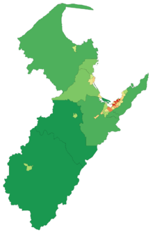
The Nelson region comprises two unitary authorities – Nelson City, administered by the Nelson City Council, and Tasman District, administered by the Tasman District Council, based in Richmond 15 kilometres (9 miles) to the southwest. It is between Marlborough, another unitary authority, to the east, and the West Coast Regional Council to the west.
For some while, there has been talk about amalgamating the two authorities to streamline and render more financially economical the existing co-operation between the two councils,[15][16][17] exemplified by the jointly owned Port Nelson and the creation of Nelson Tasman Tourism,a jointly owned tourism promotion organisation.[18] However, an official poll conducted in April 2012 showed nearly three-quarters of those who voted in Richmond were opposed to the proposal with a narrow majority in favour.
Nelson has beaches and a sheltered harbour. The harbour entrance is protected by a Boulder Bank, a natural, 13 km (8 miles) bank of rocks transported south from Mackay Bluff via longshore drift. The bank creates a perfect natural harbour which enticed the first settlers although the entrance was narrow. The wreck of the Fifeshire on Arrow Rock (now called Fifeshire Rock in memory of this disaster) in 1842 proved the difficulty of the passage.[19] A cut was later made in the bank in 1906 which allowed larger vessels access to the port.
The creation of Rocks Road around the waterfront area after the Tahunanui slump[20] in 1892 increased the effects of the tide on Nelson city's beach, Tahunanui, and removed sediment. This meant the popular beach and adjoining car park were being eroded (plus the sand dunes) so a project to replace these sands was put in place[21] and has so far proved a success, with the sand rising a considerable amount and the dunes continuing to grow.
Central Business District
The Central Business District (CBD) of Nelson is bounded by Halifax Street to the north, Rutherford Street to the west, Collingwood Street to the east, and Selwyn Place to the south.[22] Other major streets within the CBD include Trafalgar Street, Bridge Street and Hardy Street.
Suburbs
|
Nelson North –
|
City Centre –
|
Tahunanui-Port Hills
|
Stoke |
The town of Richmond (population over 14,000) has become attached to Nelson's southern suburbs and is now considered an outlying suburb of Nelson City.
National parks
Nelson is surrounded by mountains on three sides with Tasman Bay on the other and the region is the gateway to Abel Tasman National Park, Kahurangi National Park, Lakes Rotoiti and Rotoroa in the Nelson Lakes National Park. It is a centre for both ecotourism and adventure tourism and has a high reputation among caving enthusiasts due to several prominent cave systems around Takaka Hill and Mounts Owen and Arthur, which hold the largest and deepest explored caverns in the southern hemisphere.
Climate
Nelson has a temperate oceanic climate, with mild winters and warm summers. Nelson has rainfall evenly distributed throughout the year and has fewer frosts due to the highly marine geography of New Zealand. Winter is the stormiest time, when gales and storms are more common. Nelson has one of the sunniest climates of all major New Zealand centres,[23] earning the nickname 'Sunny Nelson' with an annual average total of over 2400 hours of sunshine.[24] The highest recorded temperature in Nelson is 36.3 °C (97 °F), the lowest −6.6 °C (20 °F).
| Climate data for Nelson (1981–2010) | |||||||||||||
|---|---|---|---|---|---|---|---|---|---|---|---|---|---|
| Month | Jan | Feb | Mar | Apr | May | Jun | Jul | Aug | Sep | Oct | Nov | Dec | Year |
| Average high °C (°F) | 22.4 (72.3) |
22.6 (72.7) |
21.0 (69.8) |
18.1 (64.6) |
15.6 (60.1) |
13.1 (55.6) |
12.5 (54.5) |
13.4 (56.1) |
15.0 (59) |
16.9 (62.4) |
18.9 (66) |
20.7 (69.3) |
17.5 (63.5) |
| Daily mean °C (°F) | 17.8 (64) |
17.9 (64.2) |
16.1 (61) |
13.2 (55.8) |
10.5 (50.9) |
7.9 (46.2) |
7.2 (45) |
8.4 (47.1) |
10.4 (50.7) |
12.4 (54.3) |
14.3 (57.7) |
16.4 (61.5) |
12.7 (54.9) |
| Average low °C (°F) | 13.2 (55.8) |
13.3 (55.9) |
11.3 (52.3) |
8.3 (46.9) |
5.5 (41.9) |
2.7 (36.9) |
1.9 (35.4) |
3.4 (38.1) |
5.7 (42.3) |
7.8 (46) |
9.8 (49.6) |
12.0 (53.6) |
7.9 (46.2) |
| Average precipitation mm (inches) | 76.5 (3.012) |
63.5 (2.5) |
70.8 (2.787) |
80.9 (3.185) |
82.0 (3.228) |
92.7 (3.65) |
77.6 (3.055) |
81.9 (3.224) |
85.1 (3.35) |
87.2 (3.433) |
78.3 (3.083) |
83.6 (3.291) |
960.1 (37.799) |
| Average precipitation days (≥ 1.0 mm) | 6.8 | 5.8 | 6.6 | 6.5 | 7.3 | 8.2 | 7.8 | 8.6 | 9.9 | 9.4 | 7.9 | 8.6 | 93.3 |
| Average relative humidity (%) | 74.4 | 78.5 | 79.6 | 83.0 | 87.8 | 89.6 | 90.0 | 86.6 | 79.7 | 76.9 | 73.7 | 74.2 | 81.2 |
| Mean monthly sunshine hours | 267.5 | 231.4 | 230.4 | 196.2 | 175.7 | 143.3 | 159.0 | 182.2 | 189.3 | 221.4 | 234.9 | 241.1 | 2,472.4 |
| Source: NIWA Climate Data[25] | |||||||||||||
| Climate data for Nelson (2000–2012) | |||||||||||||
|---|---|---|---|---|---|---|---|---|---|---|---|---|---|
| Month | Jan | Feb | Mar | Apr | May | Jun | Jul | Aug | Sep | Oct | Nov | Dec | Year |
| Average high °C (°F) | 22.7 (72.9) |
23.5 (74.3) |
21.8 (71.2) |
19.2 (66.6) |
16.4 (61.5) |
13.8 (56.8) |
13.0 (55.4) |
14.1 (57.4) |
15.5 (59.9) |
17.5 (63.5) |
20.0 (68) |
21.3 (70.3) |
18.2 (64.8) |
| Average low °C (°F) | 13.8 (56.8) |
14.4 (57.9) |
11.8 (53.2) |
9.0 (48.2) |
8.1 (46.6) |
5.0 (41) |
3.4 (38.1) |
4.7 (40.5) |
5.9 (42.6) |
8.0 (46.4) |
10.6 (51.1) |
13.5 (56.3) |
9.0 (48.2) |
| Average precipitation mm (inches) | 51.6 (2.031) |
36.3 (1.429) |
41.7 (1.642) |
54.4 (2.142) |
130.0 (5.118) |
125.6 (4.945) |
50.7 (1.996) |
90.0 (3.543) |
98.1 (3.862) |
79.4 (3.126) |
41.2 (1.622) |
110.8 (4.362) |
1,111.7 (43.768) |
| Source: WeatherOnline Climate Data[26] | |||||||||||||
Geographical centre of New Zealand
The geographical "centre of New Zealand" allegedly lies in Nelson;[27] on a hilltop near the centre of the city. This is the point "zero, zero" from which the first trigonometrical surveys were started in the 1870s by John Spence Browning, the Chief Surveyor for Nelson.
From this 360-degree viewpoint, the zero, zero points in neighbouring geodetic survey regions (including Wellington in the North Island) could be triangulated and a better survey of the whole of New Zealand constructed. In 1962, the 'gravitational centre' (including Stewart Island and some smaller islands in addition to the North and South Island, but excluding the Chathams) of New Zealand lay in a patch of unremarkable dense scrub in a forest in Spooners Range near Tapawera, 35 km (22 miles) south-west of Nelson: 41°30′S 172°50′E / 41.500°S 172.833°E.[28]
Demographics
| 2006 Nelson Ethnic Population Comparison[29] | |||
|---|---|---|---|
| Ethnic Group | Nelson | Tasman | New Zealand |
| European | 78% | 80% | 65% |
| Maori | 8% | 7% | 14% |
| Pacific Islander | 2% | 1% | 7% |
| Asian | 2% | 1% | 9% |
| Other | 17% | 18% | 16% |
Nelson City's total population rose from 41,568 in 2001 to 42,888 in 2006, while Tasman District's rose from 41,352 to 44,625, to exceed that of Nelson City for the first time.[30]
Figures released on 23 April 2007 by Statistics New Zealand showed that 3,774 people born in the United Kingdom and Ireland lived in the Nelson City Council area and made up 9.1% of its population[31] – the highest proportion of residents from the United Kingdom and Ireland in New Zealand – with another 9.5% born overseas. Although Statistics New Zealand no longer keeps statistics for numbers of residents born in Germany, the Embassy of the Federal Republic of Germany in Wellington has stated that a greater proportion of German speakers live in the Nelson region than anywhere else in New Zealand. There was a 23.7% rise in the number of Asians living in Nelson City and a 35.4% rise in Tasman District.
The religious structure in Nelson is similar to that of Tasman, particularly in the high proportion of people (32.2 percent of all people as at 5 March 1996) who specified no religion. This compares with 26.1 percent nationally. Anglicanism is the main Christian denomination, with 20.7 percent of all people, compared with 18.4 percent nationally. Historically, the early European settlers were largely of Anglican denomination. The building of the Anglican cathedral, as well as enabling Nelson to claim city status while being relatively small, also established the religion into the social fabric of Nelson.
Economy
The Nelson Tasman economy is based on the 'big five' industries; seafood, horticulture, forestry, farming and tourism.[32] Port Nelson[33] is the biggest fishing port in Australasia. There are also a range of growth industries, including art and craft, aviation, engineering technology, and information technology. The region is sixth in terms of GDP growth in the 2007–10 period.[34]
The sub-national GDP of the Nelson Tasman region (Nelson City and Tasman District) was estimated at $3.4 billion in 2010, 1.8% of New Zealand's national GDP.[34][35]
Nelson is home to various business agencies that serve the city and its surrounds,[36] including Nelson Tasman Tourism (NTT),[37] which aims to promote the region and help advertisers reach visitors from New Zealand and overseas,[38] and the Nelson Regional Economic Development Agency (EDA), which works to "coordinate, promote, facilitate, investigate, develop, implement, support and fund initiatives relating to economic development [and] employment growth ... within the Nelson region ..."[39][40]
Below is a list of some of the region's largest companies and employers:
- Regional airline Air Nelson has its headquarters and maintenance base at Nelson Airport.
- Australasian forest products company, Carter Holt Harvey has a large sawmill in Eves Valley near Brightwater.
- Dairy giant Fonterra produces milk powder for export at plants in Brightwater and Takaka.
- Helicopters (NZ) has its headquarters and maintenance base at Nelson Airport.
- Japanese automobile manufacturer Honda has its New Zealand distribution centre in the Whakatu Industrial Estate in Stoke.
- Beverage company McCashins has a microbrewery in Stoke
- The Nelson Building Society has branches in Motueka, Murchison, Nelson, Richmond and Takaka.
- Nelson Pine Industries produces medium-density fibreboard at a plant in Richmond.
- Fertiliser company Ravensdown has a large storage facility in Richmond.
- Sea Dragon Marine Oils[41] has a refinery in Annesbrook.
- The The Cawthron Institute has a research facility in The Wood with a focus on fisheries.
- Food manufacturer, the Talley's Group has processing facilities at Port Nelson and Port Motueka.
- The New Zealand King Salmon Company[42] processes Chinook salmon at its factory in Annesbrook.
- Trucking company the TNL Group has a large depot in Richmond
In 2013, Nelson Mayor Aldo Miccio worked on a proposal that would see Australian call centres for companies such as Gen-i and Xero relocated to Nelson. The plan was in response to Australian companies moving call and contact centres out of Asia because their Australian customers preferred English-speaking centres. If the plan was successful, Mr Miccio expected 100 to 300 jobs paying NZ$50,000-plus in the first year to be created in Nelson.[43]
Natural resources
Nelson is rich in natural resources with varying quantities of argillite, asbestos, chromite, coal, copper, crude oil, dolomite, dunite, gold, granite, iron ore, lead, limestone, marble, molybdenum, natural gas, nickel, soapstone, tungsten, uranium and zinc present within the region.[44][45][46]
In 1905, a government geologist forecast that iron deposits of 50 million tons lay in the Onekaka and Parapara areas of the Nelson region. With all the necessary materials – iron ore, limestone, water, and coal – within a few miles of each other and ownership of a nearby wharf, the Onekaka Iron and Steel Company Ltd seemed virtually self-contained. With the Nelson Evening Mail predicting that "Nelson was on the eve of a future industrial center on the shores of Golden Bay". The first iron flowed from the blast furnace at the Onekaka ironworks at 8 pm on 27 April 1922 but by 1931, the Onekaka Iron and Steel Company Ltd had gone into liquidation due to falling prices and an increase in tariffs by the Australian government. Several attempts between 1951 and 1956, by the New Zealand Government, which had nationalised the steel industry in 1938 proved unsuccessful.[47][48]
Government
Local
As a unitary authority, the Nelson City Council has the combined responsibilities and functions of both a territorial (local) and regional council. This is different from most other local authorities in New Zealand. More often a regional council is a separate organisation with several territorial authorities (city or district councils) within its borders. Other unitary authorities are the Auckland Council, Gisborne District Council, Marlborough District Council, Tasman District Council and the Chatham Islands Council.
The Nelson City Council currently holds its elections under the First Past the Post electoral system once every three years, with the most recent election held on 12 October 2013. Electors vote by indicating their choice for Mayor by placing a tick beside one of the names and the person who receives the most votes becomes Mayor. Councillors are elected the same way, with the 12 candidates who each receive the most votes becoming Councillors. Voters in this system may vote for no more than 12 candidates. The elections are conducted by post over a three-week period to make it as convenient as possible for people to vote.
The other option permitted under the Local Electoral Act 2001, but not currently used in Nelson, is the Single Transferable Vote system. Electors vote by ranking candidates in order of preference by placing a number beside each candidate's name. The elector can vote for one or up to the total number of candidates on the paper. The number of votes required for a candidate to be elected, the quota, depends on the number of positions to be filled and the number of valid votes.
Under the Local Electoral Act 2002, the Nelson City Council can resolve to change the electoral system to be used for the next two elections, and it must review this decision every six years. A referendum was held in 2003 to decide which electoral system would be used for the 2004 and 2007 Nelson City Council elections. The outcome was that the First Past the Post system was retained. The 2008 review retains that system for the 2010 and 2013 elections.[49]
On 12 October 2013, Rachel Reese was elected as Nelson's first woman mayor after receiving 1,500 votes more than incumbent mayor Aldo Miccio.[50]
As of 12 October 2016, the current council members are:-
| Mayor | Rachel Reese |
| Deputy Mayor | Paul Matheson |
| Councillors | Luke Acland Ian Barker Mel Courtney Bill Dahlberg Kate Fulton Matt Lawrey Brian McGurk Paul Matheson Gaile Noonan Mike Rutledge Tim Skinner Stuart Walker |
National
Nelson is covered by one general electorate: Nelson and one Maori electorate: Te Tai Tonga.
As of the 2014 general election, Nelson is held by Nick Smith of the National Party. The Maori electorate Te Tai Tonga, which covers the entire South Island and part of Wellington in the North Island, is currently held by Labour and represented by Rino Tirikatene.
Education
Secondary schools
Tertiary institutions
Nelson hosts two Tertiary Education Institutions, the main one being Nelson Marlborough Institute of Technology. The institute has two main campuses, one in Nelson and the other in Blenheim, in the neighbouring Marlborough region. The Institute has been providing tertiary education in the Nelson-Marlborough region for the last 100 years.[51] Nelson also has a University of Canterbury College of Education campus which currently has an intake two out of every three years for the Primary sector.
Healthcare
The main hospital in Nelson is the Nelson Hospital. It is the seat of the Nelson Marlborough District Health Board. The Manuka Street Hospital is a private institution.
Law Enforcement
The Nelson Central Police Station is located in John Street. It is the headquarters for the Tasman Police District.[52] The Tasman Police District has the lowest crime rate within New Zealand.[53]
Several gangs have established themselves in Nelson. They include the Lost Breed and the Red Devils a support club for the Hells Angels. The Rebels Motorcycle Club also have a presence in the wider Nelson-Tasman area.[54]
Media
Broadcasting
The city is served by all major national radio and television stations, with terrestrial television Freeview) and FM radio. Local radio stations include The Hits (formerly Radio Nelson), More FM (formerly Fifeshire FM),The Breeze, ZM (formerly The Planet 97FM) and community station Fresh FM. The city has one local television station, Mainland Television.
The Nelson Examiner was the first newspaper published in the South Island. It was established by Charles Elliott (1811–1876) in 1842, within a few weeks of New Zealand Company settlers arriving in Nelson.[55] Other early newspapers were The Colonist and the Nelson Evening Mail. Today the major daily newspaper is the Nelson Mail, which is part of the Fairfax Group. The Nelson Mail also publishes the weekly community papers The Nelson Leader and The Tasman Leader. The city is also served by the Nelson Weekly, a locally owned community newspaper.
WildTomato is a glossy monthly lifestyle magazine, focused on the Nelson and Marlborough regions – the Top of the South Island of New Zealand. The regional magazine was launched by Murray Farquhar as a 16-page local magazine in Nelson in July 2006.
Transport
Air transport
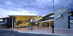
Nelson Airport is located southwest of the city, at Annesbrook. The airport operates a single terminal and 1,347-metre (4,420 ft) runway, and is the sixth-busiest airport in New Zealand by passenger numbers.[56] Approximately 800,000 passengers use the airport terminal annually and the airport averages 90 aircraft movements every day, with a plane taking off or landing every 4.5 minutes during scheduled hours. It is primarily used for domestic flights, with regular flights to and from Auckland, Blenheim, Christchurch, Kapiti Coast, Palmerston North and Wellington. Nelson Airport is home to Air Nelson, which operates and maintains New Zealand's largest domestic airline fleet and was also the headquarters of Origin Pacific Airways until their collapse in 2006. Sounds Air offers flights from Nelson to Wellington. In 2006, the airport received restricted international airport status to facilitate small private jets.
Maritime transport
Port Nelson is the maritime gateway for the Nelson, Tasman and Marlborough regions and a vital hub for economic activity. The following shipping companies call at Port Nelson:
- Australian National Line / CMA CGM
- Maersk Line
- Mediterranean Shipping Company
- Pacifica Shipping
- Toyofuji Shipping Co.
- Swire Shipping
In the mid-1994, a group of local businessmen, fronted by local politician Owen Jennings proposed building a deep-water port featuring a one-kilometre-long wharf extending from the Boulder Bank into Tasman Bay, where giant ships could berth and manoeuvre with ease. Known as Port Kakariki, $97 million project was to become the hub to ship West Coast coal to Asia, as well as handling logs, which would be barged across Tasman Bay from Mapua.[57]
In January 2010 the Western Blue Highway, a Nelson to New Plymouth ferry service, was proposed by Port Taranaki. However, to date neither the Interislander or Bluebridge have shown any interest in the route.[58]
The Anchor Shipping and Foundry Company
The 'Anchor Shipping and Foundry Company' was formed 31 March 1901 from the earlier companies of Nathaniel Edwards & Co (1857–1880) and the Anchor Steam Shipping Company (1880–1901). The Anchor Company never departed from its original aim of providing services to the people of Nelson and the West Coast of the South Island and was never a large company; it only owned 37 ships during its history. At its peak around 1930 there were 16 vessels in the fleet. The company operated three nightly return trips per week ferry service between Nelson and Wellington and a daily freight service was maintained between the two ports in conjunction with the Pearl Kasper Shipping Company while another service carried general cargo on a Nelson-Onehunga route. In 1974, the Anchor Company was sold and merged into the Union Company.[59]
Public transport
NBUS
NBus provides public transport services between Nelson and Richmond, as well as on four local routes around Nelson city.[60]
| Route numbers | central terminus | via | Outer terminus | Notes |
|---|---|---|---|---|
| 1 | Nelson | Bishopdale, Stoke | Richmond | |
| 2 | Nelson | Tahunanui, Stoke | Richmond | |
| 3 | Nelson | The Wood | Atawhai | |
| 4 | Nelson | Nelson Marlborough Institute of Technology | The Brook | |
| 5 | Nelson | Victory Square | Nelson Hospital | |
| 6 | Nelson | Washington Valley | Tahunanui |
The Late Late Bus is a weekend night transport service between Nelson and Richmond.
InterCity provides daily bus services connecting Nelson with towns and cities around the South Island.
Taxis and shuttle vans
Taxi companies in Nelson include the following:[61]
- Nelson Bays Cabs
- Nelson City Taxis
There are no conventional bus services to Nelson Airport: the airport is served by a fleet of shuttle vans provided by several operators including Nelson Bays Shuttles & Coaches and Super Shuttles. Airport shuttle vans typically travel non-stop to or from the airport and about the city and suburbs picking up or dropping passengers at each address.
Rail transport
Nelson is only one of three major urban areas in New Zealand without a rail connection – the others being Taupo and Queenstown. The Nelson Section was an isolated, 3 ft 6 in (1,067 mm) gauge, government-owned railway line between Nelson and Glenhope. It operated for 79 years between 1876 and 1955.
In 1886, a route was proposed from Nelson to the junction of the Midland Railway Company at Buller via Richmond, Waimea West, Upper Moutere, Motueka, the Motueka Valley, Tadmor and Glenhope.[62]
The only sign of rail activity in Nelson today is a short heritage operation run by the Nelson Railway Society from Founders Heritage Park using their own line between Wakefield Quay Station and Grove Station. The society has proposed future extensions of their line, possibly into or near the city centre. There have been several proposals to connect Nelson to the South Island rail network, but none have come to fruition.
Road transport
The Nelson urban area is served by ![]() State Highway 6, which runs in a north to southwest direction. The highway travels through the city and nearby town of Richmond, continuing southwest across the plains of the Wairoa and Motueka Rivers. Plans to construct a motorway linking North Nelson to Brightwater in the south have so far been successful. A number of studies have been undertaken since 2007 including the 2007 North Nelson to Brightwater Study,[63] the Southern Link Road Project[64] and the Arterial Traffic Study.[65] On 28 June 2013, the Nelson Mayor Aldo Miccio and Nelson MP Nick Smith jointly wrote to Transport Minister Gerry Brownlee seeking for the Southern Link to be given Road of National Significance (RoNS) status.[66]
State Highway 6, which runs in a north to southwest direction. The highway travels through the city and nearby town of Richmond, continuing southwest across the plains of the Wairoa and Motueka Rivers. Plans to construct a motorway linking North Nelson to Brightwater in the south have so far been successful. A number of studies have been undertaken since 2007 including the 2007 North Nelson to Brightwater Study,[63] the Southern Link Road Project[64] and the Arterial Traffic Study.[65] On 28 June 2013, the Nelson Mayor Aldo Miccio and Nelson MP Nick Smith jointly wrote to Transport Minister Gerry Brownlee seeking for the Southern Link to be given Road of National Significance (RoNS) status.[66]
Other significant road projects proposed over the years include a cross-city tunnel from Tahunanui Drive to Haven Road; or from Annesbrook (or Tahunanui) to Emano Street in Victory Square; or from Tahunanui to Washington Valley.[57]
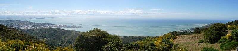
Panoramas
Culture and the arts
As the major regional centre, the city offers many lodgings, restaurants, and unique speciality shopping such as at the Jens Hansen Goldsmiths where "The One Ring" in The Lord of the Rings film trilogy was designed.[67]
- Nelson has a vibrant local music and arts scene and is known nationwide for its culturally idiosyncratic craftsmakers. These include Potters, Glass Blowers (such as Flamedaisy Glass Design and Höglund Art Glass Studio & Gallery), Fibre Spectrum Handweavers & Fibre Artists' Studio[68] and dozens of Wood carvers using native New Zealand Southern beech and exotic macrocarpa.
- Nelson is a popular visitor destination and year-round attracts both New Zealanders and international tourists.[69]
- The Nelson Saturday Market is a popular weekly market where you can buy direct from local artists.[70]
- Art organisations include the Suter Art Gallery[71] and Nelson Arts Festival.[72]
- The Victory Village community received the 2010 New Zealander of the Year award for Community of the Year.[73]
The first rugby union match in New Zealand took place at the Botanic Reserve in Nelson on 14 May 1870, between the Nelson Suburbs and Nelson College, and an informative commemorative plaque was renovated at the western edge of the grassed area by Nelson City Council in 2006.[74]
Events and festivals
Several major events take place:
- Nelson Jazz & Blues Festival[75] – January
- Nelson Kite Festival[76] – January
- Nelson Yacht Regatta[77] – January
- Adam Chamber Music Festival[78] – January / February
- Evolve Festival of Opportunities[79] – February
- Marchfest[80] – March
- Taste Nelson festival[81] – March
- Winter Music Festival[82] – July
Architecture

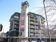
The tallest building in Nelson is the Rutherford Hotel located on the west edge of Trafalgar Square. Unlike many towns and cities in New Zealand, Nelson has retained many Victorian buildings in its historic centre and the South Street area has been designated as having heritage value.[83]
Surviving historic buildings
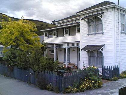
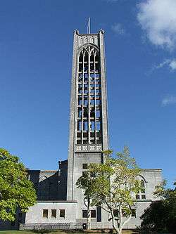
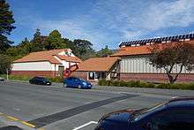
- Nelson Cathedral
- Amber House
- Broadgreen House
- Cabragh House
- Chez Eelco
- Fairfield House[84]
- Founders Park Windmill
- Isel House
- Melrose House
- Nelson Central School Renwick House
- Victorian Rose Pub
- Redwood College (Founders Park)
Museums
The Nelson region houses several museums.
- The Founders Heritage Park houses a number of groups with historical themes, including transport.
- The Nelson Provincial Museum houses a collection of locally significant artefacts.
- The World of Wearable Art houses a collection of collectable cars and a collections of works from the Wearable Art Awards.
Parks and zoo

Nelson has a large number and variety of public parks and reserves maintained at public expense by Nelson City Council.[85] Major reserves include Grampians Reserve, close to the suburb of Braemar, and the botanical Reserve in the east of Nelson, close to The Wood.
Natureland Zoological Park is a small zoological facility close to Tahunanui Beach. The facility is popular with children, where they can closely approach wallabies, monkeys, meerkats, llamas and alpacas, Kune Kune pigs, otters, and peacocks. There are also turtles, tropical fish and a walk through aviary.[86] Although the zoo nearly closed in 2008, the Orana Wildlife Trust took over its running instead. It looked like a bright future ahead for Natureland and its staff but since the repeated earthquakes in Christchurch in 2011 and the damage to Orana Park, Orana Wildlife Trust are uncertain of the future of Natureland.[87] Orana Wildlife trust have since pulled out of Natureland, which is now run independently.
Sport
Major sports teams
| Club | Sport | Founded | League | Venue |
|---|---|---|---|---|
 FC Nelson |
Football | 2011 | Nelson Pine Division 1 | Guppy Park |
| Nelson Cricket Association | Cricket | Hawke Cup | Saxton Oval | |
| Nelson Falcons | Football | 2012 | ASB Premiership Youth league | Trafalgar Park |
| Nelson Giants |
Basketball | 1982 | National Basketball League | Trafalgar Centre |
| Nelson Suburbs FC |
Football | 1967 | Mainland Premier League | Saxton Field |
| Tasman Makos |
Rugby | 2006 | ITM Cup | Trafalgar Park |
| Tasman Titans | Rugby league | 1995 | Rugby League Cup |
Major venues
| Image | Venue |
|---|---|
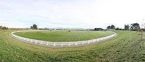 |
Saxton Oval |
| The Trafalgar Centre | |
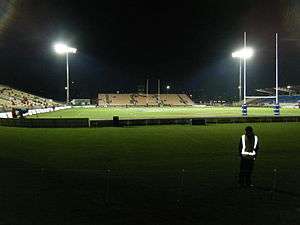 |
Trafalgar Park |
See also
References
- ↑ "Subnational Population Estimates: At 30 June 2016 (provisional)". Statistics New Zealand. 21 October 2016. Retrieved 21 October 2016. For urban areas, "Subnational population estimates (UA, AU), by age and sex, at 30 June 1996, 2001, 2006-16 (2017 boundary)". Statistics New Zealand. 21 October 2016. Retrieved 21 October 2016.
- ↑ "Nelson Arts Festival". Retrieved 22 April 2015.
- ↑ "World of Wearable Art". Retrieved 22 April 2015.
- ↑ "NZ government Māori Language Commission". Retrieved 25 August 2007.
- ↑ "Papers Past – Colonist – 16 July 1867 – NELSON, COBDEN, AND WESTPORT RAILWAY". Paperspast.natlib.govt.nz.
- ↑ Lowe, David J. (2008). "Polynesian settlement of New Zealand and the impacts of volcanism on early Maori society: an update" (PDF). University of Waikato. Retrieved 29 April 2010.
- ↑ Somerville, Ross. "Frederick Tuckett". Dictionary of New Zealand Biography. Ministry for Culture and Heritage. Retrieved 16 February 2015.
- ↑ "German Settlement in Tasman Nelson New Zealand". Theprow.org.nz. Retrieved 2016-08-08.
- ↑ "NZCMS". NZCMS. Archived from the original on 14 October 2008. Retrieved 18 July 2008.
- ↑ "Civic symbols". Nelson City Council. Archived from the original on 20 January 2011.
- ↑ "Nelson's Landmark Cathedral". Prow.
- ↑ "Nelson Anniversary Day". Theprow.org.nz. Retrieved 2016-08-08.
- ↑ "A unique record of the Notable Trees of New Zealand". Register.notabletrees.org.nz.
- ↑ Jeff Newport: A Short History of the Nelson Province. Page 18.
- ↑ "News". Tasman District Council.
- ↑ Moorjani, Anita. "Home " Tasman District Libraries". Taslib.govt.nz. Archived from the original on 12 March 2012.
- ↑ "Home " Tasman District Council". Tdc.govt.nz.
- ↑ "Archived copy". Archived from the original on 18 February 2009. Retrieved 6 February 2016.
- ↑ "Nelson – the early years". Nzine.co.nz. 3 December 1932.
- ↑ Paul C Denton, Mike R Johnston, Soils & Foundations Ltd, Nelson (12 May 2002). "Housing Development on a Large, Active Landslide: The Tahunanui Slump Story, Nelson, New Zealand". Geo-Logic Ltd. Archived from the original on 23 January 2016.
- ↑
- ↑ "Where is Nelson?". Nelson City Council. 27 April 2011.
- ↑ "Archived copy". Archived from the original on 3 February 2014. Retrieved 2012-04-07.
- ↑ "Mean Monthly Sunshine". NIWA.
- ↑ "Climate Data and Activities". NIWA Science. Retrieved 15 October 2013.
- ↑ "Nelson Climate Data". New Zealand: WeatherOnline. Retrieved 19 November 2012.
- ↑ "The earliest version of this article first appeared in NZ Science Teacher 71 21–23 1992". Retrieved 27 August 2007.
- ↑ "Nelson City Council website: gravitational centre". Archived from the original on 28 September 2007. Retrieved 27 August 2007.
- ↑ "Archived copy". Archived from the original on 2 January 2014. Retrieved 2013-12-02.
- ↑ "Archived copy". Archived from the original on 18 February 2009. Retrieved 2016-02-06.
- ↑ Amber, George. "Location Map of Amber House B&B in Nelson, New Zealand surrounded by Abel Tasman, Kahurangi and Nelson Lakes National Parks". New Zealand: Amber House.
- ↑ Nelson Regional Economic Development Agency (24 July 2014). "Nelson Regional Economic Development Strategy (REDS): Regional Prosperity" (PDF). Nelson Regional Economic Development Agency.
- ↑ "Port Nelson". Port Nelson. Retrieved 22 April 2015.
- 1 2 "Diversity puts region on sound footing". Stuff.co.nz. 2 July 2013.
- ↑ "Regional Gross Domestic Product". Statistics New Zealand. 2007. Retrieved 18 February 2010.
- ↑ "Business". Tasman. Tasman District Council. 2011. Retrieved 6 March 2011.
- ↑ "Nelson NZ". Nelson Tasman Tourism. NTT. 2011. Retrieved 6 March 2011.
- ↑ "Advertise with us". Nelson Tasman Tourism. NTT. 2011. Archived from the original on 21 August 2010. Retrieved 6 March 2011.
- ↑ "Nelson Regional Economic Development Agency". Business: EDA. Tasman District Council. 2011. Retrieved 6 March 2011.
- ↑ "home page". EDA. Nelson Regional Economic Development Agency. 2011. Retrieved 6 March 2011.
- ↑ "Fish Oils | Omega 3 | Shark Liver Oil". Seadragon.
- ↑ "Archived copy". Archived from the original on 2 January 2014. Retrieved 2013-10-26.
- ↑ Basham, Laura (23 March 2013). "Nelson's future: a centre for calls?". Nelson Mail. Fairfax.
- ↑ "Nelson Land District – Te Ara Encyclopedia of New Zealand". Teara.govt.nz. 22 April 2009.
- ↑ "Park has $50b in minerals – nelson-mail". Stuff.co.nz. 5 October 2009.
- ↑ Sally Kidson (1 December 2012). "Murchison's mysterious flames". Stuff.co.nz.
- ↑ "History – Golden Bay: Industrial Dynamo – WildTomato – The magazine for Nelson and Marlborough". WildTomato.
- ↑ "Iron ore mining in Golden Bay New Zealand". Theprow.org.nz. 14 October 2008.
- ↑ "Archived copy" (PDF). Archived from the original (PDF) on 10 February 2013. Retrieved 2013-05-06.
- ↑ Tracy Neal (12 October 2013). "Rachel Reese wins Nelson mayoralty – nelson-mail". Stuff.co.nz.
- ↑ "Development of tertiary education". Prow.
- ↑ "Tasman Police District | New Zealand Police". Police.govt.nz. Retrieved 2016-08-08.
- ↑ "NEW ZEALAND CRIME STATISTICS 2012/2013" (PDF). Police.govt.nz. Retrieved 2016-08-08.
- ↑ Sally Kidson (8 June 2013). "Gang's arrival in Nelson Part of Growing Trend". Stuff.co.nz.
- ↑ "Nelson Examiner and New Zealand Chronicle". Papers Past. National Library of New Zealand Te Puna Mātauranga Aotearoa.
- ↑ "Nelson Airport". Www.nelsonairport.co.nz. Retrieved 2 May 2014.
- 1 2 "Pie in the (blue) sky ideas". The Nelson Mail. Stuff.co.nz. 31 July 2010. Retrieved 21 August 2016.
- ↑ "Western Blue Highway Transport Study" (PDF). Nzta.govt.nz. January 2010. Retrieved 2016-08-08.
- ↑ "New Zealand Coastal Shipping – Anchor Shipping". Nzcoastalshipping.com.
- ↑ "Routes & Timetables". Nelson City Council.
- ↑ "Archived copy". Archived from the original on 29 October 2013. Retrieved 26 October 2013.
- ↑ Papers Past | THE MOTUEKA-TADMOII RAILWAY ROUTE. (Nelson Evening Mail, 1886-11-11)
- ↑ "Archived copy". Archived from the original on 6 October 2013. Retrieved 2013-08-16.
- ↑ "Southern Link Road, Nelson" (PDF). Tonkin.co.nz. Retrieved 2016-08-08.
- ↑ "Arterial Traffic Study". Nelson City Council.
- ↑ Adam Roberts (28 June 2013). "Bid beefs up proposal for Victory road". Stuff.co.nz.
- ↑ "The Real Movie Ring". Jens Hansen Contemporary Gold and Silversmith. 12 March 2013. Retrieved 2016-08-08.
- ↑ "Fibre Spectrum Handweavers & Fibre Artists Co-Operative". Fibrespectrum.co.nz. Retrieved 2016-08-08.
- ↑ "Nelson Tasman Tourism – Visitor Information". Nelsonnz.com. Retrieved 2016-08-08.
- ↑ "Nelson Market". Nelson Market. Retrieved 2016-08-08.
- ↑ "The Suter Gallery". Retrieved 25 August 2007.
- ↑ "Nelson Arts Festival". Archived from the original on 8 August 2007. Retrieved 25 August 2007.
- ↑ "Archived copy". Archived from the original on 30 April 2012. Retrieved 2010-03-05.
- ↑ "New Zealand's First Game of Rugby". theprow.org. Retrieved 2016-10-26.
- ↑ "Nelson Jazz Fest". Nelson Jazz Fest. Retrieved 2016-08-08.
- ↑ "22nd Annual Nelson Kite Festival – It's On". Itson.co.nz. 20 January 2013.
- ↑ "Home". Nelson Regatta. 23 January 2013.
- ↑ "Adam Chamber Music Festival 2013, chamber music Nelson, New Zealand". Music.org.nz. Retrieved 2016-08-08.
- ↑ "Evolve Festival of Opportunities | Evolve Festival is a celebration for health and wellbeing in the heart of Nelson City". Evolvefestival.co.nz. 24 February 2013. Retrieved 2016-08-08.
- ↑ "Nelson's Craft Beer & Musical Festival". Marchfest.com. 2016-03-19. Retrieved 2016-08-08.
- ↑ "McCashin's Taste Nelson". tastenelson. 2 March 2013. Retrieved 2016-08-08.
- ↑ "Home". Nelson Winter Festival. 22 July 2012. Retrieved 2016-08-08.
- ↑ "Archived copy". Archived from the original on 10 February 2013. Retrieved 2011-03-31.
- ↑ "Fairfield House". Register of Historic Places. Heritage New Zealand. Retrieved 21 June 2012.
- ↑ "Reserves and Parks". Nelson City Council.
- ↑ "Natureland Zoo, Nelson, New Zealand". Natureland.co.nz.
- ↑ Tracy Neal (30 June 2011). "Future of Natureland again in doubt". Stuff.co.nz.
Bibliography
- A Complete Guide To Heraldry by A.C. Fox-Davies, 1909.
External links
| Wikimedia Commons has media related to Nelson Region. |
| Wikisource has the text of the 1911 Encyclopædia Britannica article Nelson (New Zealand). |
 Nelson (New Zealand) travel guide from Wikivoyage
- Historic images of Nelson from the collection of the Museum of New Zealand Te Papa Tongarewa
- Nelson City Council
- Nelson Tasman Tourism
| North Island | ||
|---|---|---|
| South Island | ||
* Governed by a unitary authority rather than a regional council | ||