Nelamangala
| Nelamangala ನೆಲಮಂಗಲ | |
|---|---|
| outskirts | |
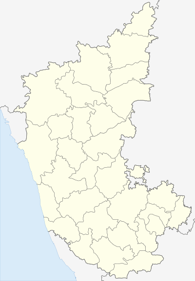
 Nelamangala Location in Karnataka, India | |
| Coordinates: 13°30′N 77°14′E / 13.5°N 77.23°ECoordinates: 13°30′N 77°14′E / 13.5°N 77.23°E | |
| Country |
|
| State | Karnataka |
| District | Bangalore Rural |
| Area | |
| • Total | 2.85 km2 (1.10 sq mi) |
| Elevation | 882 m (2,894 ft) |
| Population (2011)[1] | |
| • Total | 37,232 |
| • Density | 8,872.63/km2 (22,980.0/sq mi) |
| Time zone | IST (UTC+5:30) |
| PIN | 562 123 |
| Telephone code | 08118 |
| Vehicle registration | KA-52 |
Nelamangala is a town and taluk headquarters in the Bangalore Rural district of Karnataka state in India. Nelamangala lies near the junction of two National Highways, NH-48 (Bangalore - Mangalore) and NH-4 (Mumbai - Chennai) to north of Bangalore city.
Geography
Nelamangala Town is spread over 14.1 km² at an altitude of 882 metres It is located13°30′N 77°14′E / 13.5°N 77.23°E[2]
Demography
According to 2011 census, Nelamangala Town has a population of 37,232, in which males constitute 50.06% and females constitute 49.4% of the population. The literacy rate is 88.65%. In Nelamangala, Male literacy is around 100% while female literacy rate is 100%.
Work Profile
Out of total population, 14,600 were engaged in work or business activity. Of this 11,118 were males while 3,482 were females. In census survey, worker is defined as person who does business, job, service, and cultivator and labour activity. Of total 14600 working population, 91.54% were engaged in Main Work while 8.46% of total workers were engaged in Marginal Work.
Places of interest around Nelamangala
Nelamangala is located on NH-4, around 27 km away from Bangalore city towards Tumkur and Mumbai.[3] It has a park at Binnamangala, Vishwa Shanti Ashrama (a place for excursion and spirituality) with huge statues of Panduranga, Geeta Mandir, Ashtalakshmi Temple, Vinayaka Temple, the beautiful Vishwaroopa Vijaya Vittala statue along with a park to relax. One can also find many Dhabas(Punjabi restaurant) located throughout the stretch of National Highway(NH4).
Basavanahalli Village about 2 km from Nelamangala town,basavanahalli name is associated with the history of an ancient temple dedicated to Lord Shri laxmi Venkataramana swamy and Garuda. The Ancient name of the village according to purans are Koundinyashrama(Koundinya maharshi did the thapasya and created a holy pond called Shankapushkarani), Shamigiri(as more number of shami-Banni or Prosopis cineraria trees were there), and Vrishbhapuri - A demon who was in the form of vrushabha(bull)and converted to human by Koundinya maharshi by the grace of Maha Vishnu, later name modified to Basavapuri and finally Basavanahalli.The main temple in the village is Shree Laxmivenkataraman swamy and shree Vynatheyar(Garuda) which was built by King Janamejaya(great grandson of Arjuna) and later temple was renovated during Vijayanagara empire, as temple was renovated in later Vijayanagara style. The main attraction of the temple are Shree laxmi venkataramana swamy idol(idol with both Abhaya and Varada hastha, very rare standing posture of venkataramana swamy) and Lord Garuda (With both varada hasthas a very rare posture of garuda,a attractive sudhamurthy) Shankapushkarani (a small pond) and Mukhamantapa. The speciality of the temple is Lord Garuda. It is worshiped as the main deity as well as the procession deity. The thousands of devotees will worship Garuda. Here the Venkataramana swamy is blessing through Garuda. So majority of people will worship Garuda as their main deity. Diseases caused by naga dosha are cured well by worshiping this Lord.Also, people will be blessed by vidyabhagya, Vivaha bhagya. So Garuda is popularly known as Varaprada Garuda.
Nelamangala also famous for its Udbhava Ganesha Temple where once in a year celebration takes place. The specialty lies in the roadside trees, almost 50 years old planted by Late Ragi Siddaramaiha Shetty a local business man. But now number of trees are reducing due to the Government development plans. But you can see the trees today also. Nelamangala is a connecting place for Madhure Shanimahatma Temple, which is 14 km away from Nelamangala.
Nelamangala has a busiest street called adepete which is one of the busiest spot and is the only market place for all food products. Also Nelamangala has oldest Temples of Lord Shiva, one located in adepete, and Mahalingeshwara Temple, near Nelamangala pond, Mukthanatheshwara Temple, near Binnamangala, all these temples are in the style of cholas.
This is a very ancient Shree Ranganatha Swamy temple in T. Beguru (Family God (Manne Devvaru) of many kunchitigas), the ancient structure recently collapsed so a renovated structure has been rebuilt. T.Beguru is a village and panchayat capital for T.Beguru grama panchayath,other villages in T.Begur Mandal are Araledibba, Agasarahalli, Byranahalli, Kambayyanapalya,Thirumalapura,Geddalahalli, Kempohalli, Marohalli and Malonagatihalli. T.Begur is 9.1 km distance from its taluk main town nelamangala on NH4. T.Beguru is 38.4 km distance from its district main city bangalore rural. And 35 km distance from its State Main City Bangalore. T.Beguru is Near post office is at Nandagudi with Pin Code is 562122. Its geographical coordinates are 13°8'47"N 77°21'17"E
RTO
it comes under RT0-NELAMANGALA(KA-52).it is the smallest of all RTO'S in the state
References
- ↑ "Census of India Search details". censusindia.gov.in. Retrieved 10 May 2015.
- ↑ "Nelamangala". http://www.npa.in. Retrieved 2011-04-07. External link in
|publisher=(help) - ↑ "NELAMANGALA". http://www.bangalorerural.nic.in. Retrieved 2012-09-03. External link in
|publisher=(help)