Nauvoo Township, Hancock County, Illinois
| Nauvoo Township | |
|---|---|
| Township | |
 Location in Hancock County | |
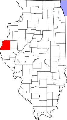 Hancock County's location in Illinois | |
| Coordinates: 40°33′10″N 91°22′53″W / 40.55278°N 91.38139°WCoordinates: 40°33′10″N 91°22′53″W / 40.55278°N 91.38139°W | |
| Country |
|
| State |
|
| County | Hancock |
| Established | November 6, 1849 |
| Area | |
| • Total | 6.36 sq mi (16.5 km2) |
| • Land | 3.9 sq mi (10 km2) |
| • Water | 2.46 sq mi (6.4 km2) 38.68% |
| Elevation | 620 ft (189 m) |
| Population (2010) | |
| • Total | 1,156 |
| • Density | 296.4/sq mi (114.4/km2) |
| Time zone | CST (UTC-6) |
| • Summer (DST) | CDT (UTC-5) |
| ZIP code | 62354 |
| GNIS feature ID | 0429422 |
Nauvoo Township is one of twenty-five townships in Hancock County, Illinois, USA. At the 2010 census, its population was 1,156 and it contained 693 housing units.[1]
Geography
According to the 2010 census, the township has a total area of 6.36 square miles (16.5 km2), of which 3.9 square miles (10 km2) (or 61.32%) is land and 2.46 square miles (6.4 km2) (or 38.68%) is water.[1]
Cities, towns, villages
- Nauvoo (vast majority)
Extinct towns
(These towns are listed as "historical" by the USGS.)
- Quashquema at 40°33′00″N 91°23′12″W / 40.550042°N 91.386542°W
Cemeteries
The township contains two cemeteries, Dundey and Smith Family.
Major highways
Landmarks
- Lovers Glen Park
- Nauvoo State Park
School districts
- Nauvoo-Colusa Community Unit School District 325
Political districts
- Illinois's 17th congressional district
- State House District 94
- State Senate District 47
References
- United States Census Bureau 2008 TIGER/Line Shapefiles
- "Nauvoo Township". Geographic Names Information System. United States Geological Survey. Retrieved 2009-09-20.
- United States National Atlas
- 1 2 "Population, Housing Units, Area, and Density: 2010 - County -- County Subdivision and Place -- 2010 Census Summary File 1". United States Census. Retrieved 2013-05-28.
External links
 |
Jefferson Township, Lee County, Iowa | |
Appanoose Township | |
| |
||||
| ||||
| | ||||
| Montrose Township, Lee County, Iowa | |
Sonora Township |
Municipalities and communities of Hancock County, Illinois, United States | ||
|---|---|---|
| Cities | ||
| Town | ||
| Villages | ||
| Townships | ||
| Unincorporated communities | ||
| Footnotes | ‡This populated place also has portions in an adjacent county or counties | |
This article is issued from Wikipedia - version of the 7/13/2016. The text is available under the Creative Commons Attribution/Share Alike but additional terms may apply for the media files.