| [3] |
Name on the Register |
Image |
Date listed[4] |
Location |
City or town |
Description |
|---|
| 1 |
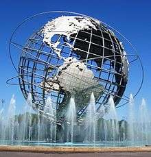
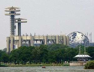
1964-1965 New York World's Fair New York State Pavilion |
|
000000002009-11-20-0000November 20, 2009
(#09000942) |
Flushing Meadows – Corona Park
40°44′39″N 73°50′40″W / 40.744028°N 73.844417°W / 40.744028; -73.844417 (1964-1965 New York World's Fair New York State Pavilion) |
Flushing |
|
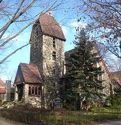
| 2 |
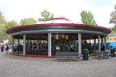
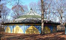
1964-1965 New York World's Fair Carousel |
|
000000002016-02-23-0000February 23, 2016
(#16000038) |
54th & 56th Aves. on 111th St.
40°44′36″N 73°50′57″W / 40.74330°N 73.84930°W / 40.74330; -73.84930 (1964-1965 New York World's Fair Carousel) |
Flushing |
Combination of two old Coney Island carousels for World's Fair is one of few fairground attractions left from it
|
| 3 |
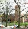
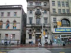
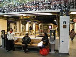
45th Road – Court House Square Station (Dual System IRT) |
|
000000002005-03-30-0000March 30, 2005
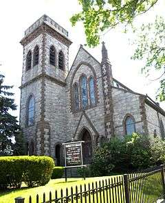
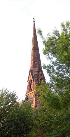
(#05000229) |
Above 23rd St. bet. 44th Dr. and 45ht Rd.
40°44′47″N 73°56′45″W / 40.746389°N 73.945833°W / 40.746389; -73.945833 (45th Road – Court House Square Station (Dual System IRT)) |
Long Island City |
Subway station (7 <7> trains)
|
| 4 |
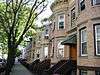
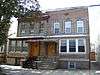
68th Avenue-64th Place Historic District |
|
000000001983-09-30-0000September 30, 1983
(#83001763) |
Roughly 64th Pl. from Catalpa Ave. to 68th Ave. from 64th St. to 65th St.
40°42′20″N 73°53′40″W / 40.705556°N 73.894444°W / 40.705556; -73.894444 (68th Avenue-64th Place Historic District) |
Ridgewood |
|
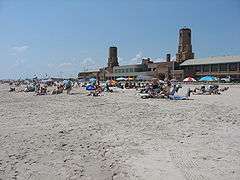
| 5 |
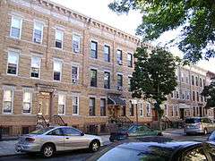
75th Avenue-61st Street Historic District |
|
000000001983-09-30-0000September 30, 1983
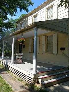
(#83001764) |
60th Lane, 60th and 62nd Sts. bounded by St. Felix, Myrtle, and Cooper Aves.
40°41′55″N 73°53′41″W / 40.698611°N 73.894722°W / 40.698611; -73.894722 (75th Avenue-61st Street Historic District) |
Ridgewood |
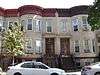
Limited to brick two-story rowhouses in the designated area.
|
| 6 |
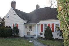
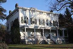
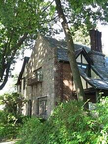
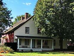
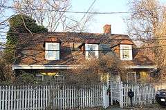
Allen-Beville House |
|
000000001983-09-22-0000September 22, 1983
(#83001760) |
29 Center Dr.
40°46′22″N 73°45′03″W / 40.772778°N 73.750833°W / 40.772778; -73.750833 (Allen-Beville House) |
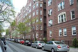
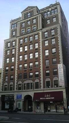
Douglaston |
|
| 7 |
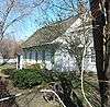
Louis Armstrong House |
|
000000001976-05-11-0000May 11, 1976
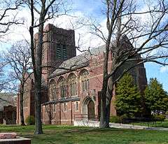
(#76001265) |
3456 107th St.
40°45′20″N 73°51′43″W / 40.755556°N 73.861944°W / 40.755556; -73.861944 (Louis Armstrong House) |
Corona |
|
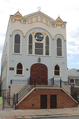
| 8 |
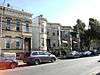
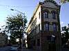
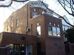
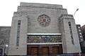
Astoria Center of Israel |
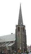
|
000000002009-10-16-0000October 16, 2009
(#09000833) |
27-35 Crescent St.
40°46′13″N 73°55′26″W / 40.770219°N 73.923772°W / 40.770219; -73.923772 (Astoria Center of Israel) |
Astoria |
|
| 9 |
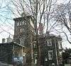
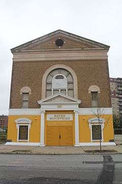
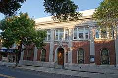
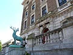
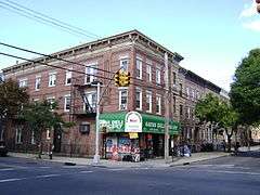
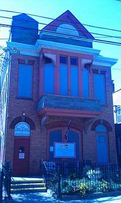
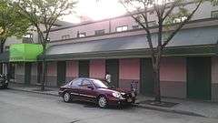
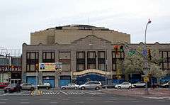
Benevolent and Protective Order of Elks, Lodge #878 |
|
000000002014-11-19-0000November 19, 2014
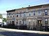
(#14000938) |
82-10, 82-20 Queens Blvd.
40°44′14″N 73°52′58″W / 40.7372°N 73.8828601°W / 40.7372; -73.8828601 (Benevolent and Protective Order of Elks, Lodge #878) |
Elmhurst |
Early fraternal organization building
|
| 10 |
Beth Olam Cemetery |
Upload image |
000000002016-05-16-0000May 16, 2016
(#16000254) |
2 Cypress Hills St.
40°41′26″N 73°52′48″W / 40.69069°N 73.87990°W / 40.69069; -73.87990 (Beth Olam Cemetery) |
Cypress Hills |
Rural cemetery started in 1851 by the three oldest Jewish congregations in the city; contains many different examples of architecture and funerary art. Shared with Brooklyn
|
| 11 |
Bohemian Hall and Park |
|
000000002001-03-23-0000March 23, 2001
(#01000239) |
29-19 24th Ave.
40°46′22″N 73°54′59″W / 40.772778°N 73.916389°W / 40.772778; -73.916389 (Bohemian Hall and Park) |
Astoria |
|
| 12 |
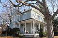
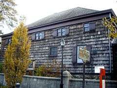
John Bowne House |
|
000000001977-09-13-0000September 13, 1977
(#77000974) |
37-01 Bowne St.
40°45′46″N 73°49′32″W / 40.762778°N 73.825556°W / 40.762778; -73.825556 (John Bowne House) |
Flushing |
|
| 13 |
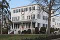
Broadway-Flushing Historic District |
|
000000002006-05-12-0000May 12, 2006
(#06000373) |
Roughly bounded by 29th Ave., 163rd St., 32nd Ave., 192nd St., 154th and 153rd Sts.
40°46′00″N 73°48′05″W / 40.766667°N 73.801389°W / 40.766667; -73.801389 (Broadway-Flushing Historic District) |
Flushing |
|
| 14 |
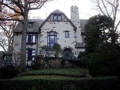
Ralph Bunche House |
|
000000001976-05-11-0000May 11, 1976
(#76001266) |
115-125 Grosvenor Rd.
40°42′25″N 73°50′16″W / 40.706944°N 73.837778°W / 40.706944; -73.837778 (Ralph Bunche House) |
Kew Gardens |
|
| 15 |
Central Avenue Historic District |
|
000000001983-09-30-0000September 30, 1983
(#83001761) |
Roughly bounded by Myrtle and 70th Ave., and 65th and 66th Sts.
40°42′10″N 73°53′25″W / 40.702778°N 73.890278°W / 40.702778; -73.890278 (Central Avenue Historic District) |
Ridgewood |
|
| 16 |
Central Ridgewood Historic District |
|
000000001983-09-30-0000September 30, 1983
(#83001762) |
Roughly bounded by Fresh Pond Rd., Putnam, 68th, Forest, Catalpa, Onderdonk, and 71st Aves.
40°42′10″N 73°53′57″W / 40.702778°N 73.899167°W / 40.702778; -73.899167 (Central Ridgewood Historic District) |
Ridgewood |
|
| 17 |
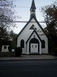
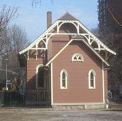
The Church-in-the-Gardens |
|
000000002009-12-11-0000December 11, 2009
(#09001086) |
50 Ascan Ave.
40°42′55″N 73°50′33″W / 40.7154°N 73.8426°W / 40.7154; -73.8426 (The Church-in-the-Gardens) |
Forest Hills |
|
| 18 |
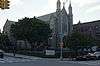
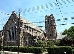
Church of the Resurrection |
|
000000002003-03-07-0000March 7, 2003
(#03000090) |
85-09 118th St.
40°42′08″N 73°49′57″W / 40.702291°N 73.83242°W / 40.702291; -73.83242 (Church of the Resurrection) |
Kew Gardens/Richmond Hill |
|
| 19 |
Congregation Tifereth Israel |
|
000000002002-11-21-0000November 21, 2002
(#02001357) |
109-18 and 109-20 54th Ave.
40°44′32″N 73°51′12″W / 40.742222°N 73.853333°W / 40.742222; -73.853333 (Congregation Tifereth Israel) |
Corona |
|
| 20 |
Cooper Avenue Row Historic District |
|
000000001983-09-30-0000September 30, 1983
(#83001765) |
6434-6446 Cooper Ave.
40°41′53″N 73°53′27″W / 40.698056°N 73.890833°W / 40.698056; -73.890833 (Cooper Avenue Row Historic District) |
Ridgewood |
|
| 21 |
Cornelia-Putnam Historic District |
|
000000001983-09-30-0000September 30, 1983
(#83001766) |
Residential rowhouses on Cornelia St. and Putnam Ave, bounded by Jefferson St., Wyckoff, and Myrtle Aves.
40°41′56″N 73°54′27″W / 40.698889°N 73.9075°W / 40.698889; -73.9075 (Cornelia-Putnam Historic District) |
Ridgewood |
|
| 22 |
Cornell Farmhouse |
|
000000001979-07-24-0000July 24, 1979
(#79001620) |
73-50 Little Neck Pkwy
40°44′54″N 73°43′14″W / 40.748333°N 73.720556°W / 40.748333; -73.720556 (Cornell Farmhouse) |
Glen Oaks |
|
| 23 |
Cypress Avenue East Historic District |
|
000000001983-09-30-0000September 30, 1983
(#83001767) |
Roughly bounded by Linden and Cornelia Sts., Seneca and St. Nicholas Aves.
40°42′06″N 73°54′31″W / 40.701667°N 73.908611°W / 40.701667; -73.908611 (Cypress Avenue East Historic District) |
Ridgewood |
|
| 24 |
Cypress Avenue West Historic District |
|
000000001983-09-30-0000September 30, 1983
(#83001768) |
Roughly bounded by St. Nicholas and Seneca Aves., Linden and Stockholm Sts.
40°42′06″N 73°54′15″W / 40.701667°N 73.904167°W / 40.701667; -73.904167 (Cypress Avenue West Historic District) |
Ridgewood |
|
| 25 |
Douglaston Hill Historic District |
|
000000002000-08-31-0000August 31, 2000
(#00001016) |
Roughly bounded by Douglaston Pkwy., Northern Blvd., 244th St., 243rd St., and Long Island RR
40°46′03″N 73°44′43″W / 40.7675°N 73.745278°W / 40.7675; -73.745278 (Douglaston Hill Historic District) |
Douglaston |
|
| 26 |
Douglaston Historic District |
|
000000002005-09-01-0000September 1, 2005
(#05000937) |
Roughly bounded by Shore Rd., Marinette St., Douglas Rd. and Cherry St.
40°46′33″N 73°45′02″W / 40.775833°N 73.750556°W / 40.775833; -73.750556 (Douglaston Historic District) |
Douglaston |
|
| 27 |
Elmhurst Avenue Subway Station (IND) |
|
000000002005-07-06-0000July 6, 2005
(#05000627) |
Beneath Broadway at 82nd St. and 45th Ave. and Elmhurst Ave.
40°44′33″N 73°52′56″W / 40.7425°N 73.882222°W / 40.7425; -73.882222 (Elmhurst Avenue Subway Station (IND)) |
Elmhurst |
Subway station (E M R trains)
|
| 28 |
Evergreens Cemetery |
|
000000002007-11-15-0000November 15, 2007
(#07001192) |
1629 Bushwick Ave.
40°41′02″N 73°54′04″W / 40.683889°N 73.901197°W / 40.683889; -73.901197 (Evergreens Cemetery) |
Ridgewood |
|
| 29 |
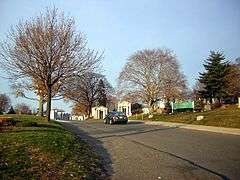
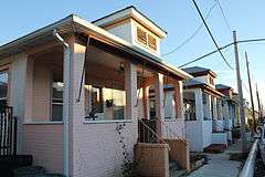
Far Rockaway Beach Bungalow Historic District |
|
000000002013-07-17-0000July 17, 2013
(#13000499) |
Beach 24th, Beach 25th & Beach 26th Sts.
40°35′39″N 73°45′30″W / 40.5943°N 73.7583°W / 40.5943; -73.7583 (Far Rockaway Beach Bungalow Historic District) |
Far Rockaway |
Small beach bungalows that have survived suburbanization of area and Superstorm Sandy
|
| 30 |
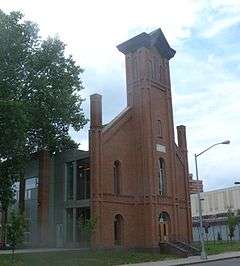
Firemen's Hall |
|
000000002000-08-31-0000August 31, 2000
(#00001013) |
13-28 123rd St.
40°47′09″N 73°50′44″W / 40.785833°N 73.845556°W / 40.785833; -73.845556 (Firemen's Hall) |
College Point |
|
| 31 |
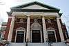
First Presbyterian Church of Newtown |
|
000000002013-09-09-0000September 9, 2013
(#13000696) |
54-05 Seabury St.
40°44′08″N 73°52′46″W / 40.7354282°N 73.8795479°W / 40.7354282; -73.8795479 (First Presbyterian Church of Newtown) |
Elmhurst |
1873 High Victorian Gothic brick and stone church built as a replica of one upstate
|
| 32 |
First Reformed Church |
|
000000001980-04-16-0000April 16, 1980
(#80002753) |
153-10 Jamaica Ave.
40°42′09″N 73°48′08″W / 40.7025°N 73.802222°W / 40.7025; -73.802222 (First Reformed Church) |
Jamaica |
|
| 33 |
Flushing Armory |
|
000000001995-03-23-0000March 23, 1995
(#95000270) |
137-58 Northern Boulevard
40°45′47″N 73°49′46″W / 40.763056°N 73.829444°W / 40.763056; -73.829444 (Flushing Armory) |
Flushing |
|
| 34 |
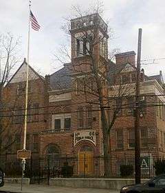
Flushing High School |
|
000000001992-02-10-0000February 10, 1992
(#91002036) |
35-01 Union St.
40°45′54″N 73°49′39″W / 40.765°N 73.8275°W / 40.765; -73.8275 (Flushing High School) |
Flushing |
|
| 35 |
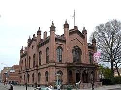
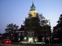
Flushing Town Hall |
|
000000001972-03-16-0000March 16, 1972
(#72000904) |
137-35 Northern Blvd.
40°45′50″N 73°49′49″W / 40.763889°N 73.830278°W / 40.763889; -73.830278 (Flushing Town Hall) |
Flushing |
1862, now Flushing Council on the Arts
|
| 36 |
Forest Park Carousel |
|
000000002004-07-16-0000July 16, 2004
(#04000706) |
Woodhaven Blvd. and Myrtle Ave.
40°42′03″N 73°51′31″W / 40.700833°N 73.858611°W / 40.700833; -73.858611 (Forest Park Carousel) |
Woodhaven |
|
| 37 |
Forest-Norman Historic District |
|
000000001983-09-30-0000September 30, 1983
(#83001769) |
Forest Ave. from Summerfield to Stephen St. and Norman St. to Myrtle Ave.
40°41′59″N 73°53′58″W / 40.699722°N 73.899444°W / 40.699722; -73.899444 (Forest-Norman Historic District) |
Middle Village |
|
| 38 |
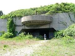
Fort Tilden Historic District |
|
000000001984-04-20-0000April 20, 1984
(#84002917) |
Rockaway Beach Boulevard
40°33′50″N 73°53′28″W / 40.563889°N 73.891111°W / 40.563889; -73.891111 (Fort Tilden Historic District) |
Rockaway |
|
| 39 |
Fort Totten Officers' Club |
|
000000001986-03-17-0000March 17, 1986
(#86000446) |
Totten and Murray Aves.
40°47′32″N 73°46′41″W / 40.792222°N 73.778056°W / 40.792222; -73.778056 (Fort Totten Officers' Club) |
Bayside |
|
| 40 |
Free Synagogue of Flushing |
|
000000002009-10-16-0000October 16, 2009
(#09000834) |
41-60 Kissena Blvd.
40°45′27″N 73°49′40″W / 40.757458°N 73.827697°W / 40.757458; -73.827697 (Free Synagogue of Flushing) |
Flushing |
|
| 41 |
Fresh Pond-Traffic Historic District |
|
000000001983-09-30-0000September 30, 1983
(#83001770) |
Roughly bounded by Fresh Pond Rd., Traffic Ave., Woodbine and Linden Sts.
40°42′34″N 73°53′49″W / 40.709444°N 73.896944°W / 40.709444; -73.896944 (Fresh Pond-Traffic Historic District) |
Ridgewood |
Residential row houses on Linden, Gates, and Palmetto Aves.
|
| 42 |
Grace Episcopal Church Complex |
|
000000001983-09-08-0000September 8, 1983
(#83001771) |
15515 Jamaica Avenue
40°42′14″N 73°48′07″W / 40.703889°N 73.801944°W / 40.703889; -73.801944 (Grace Episcopal Church Complex) |
Jamaica |
|
| 43 |
Grove-Linden-St. John's Historic District |
|
000000001983-09-30-0000September 30, 1983
(#83001772) |
Fairview Ave., St. John's Rd., Linden and Grove Sts.
40°42′23″N 73°54′26″W / 40.706389°N 73.907222°W / 40.706389; -73.907222 (Grove-Linden-St. John's Historic District) |
Middle Village |
|
| 44 |
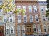
Hunters Point Historic District |
|
000000001973-09-19-0000September 19, 1973
(#73001251) |
Along 45th Ave., between 21st and 23rd Sts.
40°44′49″N 73°56′48″W / 40.746944°N 73.946667°W / 40.746944; -73.946667 (Hunters Point Historic District) |
Long Island City |
|
| 45 |
Jackson Heights Historic District |
|
000000001999-01-27-0000January 27, 1999
(#99000059) |
Bounded by Roosevelt Ave., Broadway, Leverich St., Northern Blvd., and 90th St.
40°45′05″N 73°53′13″W / 40.751389°N 73.886944°W / 40.751389; -73.886944 (Jackson Heights Historic District) |
Jackson Heights |
|
| 46 |
Jacob Riis Park Historic District |
|
000000001981-06-17-0000June 17, 1981
(#81000081) |
Rockaway Beach Blvd.
40°34′03″N 73°52′24″W / 40.5675°N 73.873333°W / 40.5675; -73.873333 (Jacob Riis Park Historic District) |
Rockaway |
Presumably including but larger than Jacob Riis Park
|
| 47 |
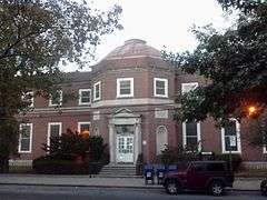
Jamaica Chamber of Commerce Building |
|
000000001983-09-08-0000September 8, 1983
(#83001773) |
8931 161st St.
40°42′19″N 73°48′00″W / 40.705278°N 73.8°W / 40.705278; -73.8 (Jamaica Chamber of Commerce Building) |
Jamaica |
|
| 48 |
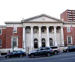
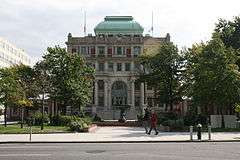
Jamaica Savings Bank |
|
000000001983-05-19-0000May 19, 1983
(#83001774) |
161-02 Jamaica Ave.
40°42′14″N 73°47′57″W / 40.703889°N 73.799167°W / 40.703889; -73.799167 (Jamaica Savings Bank) |
Jamaica |
|
| 49 |
King Manor |
|
000000001974-12-02-0000December 2, 1974
(#74001295) |
150th St. and Jamaica Ave.
40°42′11″N 73°51′43″W / 40.703056°N 73.861944°W / 40.703056; -73.861944 (King Manor) |
Jamaica |
|
| 50 |
Kingsland Homestead |
|
000000001972-05-31-0000May 31, 1972
(#72000905) |
37th St. and Parsons Blvd.
40°45′49″N 73°49′27″W / 40.763611°N 73.824167°W / 40.763611; -73.824167 (Kingsland Homestead) |
Flushing |
|
| 51 |
J. Kurtz and Sons Store Building |
Upload image |
000000001983-09-08-0000September 8, 1983
(#83001775) |
162-24 Jamaica Ave.
40°42′15″N 73°47′50″W / 40.7043°N 73.7971°W / 40.7043; -73.7971 (J. Kurtz and Sons Store Building) |
Jamaica |
|
| 52 |
La Casina |
|
000000001990-03-01-0000March 1, 1990
(#89002259) |
90-33 160th St.
40°42′16″N 73°48′00″W / 40.704444°N 73.8°W / 40.704444; -73.8 (La Casina) |
Jamaica |
|
| 53 |
Lent Homestead and Cemetery |
|
000000001984-02-02-0000February 2, 1984
(#84002918) |
78-03 19th Rd.
40°46′23″N 73°53′31″W / 40.773056°N 73.891944°W / 40.773056; -73.891944 (Lent Homestead and Cemetery) |
Jackson Heights |
|
| 54 |
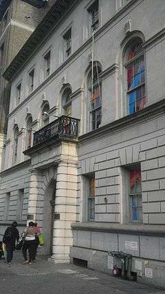
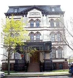
Long Island City Courthouse Complex |
|
000000001983-09-26-0000September 26, 1983
(#83001776) |
25-10 Court Sq.
40°44′45″N 73°56′36″W / 40.745833°N 73.943333°W / 40.745833; -73.943333 (Long Island City Courthouse Complex) |
Long Island City |
|
| 55 |
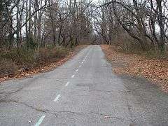
Long Island Motor Parkway |
|
000000002002-04-01-0000April 1, 2002
(#02000301) |
Roughly Alley Pond and Cunningham Parks, bet. Winchester Blvd. and Clearview Expressway, bet. 73rd Ave. and Peck Ave.
40°44′13″N 73°45′35″W / 40.736944°N 73.759722°W / 40.736944; -73.759722 (Long Island Motor Parkway) |
Fresh Meadows through Oakland Gardens |
|
| 56 |
Madison-Putnam-60th Place Historic District |
|
000000001983-09-30-0000September 30, 1983
(#83001777) |
Roughly bounded by Woodbine St., 60th Pl., 67th and Forest Aves.
40°42′21″N 73°54′06″W / 40.705833°N 73.901667°W / 40.705833; -73.901667 (Madison-Putnam-60th Place Historic District) |
Ridgewood |
|
| 57 |
Main Street Subway Station (Dual System IRT) |
|
000000002004-10-14-0000October 14, 2004
(#04001147) |
Near jct. of Roosevelt Ave. and Main St.
40°45′34″N 73°49′51″W / 40.759444°N 73.830833°W / 40.759444; -73.830833 (Main Street Subway Station (Dual System IRT)) |
Flushing |
Subway station (7 <7> trains)
|
| 58 |
Maple Grove Cemetery |
|
000000002004-08-20-0000August 20, 2004
(#04000874) |
83-15 Kew Gardens Rd.
40°42′31″N 73°49′27″W / 40.708611°N 73.824167°W / 40.708611; -73.824167 (Maple Grove Cemetery) |
Kew Gardens |
|
| 59 |
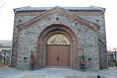
Marine Air Terminal |
|
000000001982-07-09-0000July 9, 1982
(#82003397) |
La Guardia Airport
40°46′25″N 73°53′10″W / 40.773611°N 73.886111°W / 40.773611; -73.886111 (Marine Air Terminal) |
La Guardia Airport |
|
| 60 |
Office of the Register |
|
000000001980-01-03-0000January 3, 1980
(#80002754) |
161-04 Jamaica Ave.
40°42′13″N 73°47′57″W / 40.703611°N 73.799167°W / 40.703611; -73.799167 (Office of the Register) |
Jamaica |
|
| 61 |
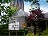
Old Quaker Meetinghouse |
|
000000001967-12-24-0000December 24, 1967
(#67000015) |
S side of Northern Blvd.
40°45′47″N 73°49′51″W / 40.763056°N 73.830833°W / 40.763056; -73.830833 (Old Quaker Meetinghouse) |
Flushing |
|
| 62 |
Paramount Studios Complex |
|
000000001978-11-14-0000November 14, 1978
(#78001897) |
35th Ave., 35th, 36th, and 37th Sts.
40°45′24″N 73°55′30″W / 40.756667°N 73.925°W / 40.756667; -73.925 (Paramount Studios Complex) |
Astoria |
Now Kaufman Astoria Studios
|
| 63 |
Parkway Village |
|
000000002012-02-28-0000February 28, 2012
(#12000052) |
Bounded by Union Tpk., 150th St., Goethals Ave., Parsons Blvd., Grand Central Pkwy., & Main St.
40°43′02″N 73°48′46″W / 40.71731°N 73.81288°W / 40.71731; -73.81288 (Parkway Village) |
Kew Gardens Hills |
675 unit apartment complex built 1947 for UN employees
|
| 64 |
Poppenhusen Institute |
|
000000001977-08-18-0000August 18, 1977
(#77000973) |
114-04 14th Rd.
40°47′04″N 73°51′13″W / 40.784444°N 73.853611°W / 40.784444; -73.853611 (Poppenhusen Institute) |
College Point |
|
| 65 |
Prospect Cemetery |
|
000000002002-01-11-0000January 11, 2002
(#01001438) |
159th St. and Beaver Rd.
40°42′04″N 73°48′01″W / 40.701111°N 73.800278°W / 40.701111; -73.800278 (Prospect Cemetery) |
Jamaica |
|
| 66 |
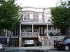
Public School 66 |
|
000000002003-08-28-0000August 28, 2003
(#03000850) |
85-11 102nd St.
40°41′52″N 73°50′47″W / 40.697778°N 73.846389°W / 40.697778; -73.846389 (Public School 66) |
Richmond Hill |
|
| 67 |
Queens County Savings Bank |
|
000000002005-06-16-0000June 16, 2005
(#05000620) |
75-44 Main St.
40°43′21″N 73°49′14″W / 40.7225°N 73.820556°W / 40.7225; -73.820556 (Queens County Savings Bank) |
Kew Gardens Hills |
|
| 68 |
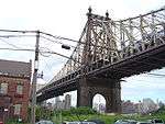
Queensboro Bridge |
|
000000001978-12-20-0000December 20, 1978
(#78001879) |
59th St.
40°45′26″N 73°57′22″W / 40.757222°N 73.956111°W / 40.757222; -73.956111 (Queensboro Bridge) |
Long Island City |
|
| 69 |
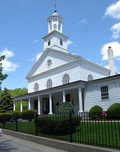
Reformed Church of Newtown Complex |
|
000000001980-04-23-0000April 23, 1980
(#80002751) |
85-15 Broadway
40°44′23″N 73°52′42″W / 40.739722°N 73.878333°W / 40.739722; -73.878333 (Reformed Church of Newtown Complex) |
Elmhurst |
|
| 70 |
Rego Park Jewish Center |
|
000000002009-10-28-0000October 28, 2009
(#09000864) |
97-30 Queens Blvd.
40°43′41″N 73°51′34″W / 40.728192°N 73.859361°W / 40.728192; -73.859361 (Rego Park Jewish Center) |
Rego Park |
|
| 71 |
RKO Keith's Theater |
|
000000001982-10-29-0000October 29, 1982
(#82001260) |
129-143 Northern Boulevard
40°45′48″N 73°49′57″W / 40.763333°N 73.8325°W / 40.763333; -73.8325 (RKO Keith's Theater) |
Flushing |
|
| 72 |
Rockaway Courthouse |
Upload image |
000000002014-02-05-0000February 5, 2014
(#13001155) |
90-01 Beach Channel Dr.
40°35′20″N 73°48′58″W / 40.589°N 73.816°W / 40.589; -73.816 (Rockaway Courthouse) |
Rockaway Beach |
|
| 73 |
Russell Sage Memorial Church |
|
000000001986-09-22-0000September 22, 1986
(#86002678) |
1324 Beach 12 St.
40°36′34″N 73°44′51″W / 40.609444°N 73.7475°W / 40.609444; -73.7475 (Russell Sage Memorial Church) |
Far Rockaway |
Church designed by Ralph Adams Cram with Louis Tiffany windows, recently restored.
|
| 74 |
Saint Benedict Joseph Labre Parish |
|
000000002007-01-25-0000January 25, 2007
(#06001297) |
94-40 118th St.
40°41′33″N 73°49′47″W / 40.6925°N 73.829722°W / 40.6925; -73.829722 (Saint Benedict Joseph Labre Parish) |
Richmond Hill |
|
| 75 |
St. George's Church |
|
000000002008-03-07-0000March 7, 2008
(#08000143) |
135-32 38th Ave.
40°45′37″N 73°49′55″W / 40.760383°N 73.83195°W / 40.760383; -73.83195 (St. George's Church) |
Flushing |
|
| 76 |
St. James Church, Elmhurst |
|
000000001999-11-12-0000November 12, 1999
(#99001331) |
86-02 Broadway
40°44′18″N 73°52′41″W / 40.738333°N 73.878056°W / 40.738333; -73.878056 (St. James Church, Elmhurst) |
Elmhurst |
|
| 77 |
St. Luke's Episcopal Church |
|
000000002010-11-10-0000November 10, 2010
(#10000900) |
85 Greenway South
40°42′50″N 73°50′41″W / 40.713889°N 73.844722°W / 40.713889; -73.844722 (St. Luke's Episcopal Church) |
Forest Hills |
|
| 78 |
St. Matthew's Episcopal Church |
|
000000002001-05-25-0000May 25, 2001
(#01000550) |
85-45 96th St.
40°41′46″N 73°50′58″W / 40.696111°N 73.849444°W / 40.696111; -73.849444 (St. Matthew's Episcopal Church) |
Woodhaven |
|
| 79 |
St. Matthias Roman Catholic Church Complex |
|
000000002012-09-04-0000September 4, 2012
(#12000599) |
58-15 Catalpa Ave.
40°42′07″N 73°54′10″W / 40.701919°N 73.902651°W / 40.701919; -73.902651 (St. Matthias Roman Catholic Church Complex) |
Ridgewood |
|
| 80 |
St. Monica's Church |
|
000000001980-04-09-0000April 9, 1980
(#80002752) |
94-20 160th St.
40°42′07″N 73°47′53″W / 40.701944°N 73.798056°W / 40.701944; -73.798056 (St. Monica's Church) |
Jamaica |
|
| 81 |
Seneca Avenue East Historic District |
|
000000001983-09-30-0000September 30, 1983
(#83001778) |
Roughly Seneca Ave. E. between Hancock and Summerfield Sts.
40°41′59″N 73°54′07″W / 40.699722°N 73.901944°W / 40.699722; -73.901944 (Seneca Avenue East Historic District) |
Ridgewood |
|
| 82 |
Seneca-Onderdonk-Woodward Historic District |
|
000000001983-09-30-0000September 30, 1983
(#83001779) |
Roughly bounded by Woodward, Seneca, Catalpa Aves., and Woodbine St.
40°42′09″N 73°54′17″W / 40.7025°N 73.90472°W / 40.7025; -73.90472 (Seneca-Onderdonk-Woodward Historic District) |
Middle Village |
|
| 83 |
Sidewalk Clock at 161-11 Jamaica Avenue, New York, NY |
|
000000001985-04-18-0000April 18, 1985
(#85000931) |
161-11 Jamaica Ave.
40°42′15″N 73°47′52″W / 40.7041°N 73.7979°W / 40.7041; -73.7979 (Sidewalk Clock at 161-11 Jamaica Avenue, New York, NY) |
Jamaica |
|
| 84 |
Sohmer and Company Piano Factory |
|
000000002014-02-14-0000February 14, 2014
(#14000007) |
31-01 Vernon Blvd.
40°46′10″N 73°56′07″W / 40.769519°N 73.935237°W / 40.769519; -73.935237 (Sohmer and Company Piano Factory) |
Astoria |
|
| 85 |
Steinway Mansion |
|
000000001983-09-08-0000September 8, 1983
(#83001780) |
18-22 41st St.
40°46′42″N 73°53′52″W / 40.778333°N 73.897778°W / 40.778333; -73.897778 (Steinway Mansion) |
Astoria |
|
| 86 |
Stockholm-DeKalb-Hart Historic District |
|
000000001983-09-30-0000September 30, 1983
(#83004618) |
Roughly DeKalb and Woodward Aves., Stockholm and Hart Sts.
40°42′32″N 73°54′52″W / 40.708889°N 73.914444°W / 40.708889; -73.914444 (Stockholm-DeKalb-Hart Historic District) |
Ridgewood |
|
| 87 |
Summerfield Street Row Historic District |
|
000000001983-09-30-0000September 30, 1983
(#83001781) |
59-12 to 59-48 Summerfield St.
40°42′01″N 73°53′48″W / 40.700257°N 73.896755°W / 40.700257; -73.896755 (Summerfield Street Row Historic District) |
Ridgewood |
|
| 88 |
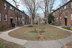
Sunnyside Gardens Historic District |
|
000000001984-09-07-0000September 7, 1984
(#84002919) |
Roughly bounded by Queens Blvd., 43rd and 52nd Sts. Barnett and Skillman Aves.
40°44′49″N 73°55′03″W / 40.746944°N 73.9175°W / 40.746944; -73.9175 (Sunnyside Gardens Historic District) |
Sunnyside Gardens |
|
| 89 |
Temple of Israel Synagogue |
|
000000002014-02-05-0000February 5, 2014
(#13001156) |
1-88 Beach 84th St.
40°35′14″N 73°48′34″W / 40.5873°N 73.8095°W / 40.5873; -73.8095 (Temple of Israel Synagogue) |
Rockaway Beach |
|
| 90 |
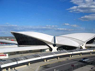
Trans World Airlines Flight Center |
|
000000002005-09-07-0000September 7, 2005
(#05000994) |
John F. Kennedy International Airport
40°38′45″N 73°46′39″W / 40.645794°N 73.777575°W / 40.645794; -73.777575 (Trans World Airlines Flight Center) |
Jamaica |
Designed by Eero Saarinen
|
| 91 |
Trinity Chapel |
|
000000002002-01-11-0000January 11, 2002
(#01001445) |
1874 Mott Avenue
40°36′13″N 73°45′05″W / 40.603611°N 73.751389°W / 40.603611; -73.751389 (Trinity Chapel) |
Far Rockaway |
|
| 92 |
Trinity Lutheran Church |
|
000000002008-05-29-0000May 29, 2008
(#08000471) |
31-18 37th St.
40°45′42″N 73°55′09″W / 40.761753°N 73.919222°W / 40.761753; -73.919222 (Trinity Lutheran Church) |
Astoria |
|
| 93 |
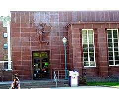
US Post Office-Far Rockaway |
|
000000001988-11-17-0000November 17, 1988
(#88002500) |
1836 Mott Ave.[5]
40°36′12″N 73°45′03″W / 40.603333°N 73.750833°W / 40.603333; -73.750833 (US Post Office-Far Rockaway) |
Far Rockaway |
|
| 94 |
US Post Office-Flushing Main |
|
000000001988-11-17-0000November 17, 1988
(#88002507) |
4165 Main St.[6]
40°45′23″N 73°49′42″W / 40.7564°N 73.8283°W / 40.7564; -73.8283 (US Post Office-Flushing Main) |
Flushing |
|
| 95 |
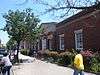
US Post Office-Forest Hills Station |
|
000000001988-11-17-0000November 17, 1988
(#88002503) |
10628 Queens Blvd.[7]
40°43′18″N 73°50′50″W / 40.721667°N 73.847222°W / 40.721667; -73.847222 (US Post Office-Forest Hills Station) |
Forest Hills |
|
| 96 |
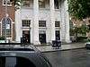
US Post Office-Jackson Heights Station |
|
000000001988-11-17-0000November 17, 1988
(#88002504) |
7802 37th Ave.[8]
40°44′57″N 73°53′16″W / 40.749167°N 73.887778°W / 40.749167; -73.887778 (US Post Office-Jackson Heights Station) |
Jackson Heights |
|
| 97 |
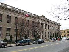
US Post Office-Jamaica Main |
|
000000001988-11-17-0000November 17, 1988
(#88002335) |
8840 164th St.[9]
40°42′00″N 73°48′00″W / 40.700000°N 73.800000°W / 40.700000; -73.800000 (US Post Office-Jamaica Main) |
Jamaica |
|
| 98 |
US Post Office-Long Island City |
|
000000001989-05-11-0000May 11, 1989
(#88002348) |
4602 21st St.[10]
40°44′44″N 73°56′57″W / 40.745556°N 73.949167°W / 40.745556; -73.949167 (US Post Office-Long Island City) |
Long Island City |
|
| 99 |
Cornelius Van Wyck House |
|
000000001983-10-06-0000October 6, 1983
(#83004149) |
37-04 Douglaston Parkway
40°46′23″N 73°45′12″W / 40.773056°N 73.753333°W / 40.773056; -73.753333 (Cornelius Van Wyck House) |
Douglaston |
|
| 100 |
Vander Ende-Onderdonk House Site |
|
000000001977-01-31-0000January 31, 1977
(#77000975) |
1820 Flushing Ave.
40°42′40″N 73°55′12″W / 40.711111°N 73.92°W / 40.711111; -73.92 (Vander Ende-Onderdonk House Site) |
Ridgewood |
|
| 101 |
Woodbine-Palmetto-Gates Historic District |
|
000000001983-09-30-0000September 30, 1983
(#83001783) |
Roughly bounded by Forest and Fairview Aves., Woodbine and Linden Sts.
40°42′25″N 73°54′15″W / 40.706944°N 73.904167°W / 40.706944; -73.904167 (Woodbine-Palmetto-Gates Historic District) |
Middle Village |
|
| 102 |
Wyckoff-Snediker Family Cemetery |
Upload image |
000000002001-05-25-0000May 25, 2001
(#01000549) |
85-45 96th St.
40°41′46″N 73°50′57″W / 40.696111°N 73.849167°W / 40.696111; -73.849167 (Wyckoff-Snediker Family Cemetery) |
Woodhaven |
Located behind St. Matthew's Episcopal Church (see above) and not clearly visible from the street. |


.jpg)
_1.jpg)

.jpg)


_1.jpg)
.jpg)

_Street_Clock.JPG)