United States National Grassland
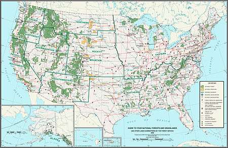
National Grassland is a classification of protected and managed federal lands in the United States authorized by Title III of the Bankhead–Jones Farm Tenant Act of 1937. For administrative purposes, they are essentially identical to United States National Forests, except that grasslands are areas primarily consisting of prairie. Like National Forests, National Grasslands may be open for hunting, grazing, mineral extraction, recreation and other uses. Various National Grasslands are typically administered in conjunction with nearby National Forests.
All but three National Grasslands are on or at the edge of the Great Plains. Those three are in southeastern Idaho, northeastern California, and central Oregon. The three National Grasslands in North Dakota, together with one in northwestern South Dakota, are administered jointly as the Dakota Prairie Grasslands. National Grasslands are generally much smaller than National Forests. Whereas a typical National Forest would be about 1,000,000 acres (400,000 ha), the average Grassland size is 191,914 acres (77,665 ha). The largest National Grassland, the Little Missouri National Grassland in North Dakota, covers 1,028,784 acres (416,334 ha), which is approximately the median size of a National Forest. As of September 30, 2007, the total area of all 20 National Grasslands was 3,838,280 acres (1,553,300 ha).[1]
Dust Bowl
The catastrophic Dust Bowl of the 1930s led to the creation of the Soil Conservation Service in 1933. This and subsequent federal laws paved the way for establishing national grasslands.
List of National Grasslands
| Name | Photo | Location[2] | Administered by | Area[1] | Description |
|---|---|---|---|---|---|
| Black Kettle |  |
Oklahoma, Texas 35°41′01″N 99°45′47″W / 35.68361°N 99.76306°W |
Cibola National Forest | 31,286 acres (126.6 km2) | Black Kettle has sandy red slate hills as well as grassland and oak brush. There are three developed recreation areas, and the Washita River flows through the grassland. |
| Buffalo Gap |  |
South Dakota 43°26′15″N 103°03′02″W / 43.43750°N 103.05056°W |
Nebraska National Forests | 595,715 acres (2,410.8 km2) | There are mixed prairie and badlands in Buffalo Gap as well as a reintroduced population of black-footed ferrets. |
| Butte Valley |  |
California 41°53′57″N 122°01′31″W / 41.89917°N 122.02528°W |
Klamath National Forest | 18,425 acres (74.6 km2) | Formed July 1991, Butte Valley is the most recent National Grassland. It contains Meiss Lake and views of the Cascade Range. |
| Caddo | 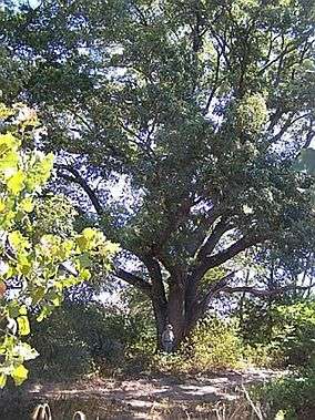 |
Texas 33°43′56″N 95°57′29″W / 33.73222°N 95.95806°W |
National Forests and Grasslands in Texas | 17,873 acres (72.3 km2) | Caddo is divided into two units and has two developed recreation areas around Lake Davy Crockett. |
| Cedar River | 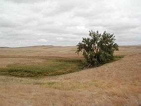 |
North Dakota 45°57′19″N 101°48′24″W / 45.95528°N 101.80667°W |
Dakota Prairie Grasslands | 6,717 acres (27.2 km2) | Cedar River is within the Standing Rock Indian Reservation and has rolling hills and ephemeral streams. |
| Cimarron | 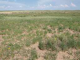 |
Kansas 37°08′18″N 101°46′56″W / 37.13833°N 101.78222°W |
Pike & San Isabel National Forests | 108,176 acres (437.8 km2) | Cimarron has shortgrass prairie with cottonwood groves along the Cimarron River. |
| Comanche | 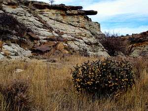 |
Colorado 37°20′12″N 103°04′26″W / 37.33667°N 103.07389°W |
Pike & San Isabel National Forests | 443,081 acres (1,793.1 km2) | There are not only prairies in Comanche, but also canyons, including Picture Canyon. |
| Crooked River | 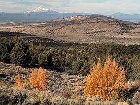 |
Oregon 44°32′36″N 121°06′34″W / 44.54333°N 121.10944°W |
Deschutes & Ochoco National Forests | 112,357 acres (454.7 km2) | Crooked River contains two National Wild and Scenic Rivers: the Deschutes and Crooked rivers. |
| Curlew | 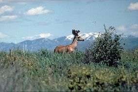 |
Idaho 42°11′15″N 112°41′57″W / 42.18750°N 112.69917°W |
Caribou-Targhee National Forest | 47,790 acres (193.4 km2) | In southern Idaho, Curlew provides habitat for sage grouse while the Sweeten Pond area supports waterfowl and shorebirds. |
| Fort Pierre |  |
South Dakota 44°08′27″N 100°16′45″W / 44.14083°N 100.27917°W |
Nebraska National Forests | 115,890 acres (469.0 km2) | Located north of Pierre, South Dakota, Fort Pierre includes several ponds open to fishing and dispersed camping. |
| Grand River | 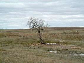 |
South Dakota 45°44′09″N 102°21′40″W / 45.73583°N 102.36111°W |
Dakota Prairie Grasslands | 154,783 acres (626.4 km2) | In addition to prairie, there are a variety of habitats in Grand River, including sand dunes, river bottoms, badlands, buttes, and sandstone outcroppings. |
| Kiowa | 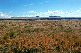 |
New Mexico 36°10′00″N 104°10′02″W / 36.16667°N 104.16722°W |
Cibola National Forest | 137,131 acres (554.9 km2) | Kiowa consists of two units in northeastern New Mexico and includes canyons along the Canadian River. |
| Little Missouri | 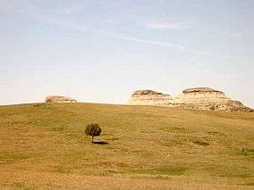 |
North Dakota 47°05′55″N 103°32′14″W / 47.09861°N 103.53722°W |
Dakota Prairie Grasslands | 1,028,784 acres (4,163.3 km2) | The largest National Grassland, Little Missouri includes badlands and short and long grass prairie. |
| Lyndon B. Johnson | 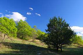 |
Texas 33°20′56″N 97°39′32″W / 33.34889°N 97.65889°W |
National Forests and Grasslands in Texas | 20,309 acres (82.2 km2) | Used primarily for recreation, Lyndon B. Johnson National Grassland has no fees and is located northwest of Fort Worth. |
| McClellan Creek |  |
Texas 35°12′42″N 100°52′16″W / 35.21167°N 100.87111°W |
Cibola National Forest | 1,449 acres (5.9 km2) | McClellan Creek National Grassland surrounds Lake McClellan, and nearly all of the grassland was burned in 2006. |
| Oglala | 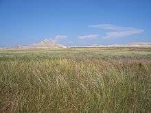 |
Nebraska 42°54′56″N 103°38′14″W / 42.91556°N 103.63722°W |
Nebraska National Forests | 94,520 acres (382.5 km2) | The badlands of Toadstool Geologic Park are within Oglala National Grassland. |
| Pawnee | 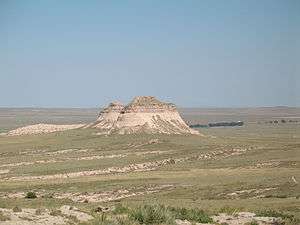 |
Colorado 40°47′38″N 104°05′01″W / 40.79389°N 104.08361°W |
Arapho & Roosevelt National Forests | 193,060 acres (781.3 km2) | Pawnee has camping at Crow Valley Recreation Area and trails to the Pawnee Buttes. |
| Rita Blanca | 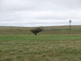 |
Texas, Oklahoma 36°26′04″N 102°36′01″W / 36.43444°N 102.60028°W |
Cibola National Forest | 92,989 acres (376.3 km2) | Rita Blanca includes grasslands, marshes, and woodlands and is located in the Texas Panhandle and western Oklahoma. |
| Sheyenne | 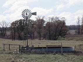 |
North Dakota 46°25′36″N 97°17′43″W / 46.42667°N 97.29528°W |
Dakota Prairie Grasslands | 70,446 acres (285.1 km2) | Sheyenne provides habitat for the largest population of greater prairie chickens in North Dakota as well as the Dakota skipper butterfly and western prairie fringed orchid. |
| Thunder Basin | 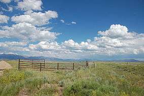 |
Wyoming 43°41′09″N 105°00′56″W / 43.68583°N 105.01556°W |
Medicine Bow – Routt National Forest | 547,499 acres (2,215.6 km2) | Thunder Basin is located in the Powder River Basin between the Big Horn Mountains and the Black Hills. |
List of Prairie Reserves
| Name | Photo | Location[3] | Date formed | Area[1] | Description |
|---|---|---|---|---|---|
| Midewin National Tallgrass Prairie |  |
Illinois 41°22′44″N 88°06′46″W / 41.37889°N 88.11278°W |
1996 | 18,226 acres (73.8 km2) | The only federally managed prairie east of the Mississippi River, Midewin is in the Central forest-grasslands transition ecoregion and was created when land was transferred to the U.S. Forest Service from the U.S. Army. It is open to non-motorized recreation. In 2015, a small research herd of American Bison were reintroduced to study the effect of this large prairie animal on tallgrass prairie regeneration. |
See also
- Grassland
- Prairie
- Temperate grasslands, savannas, and shrublands
- List of U.S. National Forests
- Wilderness preservation systems in the United States
External links
| Wikimedia Commons has media related to National Grasslands of the United States. |
References
- 1 2 3 "Land Areas of the National Forest System". U.S. Forest Service. January 2013. Retrieved December 21, 2012.
- ↑ "U.S. Board on Geographic Names". U.S. Geological Survey. Retrieved December 21, 2012.
- ↑ "Midewin National Tallgrass Prairie". Geographic Names Information System. United States Geological Survey. Retrieved December 22, 2012.