Naperville, Illinois
| Naperville, Illinois | ||
| City of Naperville | ||
| City | ||
 Jefferson Avenue in downtown Naperville. | ||
|
||
| Motto: Great Service - All the Time | ||
| Country | United States | |
|---|---|---|
| State | Illinois | |
| Counties | DuPage, Will | |
| Townships | Lisle (DuPage), Milton (DuPage), Naperville (DuPage), Winfield (DuPage), DuPage (Will), Wheatland (Will) | |
| River | DuPage | |
| Elevation | 702 ft (214 m) | |
| Coordinates | 41°44′53″N 88°09′56″W / 41.74806°N 88.16556°WCoordinates: 41°44′53″N 88°09′56″W / 41.74806°N 88.16556°W | |
| Area | 39.32 sq mi (102 km2) | |
| - land | 38.77 sq mi (100 km2) | |
| - water | 0.55 sq mi (1 km2), 1.4% | |
| Population | 144,864 (2013 estimate) | |
| Density | 4,025.38/sq mi (1,554/km2) | |
| Settled | 1831 | |
| - Incorporated | 1857 (Village) 1890 (City) [1] | |
| Government | Council–manager | |
| Mayor | Steve Chirico | |
| Timezone | CST (UTC-6) | |
| - summer (DST) | CDT (UTC-5) | |
| Postal code | 60540, 60563-60565, and PO BOX Only Codes 60566-60567 | |
| Area codes | 630 and 331 | |
 Location of Naperville within Illinois | ||
| Wikimedia Commons: Naperville, Illinois | ||
| Website: www | ||
| [2] | ||

Naperville is a city in DuPage and Will counties in the U.S. state of Illinois, and a suburb of Chicago. Naperville was voted the second-best place to live in the United States by Money magazine in 2006.[3] It was rated 1st on the list of best cities for early retirement in 2013 by Kiplinger.[4] In a 2010 study, Naperville was named the wealthiest city in the Midwest and eleventh in the nation with a population over 75,000.[5] It was ranked among the nation's safest cities by USAToday.[6] As of the 2010 census, the city had a population of 141,853, which was estimated to have increased to 144,864 by July 2013.[7] It is the fifth-largest city in Illinois.
History

In July 1831, Joseph Naper arrived at the west bank of the DuPage River with his family and friends to found what would be known as Naper's Settlement.[8] Among those original settlers were Naper's wife Almeda Landon, his brother John with wife Betsy Goff, his sister Amy with husband John Murray, and his mother Sarah. Their arrival followed a nearly two-month voyage across three Great Lakes in the Naper brothers' schooner, the Telegraph. Also on the journey were several families who remained in the settlement that would become Chicago, including that of Dexter Graves[9] who is memorialized in Graceland Cemetery by the well-known Lorado Taft statue "Eternal Silence" (also known as "the Dexter Graves Monument").
By 1832, over one hundred settlers had arrived at Naper's Settlement. Following the news of the Indian Creek massacre during the Black Hawk War, these settlers were temporarily displaced to Fort Dearborn for protection from an anticipated attack by the Sauk tribe. Fort Payne was built at Naper's Settlement, the settlers returned and the attack never materialized. The Pre-Emption House was constructed in 1834, as the Settlement became a stage-coach stop on the road from Chicago to Galena. Reconstructions of Fort Payne and the Pre-Emption House stand as part of Naper Settlement outdoor museum village, which was established by the Naperville Heritage Society and the Naperville Park District in 1969 to preserve some of the community's oldest buildings.[9]
In 1855 Sybil Dunbar came to Naperville as its first recorded black female resident; she died in 1868 and was buried in Naperville Cemetery on Washington Street.[10] A commemorative marker honoring her was placed in the cemetery in 2015.[10]
After DuPage County was split from Cook County in 1839, Naper's Settlement became the DuPage county seat, a distinction it held until 1868. Naper's Settlement was incorporated as the Village of Naperville in 1857, at which time it had a population of 2,000. Reincorporation as a city occurred in 1890.
On April 26, 1946, Naperville was the site of one of the worst train disasters in Chicago history. Two Chicago, Burlington and Quincy Railroad trains, the Advance Flyer and the Exposition Flyer, collided 'head to tail' on a single track just west of the Loomis Street grade crossing. The accident killed 45 and injured approximately 127 passengers and/or crew members.[11] This event is commemorated in a metal inlay map of Naperville on the southeast corner of the Nichols Library's sidewalk area.[12] In 2012, author Chuck Spinner published The Tragedy at the Loomis Street Crossing which details the tragedy and gives the stories of the 45 persons who perished.[13] On April 26, 2014, a memorial entitled Tragedy to Triumph was dedicated at the train station. The sculpture by Paul Kuhn is dedicated not only to the crash victims but also to the rescuers at the site.[14]
A predominantly rural community for most of its existence, Naperville experienced a population explosion beginning in the 1960s and continuing into the 1980s and 1990s, following the construction of the East-West Tollway (now known as the Ronald Reagan Memorial Tollway) and Interstate 355 (originally known as the North-South Tollway, now the Veterans Memorial Tollway). It has nearly quadrupled in size as the Chicago metropolitan area's urban sprawl brought corporations, jobs, and wealth to the area.[9]
The March 2006 issue of Chicago magazine cites a mid-1970s decision to make and keep all parking in downtown Naperville free to keep downtown Naperville "alive" in the face of competition with Fox Valley Mall in Aurora and the subsequent sprawl of strip shopping malls. Parking meters were taken down, parking in garages built in the 1980s and 1990s is free, and parking is still available on major thoroughfares during non-peak hours.[9]
Naperville marked the 175th anniversary of its 1831 founding in 2006. The anniversary events included celebrations, concerts and a balloon parade.[15]
Geography and climate
According to the 2010 census, Naperville has an area of 39.323 square miles (101.85 km2), of which 38.77 square miles (100.41 km2) (or 98.59%) is land and 0.553 square miles (1.43 km2) (or 1.41%) is water.[16] Portions of the city of Naperville drain to the West Branch of the DuPage River within DuPage County.[17] Specifically, in the flood of 1996, downtown businesses in the City of Naperville incurred significant damage. Overall, however, Forest Preserve District ownership of a large amount of property along the West Branch has minimized development in flood plains and has helped reduce the damages from overbank flooding that have occurred in the county's more developed watersheds.[17]
Naperville borders the communities of Warrenville, Wheaton, Lisle, Woodridge, Bolingbrook, Plainfield, and Aurora.
| Climate data for Naperville, Illinois | |||||||||||||
|---|---|---|---|---|---|---|---|---|---|---|---|---|---|
| Month | Jan | Feb | Mar | Apr | May | Jun | Jul | Aug | Sep | Oct | Nov | Dec | Year |
| Average high °F (°C) | 30 (−1) |
35 (2) |
47 (8) |
60 (16) |
71 (22) |
81 (27) |
83 (28) |
81 (27) |
75 (24) |
63 (17) |
48 (9) |
34 (1) |
59 (15) |
| Average low °F (°C) | 15 (−9) |
18 (−8) |
27 (−3) |
37 (3) |
46 (8) |
57 (14) |
61 (16) |
60 (16) |
51 (11) |
40 (4) |
30 (−1) |
19 (−7) |
38.4 (3.7) |
| Average precipitation inches (mm) | 1.69 (42.9) |
1.73 (43.9) |
2.36 (59.9) |
3.62 (91.9) |
4.02 (102.1) |
4.21 (106.9) |
3.90 (99.1) |
4.06 (103.1) |
3.58 (90.9) |
3.07 (78) |
3.23 (82) |
2.20 (55.9) |
37.67 (956.6) |
| Source: [18] | |||||||||||||
Demographics
| Historical population | |||
|---|---|---|---|
| Census | Pop. | %± | |
| 1870 | 1,713 | — | |
| 1880 | 2,073 | 21.0% | |
| 1890 | 2,216 | 6.9% | |
| 1900 | 2,629 | 18.6% | |
| 1910 | 3,449 | 31.2% | |
| 1920 | 3,830 | 11.0% | |
| 1930 | 5,118 | 33.6% | |
| 1940 | 5,272 | 3.0% | |
| 1950 | 7,013 | 33.0% | |
| 1960 | 12,933 | 84.4% | |
| 1970 | 22,794 | 76.2% | |
| 1980 | 42,330 | 85.7% | |
| 1990 | 85,351 | 101.6% | |
| 2000 | 128,358 | 50.4% | |
| 2010 | 141,853 | 10.5% | |
| Est. 2015 | 147,100 | [19] | 3.7% |
| U.S. Decennial Census[20] 2013 Estimate[7] | |||
There were 141,644 people, 52,270 households, and 36,289 families residing in the city. As of July 2013, Naperville was the 176th most populous city in the United States.[21]
According to the 2005 American Community Survery, the population density was 4,162.8 inhabitants per square mile (1,606.3/km²). There were 51,636 housing units at an average density of 561.3/km² (1454.5/mi²).[22] The racial makeup of the city was 82.00% White, 2.54% African American, 0.07% Native American, 12.65% Asian, 0.00% Pacific Islander, 1.26% from other races, and 1.48% from two or more races Hispanic or Latino of any race were 4.23% of the population.
There were 48,655 households out of which 45.3% had children under the age of 18 living with them, 70.0% were married couples living together, 6.2% had a female householder with no husband present, and 23.7% were non-families. 17.8% of all households were made up of individuals and 3.9% had someone living alone who was 65 years of age or older. The average household size was 3.04 and the average family size was 3.55.
In the city, the population was spread out with 30.2% under the age of 18, 7.6% from 18 to 24, 29.4% from 25 to 44, 26.7% from 45 to 64, and 6.1% who were 65 years of age or older. The median age was 35.9 years. For every 100 females there were 95.9 males. For every 100 females age 18 and over, there were 95.2 males.
The median income for a household in the city was $105,585, and the median income for a family was $130,164. Males had a median income of $82,515 versus $46,533 for females. The per capita income for the city was $48,239. About 2.5% of the population was below the poverty line, including 1.2% of those under age 18 and 9.1% of those age 65 or over.
In 2011, 14.9% of Naperville's residents were Asian, making it the Chicago suburb with the tenth highest percentage of Asians.[23]
Economy
Naperville is within the Illinois Technology and Research Corridor. Employers contributing to the population explosion of the 1980s and 1990s included: Bell Labs and Western Electric (now Alcatel-Lucent), Amoco (now BP and Ineos), Nalco, Calamos, Nicor, and Edward Hospital. Tellabs has its corporate headquarters in Naperville,[24] and ConAgra's Grocery division branch office employs approximately 400 workers.[25] Kraft Foods opened their Naperville site in 1968, and employs over 200 individuals at the plant, which supplies all Triscuit products for North America.[26] Naperville is also home to the headquarters of Dukane Precast, and their double-wall precast concrete manufacturing plant.[27] Fermilab and Argonne National Laboratory are also nearby. Naperville was one of the ten fastest growing communities in the United States during the 1990s.[28]
The Naperville area is home to many popular retailers, restaurants and shopping centers, such as downtown Naperville, Freedom Commons, Springbrook Prairie Pavilion, and the Route 59 and Ogden Avenue corridors.[29] Naperville has over eleven automobile dealerships, and in October 2006, the city opened the country's first public-private automobile test track, situated on a 9-acre (3.6 ha) course, at a cost of $1.5 million.[30][31]

Top employers
According to the City's 2010 Comprehensive Annual Financial Report,[32] the city's top ten employers are:
| # | Employer | # of Employees |
|---|---|---|
| 1 | Edward Hospital | 4,288 |
| 2 | Nicor | 3,700 |
| 3 | Alcatel-Lucent | 3,600 |
| 4 | Indian Prairie School District 204 | 3,184 |
| 5 | Naperville Community Unit School District 203 | 2,575 |
| 6 | BP America | 1,750 |
| 8 | Tellabs | 1,200 |
| 9 | Nalco | 1,000 |
| 10 | City of Naperville | 998 |
Culture

The Naperville Public Library has been ranked number one in the United States each year from 1999 through 2010, for cities with populations between 100,000 and 249,999 by Hennen's American Public Library Ratings.[33]
There are three public library locations within the city limits:
- The Nichols Library is in downtown Naperville, at 200 W. Jefferson Street. It opened at this location in March 1986. It is a 63,300 square feet (5,900 m2) structure[34] and is pictured at right. The previous library building still stands on Washington Street, just south of the YMCA building, at Washington and Van Buren.
- The Naper Boulevard Library was dedicated in December 1992 and underwent internal renovations in 2015. It is at 2035 S. Naper Boulevard and is the smallest of the three buildings at 32,000 square feet (3,000 m2)[34]
- The 95th Street Library is near the intersection of 95th Street and Route 59, at 3015 Cedar Glade Drive (just west of Neuqua Valley High School). Opened in September 2003, it is the newest and largest of the three facilities at 73,000 square feet (6,800 m2)[34] and features a modern, curving architectural style.
In May 2005, a local technology company was contracted to install fingerprint scanners as a more convenient access method to the libraries internet computers,[35] provoking some controversy. After further testing, the technology was not implemented.[35]
The three libraries are used heavily by the public, including around one and a half million visitors and a circulation of about five million items yearly.[34][36]
Naperville is home of the Naperville Independent Film Festival, an annual film festival which features the work of independent filmmakers.[37]

Tourism
The Naperville Historic District is a set of 613 buildings in the older eastern section of Naperville and is listed on the National Register of Historic Places.
Moser Tower and Millennium Carillon
In 1999, Naperville was designated a White House Millennium Community, due to the construction of the Moser Tower and Millennium Carillon. The tower is a bell tower just north of Aurora Avenue and at the base of Rotary Hill within the Riverwalk Park complex. The Carillon is designated as a Grand Carillon, with 72 bells, and is one of only four in the world that span six octaves. It was dedicated in an Independence Day event on June 29, 2000, with a reception attended by over 15,000, and a performance by the Naperville Municipal Band and the Naperville Men's Glee Club and Festival Chorus. The Carillon is both manually and also computer-playable, with most performances done by hand, but with half the bells played by a computer-controlled system at set times during the day. At present, the Carillon is operational and tours are available after concerts. Disputes over funding the completion of the tower were debated before the Naperville City Council during the fall of 2005 (and are still not resolved). The tower's design won an award for "Best Custom Solution" from the Precast/Prestressed Concrete Institute (PCI).[38]
Law and government
Townships
Naperville is located in six townships in two counties. In Dupage County, the Northwest portion is in Winfield Township, the Northeast portion is in Milton Township, the West central portion is in Naperville Township, and the East central portion is in Lisle Township. In Will County, the Southwest portion is in Wheatland Township, and the Southeast portion is in DuPage Township.[39] The largest number of Naperville residents live in Lisle Township, followed by Naperville Township.
Education
Colleges and universities
- North Central College is on a 59-acre (24 ha) campus in Downtown Naperville on Chicago Avenue. It was founded by a predecessor church to the United Methodist Church in 1861 and has been in Naperville since 1870. The college remains affiliated with the United Methodist Church.
- Northern Illinois University maintains a satellite campus on Diehl Road offering several degrees at its 113,000-square-foot (10,500 m2) facility.
- DePaul University maintains a satellite campus on Warrenville Road. It has been in Naperville since 1997.
- The College of DuPage Naperville Regional Center is on Rickert Drive.[40]
- DeVry University maintains a satellite campus on Westings Avenue in Naperville.
- Governors State University recently opened a satellite campus on West 95th Street in Naperville.
- Northwestern College has a Naperville campus on North Mill Street.
- The University of Illinois at Urbana–Champaign opened a Business & Industry Services campus in Naperville in 2007.
Primary and secondary schools
Public schools
Two K-12 public school districts serve the city of Naperville (along with a number of private, parochial schools, including private schools in neighboring Aurora and Lisle). Within the state of Illinois, school districts are numbered by their county.
Naperville Community Unit School District 203, established in 1972 through the merger of elementary and high school districts, serves central and northern Naperville (as well as portions of neighboring Lisle and Bolingbrook). The current District 203 school buildings were constructed between 1928 (Ellsworth) and 2010 (Ann Reid Early Childhood Center).[41]

The 203 school district has two high schools: Naperville Central High School and Naperville North High School, 5 junior high schools and 15 elementary schools within Naperville city limits.[42] Additionally, the school district has one junior high and one elementary school in Lisle.
Indian Prairie School District 204 (IPSD) was also formed through merged districts in 1972. Neuqua Valley High School, along with three middle schools and 19 elementary schools from this district, are within Naperville city limits in the southern part. In total, IPSD runs and maintains 3 high schools, 7 junior high schools, 21 elementary schools, 1 preschool, and 1 alternative high school. The district serves western and southwestern Naperville, along with eastern Aurora and parts of Bolingbrook and Plainfield.[43]
Private schools
Private schools in the city limits include(d):
- All Saints Catholic Academy, founded in 2005, preschool through 8th grade [44]
- Bethany Lutheran School, preschool through 8th grade [45]
- Calvary Christian School, kindergarten through 8th grade [46]
- Chesterbrook Academy, kindergarten through 5th grade
- Covenant Classical School, kindergarten through 8th grade [47]
- Naperville Academy, established by law in 1841,[48] incorporated in 1851,[49][50] and opened in 1852.[51] It became a public school in 1860 and the school building stood until 1928.[50]
- Naperville Christian Academy, Classical Christian school, preschool through 12th grade[52]
- St. Raphael School, Roman Catholic school, kindergarten through 8th grade[53]
- Saints Peter and Paul School, opened in 1855, Catholic school, kindergarten through 8th grade[54]
Media
Television
- Naperville Community Television, NCTV17 (Channel 17) – Community-based programming that includes news, sports, and talk shows.[55]
Newspapers
- Daily Herald
- Naperville Reporter (GateHouse Media)
- Naperville Sun
Radio
- 1610-AM WPFP 929, AM 1610 – emergency, city and road information[56][57]
- Stop and Go Radio – Internet community radio station[58]
- WONC (89.1 FM) – album oriented rock format, owned by North Central College[59]
- WCKG (1530 AM) – The Voice of Dupage County and Naperville's News/Talk. Providing local Dupage County weather and suburban news[60]
Infrastructure
Health systems
Edward Hospital serves Naperville while Good Samaritan in Downers Grove, Central DuPage in Winfield and two other hospitals in nearby Aurora also serve the city. For many years, Edward Hospital and others have tried to introduce a new hospital into Naperville only to have their request turned down. Thus, Naperville remains the only large Illinois city with only one hospital. Edward Hospital currently is trying to open a hospital in nearby Plainfield to help Naperville citizens with travel times to Edward Hospital.[61]
Parks

The Naperville Park District manages and provides leisure and recreational activities for Naperville and nearby residents. The District was established by referendum in 1966. As of 2007, the Park District manages over 2,400 acres (10 km2) of open space, including over 130 parks and four sports complexes.[62] The Park District also manages two golf courses, Springbrook and Naperbrook.[63] In addition, the Park District is responsible for the Naperville Riverwalk, construction of which began in 1981, marking the 150th anniversary of the first Joseph Naper's settlement. The Park District maintains and beautifies the riverwalk throughout the year with the help of community members. The Naperville Riverwalk is 1.75 miles long and runs along the West Branch of the DuPage River. It is made up of brick paths, fountains, and covered bridges. In addition, the riverwalk features the Dandelion Fountain, the Naperville Century Walk, the Riverwalk Eatery, and the Commander Dan Shanower-Sept. 11 Memorial. The memorial also includes over 140 faces made by local school children symbolizing the casualties of September 11.[64] As of April 2015, a 2.4 acre Water Street District development has started just south of the Naperville Riverwalk between Main and Webster streets. The city of Naperville and Naperville Park District are planning to expand the riverwalk to add an art wall and seating areas. The Water Street project is expected to be completed in the fall of 2016.[65] Also, North Central College with the help of the city of Naperville is planning to construct a park along the riverwalk, but the project has been suspended for the time being.[66] Some of the other facilities managed by the Park District include:
- Centennial Beach, with adjacent Centennial Park.
- Two parks dedicated to skateboarding and in-line skating, at Frontier Sports Complex and Centennial Park.
- Commissioners Park, which includes Naperville's first official Cricket pitch, opened in 2006.
- Alfred Rubin Riverwalk Community Center
- Community Garden Plots, on West Street.
- Knoch Knolls Park, which includes a small, but recently extended, mountain biking trail and eighteen-hole frisbee golf course, located south between Ring Road and 95th Street.
- Naperville Sportsman's Club, Public trap shooting range
- Springbrook Prairie, which is 1,829 acres of land, 13 miles of trails, activities including bird watching, kayaking, model-aircraft area, fishing, biking, running, and other recreational activities.
Post office
In 1941, New Deal artist Rainey Bennett painted an oil on canvas mural for the Naperville post office titled, George Martin's Home Overlooking Old Naper Hill.[67]
Transportation
Roads
As a typical American suburb, Naperville' uses automobiles as its main mode of transportation. The Ronald Reagan Memorial Tollway (the tolled portion of Interstate 88) runs near the north edge of Naperville with 3 exits serving the city at IL 59, Winfield Rd. (in Warrenville), and Naperville Rd. Interstate 55 runs about 5 miles south of the city, through Bolingbrook and Romeoville. People wishing to reach Naperville from I-55 exit at Weber Road and head north.
US Route 34 Ogden Avenue enters Naperville in the west at Illinois Route 59 coming from Oswego and Aurora at an east-northeast/west-southwest angle. At Rickert Drive, US 34 Ogden Ave curves to the north and goes under the BNSF Railroad bridge before turning east at North Aurora Road/Raymond Dr. US 34 Ogden Ave exits the east side of the city at Naper Blvd and continues into Lisle and Downers Grove.
Illinois Route 59 travels north and south coming into town from Plainfield on the south (just south of 111th Street) and Warrenville on the north (at I-88). Route 59 is also the west border with Aurora from US 34 Ogden Ave to the BNSF Railroad bridge. A Diverging Diamond Interchange, the first in Northeast Illinois, was completed in 2015 at the junction of IL Route 59 and Interstate 88.
Main east-west streets include: 111th St. (Hassert Blvd.), 95th St. (Knoch Knolls Rd.), 87th St., Aurora Ave., North Aurora Rd., Diehl Rd., Rickert Dr., Royce Rd., Bailey Rd., Hobson Rd., and Chicago Ave.
Main north-south streets include: Raymond Dr., Book Rd., River Rd., West St., Naperville-Plainfield Rd., Modaff Rd., Washington St., Naper Blvd.(Naperville Rd.), and Wehrli Rd.
From 75th Street south Naperville numbered east-west streets roughly follow the same grid layout as the City of Chicago. In other words, if 75th Street continued east past its terminus at Illinois Route 83, in Willowbrook, it would eventually be the same 75th Street as found in Chicago city limits. However, the older part of Naperville has a second numerical grid, starting downtown at Main and Benton, with 4th and 5th Avenues just north of the BNSF tracks, and continuing through 15th Avenue. The difference is that the numbers in the older system go up from downtown, traveling south to north, and the other grid's numbers go up as you travel north to south. There is also a geographical-based naming system, with West Street and North Street defining the older boundaries of the city. Along with these are streets named after the city they lead to, i.e., Naper/Plainfield Road heads towards Plainfield, while Aurora Avenue leads to Aurora and Chicago Avenue to Chicago (it becomes Maple Ave. in neighboring Lisle before becoming 55th Street in Downers Grove).
Train service
The first rail link to Chicago dates to 1864, established by the Chicago, Burlington and Quincy Railroad. Naperville currently has three tracks belonging to the BNSF Railway that run through the north end of town, with passenger rail service provided by Metra and Amtrak. Amtrak's four daily trains through Naperville are the Illinois Zephyr and Carl Sandburg (both destined for Quincy, Illinois), the California Zephyr (destined for Emeryville, California), and the Southwest Chief (destined for Los Angeles). A third Metra station is planned on the Suburban Transit Access Route ("STAR") at Wolf's Crossing.
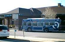
Bus service
Pace provides rush hour feeder bus service to the Metra stations, and previously, through 2008, had provided for local midday service. Both services have always been operated under contract; First Student, a national transportation management firm, is the current contract operator. In addition, Pace directly operates bus route 530 from Naperville to Aurora (which serves Aurora's Westfield Fox Valley Mall) and bus route 714 from Naperville to Wheaton (which serves the College of DuPage), both through its Fox Valley division. Pace also directly operates route 888, a rush hour express route named the "Tri-State Flyer," from Homewood and South Holland to corporate employment sites in the western suburbs, including those in the northern part of Naperville; this route is operated by Pace through its South division. Intercity bus service in Naperville consists of a route from Chicago and Naperville to Davenport, Iowa, and points further west, operated by both Burlington Trailways and Greyhound Lines. The Burlington Trailways buses stop at the Naperville Metra and Amtrak station, downtown on Fourth Avenue; the Greyhound Lines buses stop at the Route 59 Metra station.
Airport
Chicago O'Hare Airport and Chicago Midway Airport are approx. 28 and 25 mi (45 and 40 km) away from Naperville, respectively.
There is also one private airport, the Naper Aero Club field, designation LL-10, on the western edge of town. The field is notable for being the home of the Lima Lima Flight Team.
Notable people
Sister cities
References
- ↑ "Naperville History". The Encyclopedia of Chicago. Naperville Heritage Society. 2004. Retrieved December 23, 2010.
- ↑ "City of Naperville". Geographic Names Information System. United States Geological Survey. February 27, 2008. Retrieved December 23, 2010.
- ↑ "Best Places to Live 2006 – Money Magazine". CNN.
- ↑ Rapacon, Stacy (March 2013). "10 Best Cities for Early Retirement". kiplinger.com. Kiplinger. Retrieved 2 October 2014.
- ↑ Thomas, G. Scott (February 22, 2010). "Rich City, Poor City: Ratings of America's Wealth Centers" (PDF). Portfolio.com. Bizjournals. Archived from the original (PDF) on August 27, 2011. Retrieved May 1, 2013. via Internet Archive
- ↑ http://www.usatoday.com/story/money/business/2014/11/15/24-7-wall-st-safest-cities/18933099/
- 1 2 "2013 Population Estimates". Annual Estimates of the Resident Population: April 1, 2010 to July 1, 2013. U.S. Census Bureau. Retrieved 15 September 2014.
- ↑ "Several Towns Named After Founders and Heroes". The Daily Herald. December 28, 1999. p. 220. Retrieved August 17, 2014 – via Newspapers.com.

- 1 2 3 4 Rodkin, Dennis (March 2006). "Why Everybody Loves Naperville". Chicago. Retrieved December 23, 2010.
- 1 2 "Naperville honors its first female black resident with grave marker". DailyHerald.com. Retrieved 2015-05-29.
- ↑ Doster, Adam (April 26, 2013). "This Is the 67th Anniversary of the Horrible Naperville Train Crash You've Never Heard Of". chicagomag.com. Chicago Magazine. Retrieved August 23, 2013.
- ↑ Nichols Library Map – Naperville Illinois on Flickr
- ↑ The Tragedy at the Loomis Street Crossing 2012 By Chuck Spinner ISBN 978-1-4685-5594-3 ISBN 978-1-4685-5593-6 Library of Congress # 2012904250
- ↑ Anatomy of an art project Naperville Sun February 28, 2014 Pages 1,6 & 7 By Susan Frick Carlman Chicago Sun Times Media
- ↑ "Naper Settlement Annual Report" (PDF). Naperville Heritage Society. 2006. Retrieved December 23, 2010.
- ↑ "G001 - Geographic Identifiers - 2010 Census Summary File 1". United States Census Bureau. Retrieved 2015-12-27.
- 1 2 "West Branch DuPage River Watershed Plan" (PDF). DuPage County Division of Stormwater Management. February 14, 2006. Retrieved December 23, 2010.
- ↑ "Monthly Averages for Naperville, IL (60540)". The Weather Channel. Retrieved March 22, 2012.
- ↑ "Annual Estimates of the Resident Population for Incorporated Places: April 1, 2010 to July 1, 2015". Retrieved July 2, 2016.
- ↑ "U.S. Decennial Census". Census.gov. Retrieved June 9, 2013.
- ↑ "Annual Estimates of the Resident Population for Incorporated Places of 50,000 or More, Ranked by July 1, 2013 Population: April 1, 2010 to July 1, 2013". U.S. Census Bureau, Population Division. May 2014. Retrieved 15 September 2014.
- ↑ "Fact Sheet for Naperville, IL". 2005 American Community Survey. US Census Bureau. September 2006. Retrieved September 10, 2007.
- ↑ Selvam, Ashok. "Asian population booming in suburbs." Daily Herald (Arlington Heights, Illinois). March 6, 2011. Retrieved on June 19, 2013.
- ↑ "Tellabs Locations". Tellabs. 2010. Retrieved December 24, 2010.
- ↑ "Locations: Naperville, Illinois". ConAgra Foods, Inc. 2010. Retrieved December 24, 2010.
- ↑ "Kraft Foods' Naperville Plant Celebrates 41st Anniversary". Chamber News. Naperville Area Chamber of Commerce. July 2, 2009. Retrieved December 24, 2010.
- ↑ "About Our Plant". Dukane Precast. 2010. Retrieved December 24, 2010.
- ↑ http://www.census.gov/prod/2001pubs/c2kbr01-2.pdf
- ↑ "Shopping Spree". Visit Naperville.com. Naperville Convention and Visitors Bureau. 2010. Retrieved February 1, 2010.
- ↑ "Naperville Auto Test Track". City of Naperville. 2010. Retrieved February 1, 2010.
- ↑ Filipponio, Frank (October 7, 2006). "Country's first public test drive track opens in Illinois". AutoBlog. Retrieved February 1, 2010.
- ↑ "City of Naperville CAFR" (PDF). Retrieved May 3, 2013.
- ↑ Hennen, Jr., Thomas J. (April 2010). "2010 Hennen's American Public Library Ratings Edition". Hennen's American Public Library Ratings Index. Retrieved July 19, 2010.
- 1 2 3 4 "Strategic Plan 2007–2010" (PDF). Naperville Public Library. July 2009. Retrieved December 24, 2010.
- 1 2 "American Libraries – Naperville to Launch Fingerprint ID System for Internet Access". ALA. May 20, 2005. Retrieved September 22, 2010.
- ↑ "Naperville Public Library Fact Sheet" (PDF). Naperville Public Library. 2010. Retrieved December 24, 2010.
- ↑ Jenco, Melissa (September 17, 2009). "Naperville Film Fest: 8 days, 80 flicks". Daily Herald. Retrieved September 27, 2009.
- ↑ "Millennium Carillon – Naperville, Ill." (PDF). Ascent Magazine. Precast/Prestressed Concrete Institute. Fall 2002. p. 26. Retrieved December 23, 2010.
- ↑ "Townships". City of Naperville, Illinois. 2009. Retrieved December 23, 2010.
- ↑ "Naperville Regional Center". College of DuPage. Retrieved October 18, 2010.
- ↑ "Links to Schools – Naperville Community Unit School District 203". Naperville203.org. Retrieved September 22, 2010.
- ↑ "Schools K-12 – Naperville, IL Schools, California Schools, Texas Schools, Florida Schools, Arizona Schools". Schoolsk-12.com. Retrieved September 22, 2010.
- ↑ "IPSD 204: Schools At-A-Glance". Ipsdweb.ipsd.org. Retrieved September 22, 2010.
- ↑ All Saints Catholic Academy
- ↑ "Bethany Lutheran School". Private School Review. Retrieved 1 June 2015.
- ↑ "Calvary Christian School". education.com. Retrieved 1 June 2015.
- ↑ Covenant Classical School
- ↑ "Academies and Colleges". Laws of the State of Illinois Enacted by the General Assembly. Illinois University. 1841. pp. 17, 24.
- ↑ Federal Writers' Project (1948). Knoblauch, Marion, ed. Du Page County: A Descriptive and Historical Guide 1831–1939. American Guide Series. Illinois: I.A.Ruby.
- 1 2 "History of DuPage County". dupagehistory.org. 1 November 2012. Retrieved 2 June 2015.
- ↑ Naperville Woman's Club Commemorative History (second ed.). lulu.com. 2013. p. 31.
- ↑ "Illinois Member Schools". Association of Classical & Christian Schools. Retrieved 2 June 2015.
- ↑ "St. Raphael School". Chicago Tribune. Retrieved 2 June 2015.
- ↑ Gibula, Gary (3 February 2014). "Ss Peter and Paul School principal retiring". Chicago Tribune. Retrieved 2 June 2015.
- ↑ nctv17.com
- ↑ WPFP, 1610 AM, emergency, city and road information.
- ↑ Naperville Illinois Radio Station.
- ↑ Stop and Go Radio – Internet-based community radio.
- ↑ WONC, 89.1 FM, radio station at North Central College.
- ↑ .
- ↑ "Edward Hospital pushes for Plainfield facility, again". Daily Herald. September 27, 2007. Retrieved September 22, 2010.
- ↑ "Naperville Park District | Parks & Facilities". Napervilleparks.org. Retrieved September 22, 2010.
- ↑ "Naperville Park District | Golf". Napervilleparks.org. Retrieved September 22, 2010.
- ↑ "Official Site of the City of Naperville, IL".
- ↑ "Construction poised to begin on Water Street with New Parking Facility in Downtown Naperville".
- ↑ "Naperville Riverwalk park plan on hold after grant suspended".
- ↑ "New Deal/W.P.A. Artist Biographies". wpamurals,org. WPA Murals. Retrieved 19 October 2015.
- ↑ "City of Naperville || Sister Cities Commission". Naperville.il.us. Retrieved September 22, 2010.
- ↑ Sturges, Jenette. "Naperville gains new sister city in Mexico". Naperville Sun. Retrieved November 28, 2011.
Further reading
- Ebner, Michael H. (1999). "Harold Moser's Naperville". Illinois History Teacher. Illinois Historic Preservation Agency. 7 (1): 39–47. Retrieved October 7, 2010.
- Gingold, Katharine K.; Gingold, Donald M. (2006). Ruth by Lake and Prairie: True Stories of Early Naperville, Illinois. Naperville, Ill: Gnu Ventures Company Publication. ISBN 0-9792419-0-1.
External links
| Wikimedia Commons has media related to Naperville, Illinois. |
| Wikivoyage has a travel guide for Naperville. |
City-related sites
- City of Naperville, Illinois official website
- Naperville Area Chamber of Commerce
- Naperville Park District
- Naperville Public Library
- Visit Naperville – Naperville Convention and Visitors Bureau
Public schools
- Indian Prairie School District 204
- Naperville Community Unit School District 203
- White Eagle Elementary School
Municipalities and communities of DuPage County, Illinois, United States | ||
|---|---|---|
| Cities | ||
| Villages |
| |
| Townships | ||
| Unincorporated communities | ||
| Ghost towns | ||
| Footnotes | ‡This populated place also has portions in an adjacent county or counties | |
Municipalities and communities of Will County, Illinois, United States | ||
|---|---|---|
| Cities | ||
| Villages |
| |
| CDPs | ||
| Townships | ||
| Unincorporated communities |
| |
| Ghost town | ||
| Footnotes | ‡This populated place also has portions in an adjacent county or counties | |
| Major city |  | |
|---|---|---|
| Cities (over 30,000 in 2010) | ||
| Towns and villages (over 30,000 in 2010) |
| |
| Counties | ||
| Regions | ||
| Sub-regions | ||
| ||
 |
North Aurora | Warrenville | Wheaton | |
| Aurora | |
Lisle | ||
| ||||
| | ||||
| Plainfield | Bolingbrook | Woodridge |