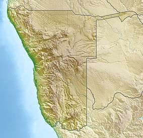
Namib-Naukluft National Park
| Namib-Naukluft National Park, Namibia | |
|---|---|
|
IUCN category II (national park) | |
|
Sand dunes near Sossusvlei | |
 Map of Africa | |
| Location | Namibia |
| Nearest city | Windhoek |
| Coordinates | 24°32′47″S 15°19′47″E / 24.54639°S 15.32972°ECoordinates: 24°32′47″S 15°19′47″E / 24.54639°S 15.32972°E |
| Area | 49,768 km2 (19,216 sq mi) |
| Established | August 1, 1979 |
| Governing body | Ministry of Environment and Tourism |
.jpg)
The Namib-Naukluft National Park is a national park of Namibia encompassing part of the Namib Desert (considered the world's oldest desert) and the Naukluft mountain range. With an overall area of 49,768 km2 (19,216 sq mi), the Namib-Naukluft is the largest game park in Africa and the fourth largest in the world.[1] The most well-known area of the park is Sossusvlei, which is the main visitor attraction in Namibia.
A surprising collection of creatures survives in the hyper-arid region, including snakes, geckos, unusual insects, hyenas, gemsboks and jackals. More moisture comes in as a fog off the Atlantic Ocean than falls as rain, with the average 106 millimeters of rainfall per year concentrated in the months of February and April.
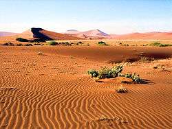
The winds that bring in the fog are also responsible for creating the park’s towering sand dunes, whose burnt orange color is a sign of their age. The orange color develops over time as iron in the sand is oxidized, like rusty metal; the older the dune, the brighter the color.
These dunes are the tallest in the world, in places rising more than 300 meters (almost 1000 feet) above the desert floor. The dunes taper off near the coast, and lagoons, wetlands, and mudflats located along the shore attract hundreds of thousands of birds.
‘Namib’ means open space and the Namib Desert gave its name to form Namibia – “land of open spaces”. The park was established in 1907 when the German Colonial Administration proclaimed the area between the Swakop River and the Kuiseb River a game reserve. The park's present boundaries were established in 1978 by the merging of the Namib Desert Park, the Naukluft Mountain Zebra Park and parts of Diamond Area 1 and some other bits of surrounding government land.
The park has some of the most unusual wildlife and nature reserves in the world, and covers an area of 49,768 km2 (19,216 sq mi). It's an area larger than Switzerland (41,285 km2), roughly the size of the US states New Hampshire and Vermont combined. The region is characterised by high, isolated inselbergs and kopjes (the Afrikaans term for rocky outcrops), made up of dramatic blood red granites, rich in feldspars and sandstone. The easternmost part of the park covers the Naukluft Mountains.
- More images related to the Namib-Naukluft National Park
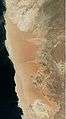 Satellite photo indicating the borders of the Namib-Naukluft National Park and the Namib Rand Nature Reserve
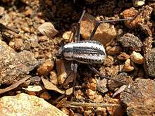 Namib desert beetle, Stenocara gracilipes
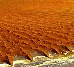 High dunes in the Namib desert
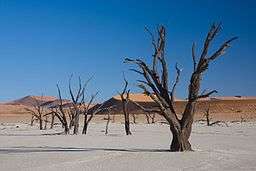 550-year-old dead trees in Dead Vlei
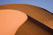 A typical dune in the park
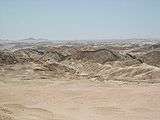 Moon landscape near Swakopmund
.jpg) Rüppell's korhaan in the grasslands near the dunes
Rüppell's korhaan in the grasslands near the dunes
See also
External links
- Ministry of Environment and Tourism report
- Gobabeb Training & Research Centre - A major centre for Namib ecological and development research since 1962; joint venture between the Ministry of Environment and Tourism and the Desert Research Foundation of Namibia
Notes
References
| Wikimedia Commons has media related to Namib-Naukluft National Park. |
- "Namib-Naukluft National Park, Namibia (1)". NASA Earth Observatory.
- "Namib-Naukluft National Park, Namibia (2)". NASA Earth Observatory.