Nalbari district
| Nalbari district নলবাৰী জিলা | |
|---|---|
| District | |
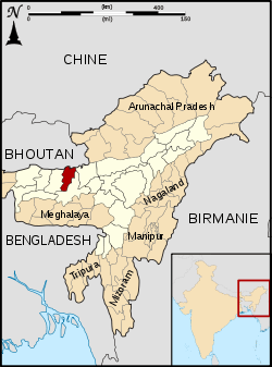 Nalbari district's location in Assam | |
| Country |
|
| State | Assam |
| Headquarters | Nalbari |
| Time zone | IST |
| ISO 3166 code | IN-AS |
| Website | http://nalbari.nic.in/ |
Nalbari (Pron: nɔ:lˈbɑ:ri) is an administrative district in the state of Assam in India. The district headquarters are located at Nalbari.
History
Nalbari was declared a sub division of undivided Kamrup District in 1967. The district was created on 14 August 1985 when it was split from Kamrup district.[1] 1 June 2004 saw the formation of from parts of three districts, including Nalbari.[1]
Geography
Nalbari district occupies an area of 2,257 square kilometres (871 sq mi),[2] comparatively equivalent to Indonesia's Morotai Island.[3] The latitude of Nalbari is 26 degrees north and 27 degrees north and the longitude is 91 degrees east and 97 degrees east. The tributaries of the Brahmaputra, the Nona, Buradia, Pagaldia, Borolia and Tihu, which originate in the foothills of the Himalayan Range, are wild in nature and make an enormous contribution to the agrarian economy of the district.
Demographics
According to the 2011 census Nalbari district has a population of 769,919,[4] roughly equal to the nation of Djibouti[5] or the US state of Alaska.[6] This gives it a ranking of 488th in India (out of a total of 640).[4] The district has a population density of 763 inhabitants per square kilometre (1,980/sq mi) .[4] Its population growth rate over the decade 2001-2011 was 11.74%.[4] Nalbari has a sex ratio of 945 females for every 1000 males,[4] and a literacy rate of 79.89%.[4] Hindus 873,749 and Muslims 253,842.
Education
The rate of total literacy of the Nalbari District, according to 2011 census, is 79.89% as against 80.95% in 2001. The rural literacy rate is 78.44%, while the urban rate is 91.46%. Male literacy is 85.58% consisting of Rural 84.38% and Urban 95.24%. Female literacy is 73.85% consisting of Rural 72.14% and Urban 87.48%. The total literacy rate of the state as a whole is 73.18%.[7]
See also
References
- 1 2 Law, Gwillim (2011-09-25). "Districts of India". Statoids. Retrieved 2011-10-11.
- ↑ Srivastava, Dayawanti et al. (ed.) (2010). "States and Union Territories: Assam: Government". India 2010: A Reference Annual (54th ed.). New Delhi, India: Additional Director General, Publications Division, Ministry of Information and Broadcasting (India), Government of India. p. 1116. ISBN 978-81-230-1617-7.
- ↑ "Island Directory Tables: Islands by Land Area". United Nations Environment Program. 1998-02-18. Retrieved 2011-10-11.
Morotai 2,266km2
- 1 2 3 4 5 6 "District Census 2011". Census2011.co.in. 2011. Retrieved 2011-09-30.
- ↑ US Directorate of Intelligence. "Country Comparison:Population". Retrieved 2011-10-01.
Djibouti 757,074 July 2011 est.
- ↑ "2010 Resident Population Data". U. S. Census Bureau. Retrieved 2011-09-30.
Alaska 710,231
- ↑ "Census 2011". censusindia.gov.in. Retrieved 2012-05-24.
External links
 |
Baksa district | | ||
| Barpeta district | |
Kamrup district | ||
| ||||
| | ||||
| Kamrup district |
| Topics | |
|---|---|
| History | |
| Districts & Divisions |
|
| Geography | |
| Culture | |
| Arts, Literature, Music Cinema |
|
| People | |
| Notable surnames |
|
| Urban centres | |
| |
Coordinates: 26°27′00″N 91°26′24″E / 26.45000°N 91.44000°E