Nahiya al-Rai
| Nahiya al-Rai ناحية الراعي | |
|---|---|
| Subdistrict | |
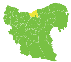 Location of Nahiya al-Rai within Aleppo Governorate | |
| Country |
|
| Governorate | Aleppo |
| District | al-Bab |
| Seat | al-Rai |
| Area | |
| • Total | 352.3 km2 (136.0 sq mi) |
| Population (2004)[1] | 15,378 |
| Geocode | SY020202 |
Nahiya al-Rai (Arabic: ناحية الراعي) is a subdistrict of al-Bab District in northern Aleppo Governorate, northwestern Syria. Administrative centre is al-Rai. At the 2004 census, the subdistrict had a population of 15,378.[1]
Neighbouring subdistricts are Nahiya al-Bab (southwest) and Nahiya Arima (southeast), both in al-Bab District, as well as Nahiya Akhtarin (west) in Azaz District, and Nahiya Ghandoura (east) belonging to Jarabulus District. To the north is the Kilis Province of Turkey.
Cities, towns and villages
| PCode | Name | Population |
|---|---|---|
| C1250 | al-Rai | 4,609 |
| C1253 | Haji Kusa | 1,011 |
| C1247 | al-Waqf | 902 |
| C1260 | Ameriyeh | 881 |
| C1255 | Shawa | 791 |
| C1269 | Tal Elhawa | 774 |
| C1254 | Misannah Bab | 610 |
| C1270 | Ayyasha | 468 |
| C1275 | Qantarah, al-Bab | 465 |
| C1273 | Haddabat | 387 |
| C1264 | Atharia | 374 |
| C1251 | Hleisa | 372 |
| C1265 | Um Elthadaya Mamli | 326 |
| C1258 | Tal Mizab | 315 |
| C1274 | Karsanli | 298 |
| C1248 | Sandi | 298 |
| C1259 | Tweiran | 283 |
| C1249 | Matmana | 266 |
| C1257 | Nahda | 264 |
| C1267 | Tal Eisheh | 250 |
| C1262 | Khalilieyh | 247 |
| C1266 | Zalaf | 240 |
| C1252 | Haji Wali | 187 |
| C1272 | Bab Laymun | 143 |
| C1268 | Zyaret Elbab | 140 |
| C1271 | Tal Atieh | 128 |
| C1263 | Tlilet Elbab | 126 |
| C1261 | Silsileh | 119 |
| C1256 | Jbine | 104 |
References
- 1 2 "2004 Census Data for Nahiya Ayn al-Rai" (in Arabic). Syrian Central Bureau of Statistics. Retrieved 15 October 2015. Also available in English: "2004 Census Data". UN OCHA. Retrieved 15 October 2015.
This article is issued from Wikipedia - version of the 9/6/2016. The text is available under the Creative Commons Attribution/Share Alike but additional terms may apply for the media files.