Nahiya Jarabulus
| Jarabulus Nahiya ناحية جرابلس | |
|---|---|
| Subdistrict | |
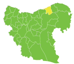 Location of Jarabulus Nahiya within Aleppo Governorate | |
| Country |
|
| Governorate | Aleppo |
| Seat | Jarabulus |
| Area | |
| • Total | 316.52 km2 (122.21 sq mi) |
| Population (2004)[1] | 41,575 |
| Geocode | SY020800 |
Jarabulus Nahiya (Arabic: ناحية مركز عفرين) is a subdistrict of Jarabulus District in Aleppo Governorate of northern Syria. Administrative centre is the city of Jarabulus.
At the 2004 census, the subdistrict had a population of 64,758.[1]
Cities, towns and villages
| PCode | Name | Population |
|---|---|---|
| C2227 | Jarabulus | 11,570 |
| C2226 | Jarabulus Tahtani | 2,170 |
| C2224 | al-Jamel | 2,091 |
| C2235 | Tukhar Kabir | 1,832 |
| C2238 | Marma al-Hajar | 1,818 |
| C2229 | Haymar | 1,749 |
| C2237 | Qiratah | 1,546 |
| C2214 | al-Haluwaniyah | 1,523 |
| C2230 | Suraysat | 1,517 |
| C2221 | Zahr al-Magharah | 1,376 |
| C2225 | Umm Ruthah Fawqani | 1,371 |
| C2236 | Yusuf Bayk | 1,138 |
| C2233 | Ayn al-Bayda | 1,111 |
| C2218 | Magharah | 1,054 |
| C2213 | Amarnah | 1,050 |
| C2240 | Mazaalah | 987 |
| C2241 | Qandariyah | 888 |
| C2217 | Dabis | 880 |
| C2232 | Mahsanli | 807 |
| C2219 | Halwanji | 763 |
| N/A | al-Bir Fawqani | 618 |
| C2215 | al-Hajalieh | 574 |
| C2239 | Majra Saghir | 565 |
| C2222 | Turaykham | 488 |
| C2231 | Hadrah | 477 |
| N/A | Jubb al-Kusa | 417 |
| C2223 | Umm Rotha Tahtani | 306 |
| C2228 | Umm Susah | 288 |
| N/A | Balaban | 227 |
| C2216 | al-Bir Tahtani | 179 |
| C2220 | Zughrah | 144 |
| N/A | Jab Jarawa | 51 |
References
- 1 2 "2004 Census Data for Jarabulus nahiyah" (in Arabic). Syrian Central Bureau of Statistics. Retrieved 15 October 2015. Also available in English: "2004 Census Data". UN OCHA. Retrieved 15 October 2015.
This article is issued from Wikipedia - version of the 8/30/2016. The text is available under the Creative Commons Attribution/Share Alike but additional terms may apply for the media files.