Nahiya Arima
| Nahiya Arima ناحية عريمة | |
|---|---|
| Subdistrict | |
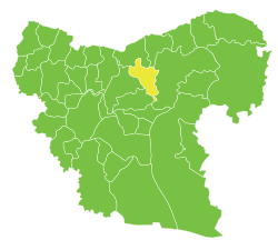 Location of Nahiya Arima within Aleppo Governorate | |
| Country |
|
| Governorate | Aleppo |
| District | al-Bab |
| Seat | Arima |
| Area | |
| • Total | 317.38 km2 (122.54 sq mi) |
| Population (2004)[1] | 32,041 |
| Geocode | SY020203 |
Nahiya Arima (Arabic: ناحية عريمة, translit. Nāḩiyat Arima) is a subdistrict of al-Bab District in northern Aleppo Governorate, northwestern Syria. Administrative centre is Arima. At the 2004 census, the subdistrict had a population of 32,041.[1]
Cities, towns and villages
| PCode | Name | Population |
|---|---|---|
| C1329 | Arima | 2,839 |
| C1339 | Sukkariyah Kabira | 2,437 |
| C1322 | Sukkariyah Saghira | 2,332 |
| C1331 | Iylan | 2,117 |
| C1333 | Qanli Quyu | 1,550 |
| C1346 | Barshaya | 1,448 |
| C1344 | Shuwayhah | 1,375 |
| C1325 | Hajaliyah | 1,211 |
| C1338 | Orubah | 1,186 |
| C1348 | Bir Tafreeah | 1,089 |
| C1330 | Kreidiyeh | 1,037 |
| C1337 | Jeb Naassan | 1,011 |
| C1350 | Madiq Bu Azar | 876 |
| C1327 | Jurneyyeh | 829 |
| C1343 | Shdar | 778 |
| N/A | Birazia | 774 |
| C1349 | Big Nabata | 764 |
| C1335 | Jeb Sultan | 741 |
| C1340 | Jablet Elhamra | 736 |
| C1341 | Um Shakif | 691 |
| N/A | Al-Dhdhib | 678 |
| C1342 | Um Adae Ajami | 675 |
| C1328 | Olasha | 632 |
| C1347 | Little Tafreeah | 622 |
| N/A | Al-Buwwaihij | 607 |
| C1326 | Omyaniye - Korhyok | 518 |
| C1334 | Wadi - Little Jqal | 425 |
| C1332 | Sunbula - Saboyran | 392 |
| C1345 | Tarhin | 392 |
| N/A | Ajami | 385 |
| C1323 | Hota | 327 |
| C1324 | Mazrufeh | 288 |
| N/A | Qanafidah | 198 |
| C1336 | Thalabiyeh - Big Jqal | 81 |
References
- 1 2 "2004 Census Data for Nahiya Arima" (in Arabic). Syrian Central Bureau of Statistics. Retrieved 15 October 2015. Also available in English: "2004 Census Data". UN OCHA. Retrieved 15 October 2015.
This article is issued from Wikipedia - version of the 9/4/2016. The text is available under the Creative Commons Attribution/Share Alike but additional terms may apply for the media files.