New York State Route 169
| ||||
|---|---|---|---|---|
|
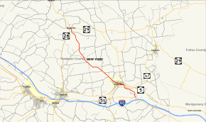
Map of Herkimer County in eastern New York with NY 169 highlighted in red | ||||
| Route information | ||||
| Maintained by NYSDOT and the city of Little Falls | ||||
| Length: | 12.42 mi[1] (19.99 km) | |||
| Existed: | 1930[2] – present | |||
| Major junctions | ||||
| South end: |
| |||
|
| ||||
| North end: |
| |||
| Location | ||||
| Counties: | Herkimer | |||
| Highway system | ||||
| ||||

New York State Route 169 (NY 169) is a north–south state highway located within Herkimer County, New York, in the United States. It extends for 12.58 miles (20.25 km) from an intersection with NY 5S in the town of Danube to a junction with NY 28 and NY 29 in the village of Middleville. The route directly connects the city of Little Falls to the New York State Thruway (Interstate 90 or I-90), which bypasses the city to the south. Outside of Little Falls, NY 169 is a two-lane highway that passes through sparsely developed areas. The route originally began in Little Falls when it was assigned as part of the 1930 renumbering of state highways in New York; however, it was extended southward in the early 1970s to connect to a new exit on the Thruway.
Route description

NY 169 begins a short distance north of New York State Thruway (I-90) exit 29A at an intersection with NY 5S in the town of Danube. It initially heads northward through the rural town, paralleling a north–south roadway leading away from the exit and over NY 5S. The two roads converge after 0.3 miles (0.5 km), directly connecting NY 169 to the Thruway. NY 169 continues on a northward course for another 0.25 miles (0.40 km) to the southern bank of the Mohawk River, where it turns to the northwest and subsequently follows the river through a wooded area that leads the route into the city of Little Falls.[3]
As the route approaches downtown Little Falls, it makes a slight turn to the north, crossing over the Mohawk River (here part of the Erie Canal) and the CSX Transportation-owned Mohawk Subdivision on its way to an intersection with a divided highway carrying NY 5 and NY 167. NY 169 turns west here, following the highway for 0.25 miles (0.40 km) to the eastern fringe of downtown. The resulting overlap with NY 167 is a wrong-way concurrency as NY 169 northbound is concurrent to NY 167 southbound and vice versa. At East Main Street, NY 169 leaves NY 5 and NY 167 to follow East Main Street into downtown. The street splits into a one-way couplet three blocks later, at which point southbound NY 169 is shifted one block south onto Albany Street.[3]
The route follows the couplet for three blocks, passing through the city's central business district prior to intersecting Ann Street. Here, the two directions of NY 169 converge to follow Ann Street north into a more residential neighborhood. The junction of Albany Street and Ann Street also features northbound NY 167, which approaches the same intersection from the west along Albany Street and abuts NY 169 southbound as the latter route turns east on Albany Street from Ann Street. NY 169 follows Ann Street for four blocks (five southbound) to Monroe Street, where it intersects the southern terminus of NY 170.[3]

While East Monroe Street, located to the east of Ann Street, heads along the northern fringe of Little Falls as NY 170, West Monroe Street carries NY 169 northwestward past more homes and, eventually, out of the city limits. Now in the town of Little Falls, the route passes through mostly open areas while serving a small handful of isolated homes. It eventually crosses into the town of Fairfield, where it takes on a more northerly and more winding alignment. After 4.5 miles (7.2 km), the route reaches the village of Middleville, located 8 miles (13 km) northwest of Little Falls. Within Middleville, NY 169 passes by a row of homes prior to ending at an intersection with NY 28 and the western terminus of NY 29.[3] The portion of NY 169 between NY 5 and the northern city limits of Little Falls is city-maintained; the remainder of the route is maintained by the New York State Department of Transportation (NYSDOT).[4]
History
The portion of what is now NY 169 between the Little Falls city line and Middleville became part of a realigned Route 26, an unsigned legislative route, in 1910.[5] It was not assigned a posted designation until the 1930 renumbering of state highways in New York when it was designated as NY 169, which originally began in downtown Little Falls.[2] The route was extended southward to NY 5S in the early 1970s to access the new exit 29A on the New York State Thruway.[6][7]
Major intersections
The entire route is in Herkimer County.
| Location | mi[1] | km | Destinations | Notes | |
|---|---|---|---|---|---|
| Danube | 0.00 | 0.00 | |||
| 0.37 | 0.60 | Exit 29A (I-90 / Thruway) | |||
| City of Little Falls | 2.31 | 3.72 | Eastern terminus of NY 5 / NY 169 and NY 167 / NY 169 overlaps | ||
| 2.53 | 4.07 | Western terminus of NY 5 / NY 169 and NY 167 / NY 169 overlaps | |||
| Southbound intersection only | |||||
| 3.28 | 5.28 | Southern terminus of NY 170 | |||
| Middleville | 12.42 | 19.99 | Western terminus of NY 29 | ||
1.000 mi = 1.609 km; 1.000 km = 0.621 mi
| |||||
See also
.svg.png) New York Roads portal
New York Roads portal
References
- 1 2 "2008 Traffic Volume Report for New York State" (PDF). New York State Department of Transportation. June 16, 2009. p. 177. Retrieved February 1, 2010.
- 1 2 Road Map of New York (Map). Cartography by General Drafting. Standard Oil Company of New York. 1930.
- 1 2 3 4 Google (November 22, 2015). "Overview map of NY 169" (Map). Google Maps. Google. Retrieved November 22, 2015.
- ↑ "Herkimer County Inventory Listing" (CSV). New York State Department of Transportation. March 2, 2010. Retrieved February 17, 2011.
- ↑ New York State Department of Highways (1920). Report of the State Commissioner of Highways. Albany, NY: J. B. Lyon Company. p. 539. Retrieved June 25, 2010.
- ↑ New York Thruway (Map). Cartography by Rand McNally and Company. New York State Thruway Authority. 1971.
- ↑ New York (Map) (1973 ed.). Cartography by H.M. Gousha Company. Shell Oil Company. 1973.
External links
| Wikimedia Commons has media related to New York State Route 169. |
- New York State Route 169 at Alps' Roads • New York Routes • New York State Highway Termini