NOAA-17
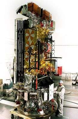 NOAA-M before launch | |
| Mission type | Weather satellite |
|---|---|
| Operator | NOAA |
| COSPAR ID | 2002-032A |
| SATCAT № | 27453 |
| Mission duration | 2 years[1] |
| Spacecraft properties | |
| Spacecraft type | TIROS-N |
| Manufacturer | Lockheed Martin |
| Launch mass | 1,457 kilograms (3,212 lb)[2] |
| Power | 830 watts[3] |
| Start of mission | |
| Launch date | 24 June 2002, 18:23:04 UTC[4] |
| Rocket | Titan II(23)G Star-37XFP-ISS |
| Launch site | Vandenberg SLC-4W |
| End of mission | |
| Disposal | Decommissioned |
| Deactivated | 10 April 2013[5] |
| Orbital parameters | |
| Reference system | Geocentric |
| Regime | Sun-synchronous |
| Semi-major axis | 7,187.63 kilometers (4,466.19 mi) |
| Eccentricity | 0.0011757 |
| Perigee | 808 kilometers (502 mi) |
| Apogee | 825 kilometers (513 mi) |
| Inclination | 98.31 degrees |
| Period | 101.07 minutes |
| Epoch | 8 December 2013, 12:57:13 UTC[6] |
NOAA-17 was a weather forecasting satellite operated by NOAA. It was launched on 24 June 2002, in a sun-synchronous orbit, 824 km above the Earth, orbiting every 101 minutes. It hosted the AMSU, AVHRR and High Resolution Infrared Radiation Sounder (HRIS) instruments. The satellite was retired in 2013.
Automatic Picture Transmission frequency was 137.5 MHz.
NOAA-17 was decommissioned on 10 April 2013.[5]
References
- ↑ Krebs, Gunter. "NOAA 15, 16, 17 (NOAA K, L, M)". Gunther's Space Page. Retrieved 8 December 2013.
- ↑ "NOAA 17". National Space Science Data Center. Retrieved 9 December 2013.
- ↑ "UCS Satellite Database". Union of Concerned Scientists. Retrieved 9 December 2013.
- ↑ McDowell, Jonathan. "Launch Log". Jonathan's Space Page. Retrieved 9 December 2013.
- 1 2 "NASA Office of Spacecraft Operations, NOAA 17 Spacecraft Status Summary".
- ↑ "NOAA 17 Satellite details 2002-032A NORAD 27453". N2YO. 8 December 2013. Retrieved 9 December 2013.
TIROS satellites | ||
|---|---|---|
| TIROS |  | |
| TOS | ||
| ITOS |
| |
| TIROS-N | ||
| Adv. TIROS-N | ||
This article is issued from Wikipedia - version of the 2/3/2016. The text is available under the Creative Commons Attribution/Share Alike but additional terms may apply for the media files.