Nøtterøy
| Nøtterøy kommune | |||
|---|---|---|---|
| Municipality | |||
 | |||
| |||
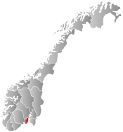
 Nøtterøy within Vestfold | |||
| Coordinates: 59°12′4″N 10°24′28″E / 59.20111°N 10.40778°ECoordinates: 59°12′4″N 10°24′28″E / 59.20111°N 10.40778°E | |||
| Country | Norway | ||
| County | Vestfold | ||
| Administrative centre | Borgheim | ||
| Government | |||
| • Mayor (2007) | Roar Jonstang (H) | ||
| Area | |||
| • Total | 61 km2 (24 sq mi) | ||
| • Land | 60 km2 (20 sq mi) | ||
| Area rank | 415 in Norway | ||
| Population (2009) | |||
| • Total | 20,600 | ||
| • Rank | 44 in Norway | ||
| • Density | 343/km2 (890/sq mi) | ||
| • Change (10 years) | 8.6 % | ||
| Demonym(s) | Nøttlending[1] | ||
| Time zone | CET (UTC+1) | ||
| • Summer (DST) | CEST (UTC+2) | ||
| ISO 3166 code | NO-0722 | ||
| Official language form | Bokmål | ||
| Website |
www | ||
|
| |||

Nøtterøy is a municipality in Vestfold county, Norway. The administrative centre of the municipality is the village of Borgheim. The parish of Nøtterø was established as a municipality on 1 January 1838 (see formannskapsdistrikt). Two islands were later transferred from the municipality of Stokke to Nøtterøy: Håøya (in 1901) and Veierland (in 1964). [2]
The whole municipality is made up of a small island group south of Tønsberg municipality, including the islands of Nøtterøy, Føynland, Veierland, and about 175 smaller islands. Nøtterøy includes the villages of Borgheim, Glomstein, Teie, and Torød. As 2010, 16,418 of the municipality lived within the town of Tønsberg, an urban area shared between the two municipalities.[3]
General information

Nøtterøy Church
Nøtterøy Church (Nøtterøy kirke) is the main church in Nøtterøy parish. The church was originally built ca. 1100. It was constructed of the granite in Romanesque architecture style. The church was extended eastward in 1839 and 1883. In the midst of the church hangs a huge chandelier, which was bestowed as gift in 1868. It has approximately 600 seats and two galleries. Nøtterøy rectory is located west of church.[4]
Name
The Old Norse form of the name was Njótarvin (Njotarin) from Njót and vin. The name of the island "Njót" and "vin" meaning pastures or farm.[5] The name is probably derived from the verb njóta which means to "enjoy" or "benefit from". Prior to 1918, the name was spelled "Nøtterø".[6][7]
Coat-of-arms
The coat-of-arms is from modern times. They were granted on 24 October 1986. The arms show a silver anchor on a blue background. It is an appropriate symbol for the municipality which consists of islands and is dependent on fishing and sailing. The anchor was already used in the 17th century as a local symbol.[8]
Notable residents
- Trygve Bratteli, Prime minister of Norway
- Jan P. Syse, Prime minister of Norway
References
- ↑ "Navn på steder og personer: Innbyggjarnamn" (in Norwegian). Språkrådet. Retrieved 2015-12-01.
- ↑ Sten Lundbo. "Nøtterøy". Store norske leksikon. Retrieved October 1, 2016.
- ↑ "Tettsteder. Folkemengde og areal, etter kommune. 1.januar 2011." (in Norwegian). Statistics Norway. Retrieved 4 February 2012.
- ↑ "Nøtterøy kirke". Den Norske Kirke. Retrieved October 1, 2016.
- ↑ Nøtterø En Bygdebok (1922)
- ↑ Rygh, Oluf (1907). Norske gaardnavne: Jarlsberg og Larviks amt (in Norwegian) (6 ed.). Kristiania, Norge: W. C. Fabritius & sønners bogtrikkeri. p. 233.
- ↑ Nøtterø En Bygdebok (1922)
- ↑ Norske Kommunevåpen (1990). "Nye kommunevåbener i Norden". Retrieved 2009-01-13.
External links
 Media related to Nøtterøy at Wikimedia Commons
 The dictionary definition of Nøtterøy at Wiktionary
- Municipal fact sheet from Statistics Norway
 Vestfold travel guide from Wikivoyage
- Remnants of the German gun battery from WW2