Myrtleford
| Myrtleford Victoria | |||||||
|---|---|---|---|---|---|---|---|
 Myrtleford | |||||||
 Myrtleford | |||||||
| Coordinates | 36°33′0″S 146°43′0″E / 36.55000°S 146.71667°ECoordinates: 36°33′0″S 146°43′0″E / 36.55000°S 146.71667°E | ||||||
| Population | 3,181 (2011 census)[1] | ||||||
| Established | 1858 | ||||||
| Postcode(s) | 3737 | ||||||
| Elevation | 223 m (732 ft) | ||||||
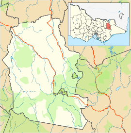
| Location |
| ||||||
| LGA(s) | Alpine Shire | ||||||
| State electorate(s) | Ovens Valley | ||||||
| Federal Division(s) | Indi | ||||||
| |||||||
Myrtleford is a town in Victoria, Australia. It is located in the northeast of the state, 274 km northeast of Melbourne and 46 km southeast of Wangaratta. Myrtleford is part of the Alpine Shire local government area and at the 2011 census the town had a population of 3,181.[1]
History
Aboriginal people inhabited the Alpine valleys and high country for thousands of years prior to European settlement and knew its flora, fauna, geography and seasonal changes intimately. Groups visited the Alps in summer to hold ceremonies and gather the nutritious Bogong moths that shelter there.
European settlement began in the early 19th century and from 1837 Myrtleford was a remote cattle run known as Myrtle Creek. Myrtle Creek, today known as the Barwidgee Creek, formed the boundary of the run and was given its name by the first Europeans in the area. When gold was discovered in the Buckland Valley, thousands of diggers had to cross Myrtle Creek on their way to the goldfields. A small township developed at this fording place, with the name Myrtleford consequently adopted.
The post office opened on 26 July 1858 as Myrtle Creek and was renamed Myrtleford in 1871.[2] The road through Myrtleford was then called the Buckland Road, today it is known as the Great Alpine Road.
Today
Myrtleford is located in the Ovens Valley and is the largest town in the Alpine Shire. Agriculture, timber and tourism are important industries. Tobacco growing was Myrtleford and the surrounding area's major industry for many years, forming the backbone of Myrtleford's economy until the industry was closed down in 2006. Today wine grapes, hops, walnuts and chestnuts, blueberries and raspberries, cherries, apples, kiwifruit, olives, vegetables, beef and dairy cattle are all farmed in the region. Carter Holt Harvey manufacture timber products at Myrtleford. Tourism in the local area also contributes to Myrtleford's economy.
Myrtleford's town centre is located on Clyde, Standish and Myrtle Streets (the Great Alpine Road). The Happy Valley Creek flows through the town centre, the Ovens River and Buffalo River flow close by and Lake Buffalo is located 21 km south of Myrtleford.
Myrtleford has three schools, Myrtleford P-12 College, offering government primary and secondary education as well as St. Mary's Primary School and Marian College, offering Catholic primary and secondary education. There is a public hospital, the Myrtleford District War Memorial Hospital and a weekly newspaper, The Myrtleford Times.
Sports
Myrtleford Football Club compete in the Ovens & Murray Football League.[3]
Myrtleford Savoy Soccer Club compete in the Albury Wodonga Football Association.
Myrtleford Ski Club was formed in 1938 and has a ski lodge for use by members and guests at Falls Creek.
Events
Myrtleford hosts a number of festivals throughout the year.
The Myrtleford Bush Market
Held annually on the first Friday in January (except where the Friday is New Years Day), the market offers a wide selection of stalls selling clothing, craft items plus food and wine.
The Myrtleford Festival
Since 1961, Myrtleford has held a regular public celebration organized by members of the community with clear, strong, broad-based community support.
The Myrtleford Festival has a steering Committee of nine volunteers, backed up by an energetic team.
Each Festival is run with a whole-of-community approach, engaging business, service providers and community groups as required.
The original festival was first known as the Tobacco and Hops Festival. It was held over the Labour Day Weekend, the harvest season. At times, the Festival has also been held over the Easter period. With the introduction of a third major local industry, it became known as the Tobacco, Hops and Timber Festival in 1981.
In November 2008, the Festival was renamed The Myrtleford Festival, and it is once again held over the Labour Day long weekend in March.
http://www.themyrtlefordfestival.com.au
La Fiera Italian Festival
A high proportion of the local residents' heritage is of Italian descent. To honour this, The La Fiera festival is a celebration of Italian heritage; showcasing food, wine, sport, film, religion, culture, art and music. La Fiera will be held in 2014 between Tuesday, May 20 and Sunday, May 25. Website: http://www.lafiera.com.au
Golden Spurs Rodeo
The Myrtleford Golden Spurs Rodeo is the second longest running Victorian rodeo and the first of the summer circuit. Myrtleford is regarded as having one of the most spectacular rodeo arenas in Australia. In 2009, over 360 riders were entered, making it one of the biggest rodeos in Australia.
Climate
Myrtleford has a temperate climate with hot, relatively dry summers and cool, wet winters, with a high diurnal range throughout the year. Under the Köppen climate classification, the town has a borderline oceanic (Cfb) and Mediterranean climate (Csb). Winters are cool and wet with frequent frosts on clear nights. Rainfall is highest during the winter months. Snow is extremely rare in Myrtleford however a snow capped Mount Buffalo is visible from the town centre frequently during winter.
| Climate data for Myrtleford | |||||||||||||
|---|---|---|---|---|---|---|---|---|---|---|---|---|---|
| Month | Jan | Feb | Mar | Apr | May | Jun | Jul | Aug | Sep | Oct | Nov | Dec | Year |
| Average high °C (°F) | 30.8 (87.4) |
30.0 (86) |
27.3 (81.1) |
21.8 (71.2) |
17.0 (62.6) |
13.5 (56.3) |
12.6 (54.7) |
14.5 (58.1) |
17.9 (64.2) |
20.9 (69.6) |
24.5 (76.1) |
28.5 (83.3) |
21.61 (70.88) |
| Average low °C (°F) | 11.7 (53.1) |
11.8 (53.2) |
9.3 (48.7) |
6.0 (42.8) |
4.1 (39.4) |
2.4 (36.3) |
2.1 (35.8) |
2.8 (37) |
3.8 (38.8) |
6.0 (42.8) |
8.0 (46.4) |
10.1 (50.2) |
6.5 (43.7) |
| Average precipitation mm (inches) | 44.8 (1.764) |
47.8 (1.882) |
60.1 (2.366) |
61.3 (2.413) |
84.3 (3.319) |
104.1 (4.098) |
106.5 (4.193) |
102.0 (4.016) |
83.2 (3.276) |
91.0 (3.583) |
59.6 (2.346) |
60.1 (2.366) |
905.2 (35.638) |
| Average precipitation days | 5.0 | 4.6 | 5.8 | 6.9 | 10.0 | 12.1 | 13.3 | 13.3 | 11.1 | 10.5 | 7.3 | 6.5 | 106.4 |
| Average relative humidity (%) | 32 | 37 | 42 | 48 | 62 | 68 | 68 | 59 | 54 | 51 | 44 | 35 | 50 |
| Source: [4] | |||||||||||||
Notable residents
- Alby Lowerson, WWI Victorian Cross recipient.
- Guy Rigoni, Australian Rules footballer.
- Gary Ablett Snr, Australian Rules footballer.
- Malcolm Milne, olympic skier.
- Ross Milne, olympic skier.
- Sam Kekovich, Australian Rules footballer.
- Merv Hughes, Australian Cricketer.
- Steve Mautone, retired professional football association goalkeeper.[5]
- Chloe McConville, Australian racing cyclist and former cross-country skier.[6]
- Cris Bonacci, Musician, Producer
Gallery
 Historical tobacco kiln, typical of those built in the area from the 1930s until the 1960s.
References
- 1 2 Australian Bureau of Statistics (31 October 2012). "Myrtleford (State Suburb)". 2011 Census QuickStats. Retrieved 1 December 2014.
- ↑ Premier Postal History, Post Office List, retrieved 2008-04-11
- ↑ Full Points Footy, Myrtleford, archived from the original on April 6, 2008, retrieved 2008-07-25
- ↑ "Climate statistics for". Bureau of Meteorology. Retrieved 18 January 2014.
- ↑ Steve Mautone
- ↑ "High Performance > Rider Profiles > Female > Chloe McConville". Cycling Australia. Retrieved 19 June 2015.
External links
![]() Media related to Myrtleford, Victoria at Wikimedia Commons
"Australian Places Myrtleford". Retrieved 2012-03-12.
Media related to Myrtleford, Victoria at Wikimedia Commons
"Australian Places Myrtleford". Retrieved 2012-03-12.