Muthukur
| Muthukur | |
|---|---|
| Village | |
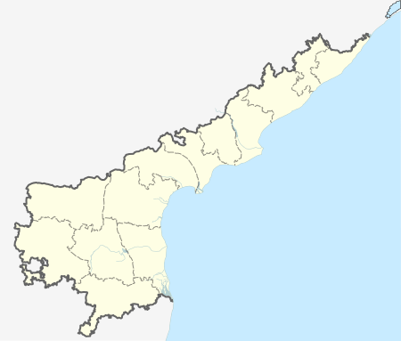
 Muthukur  Muthukur Location in Andhra Pradesh, India | |
| Coordinates: 14°16′00″N 80°06′00″E / 14.2667°N 80.1000°ECoordinates: 14°16′00″N 80°06′00″E / 14.2667°N 80.1000°E | |
| Country |
|
| State | Andhra Pradesh |
| District | Nellore District |
| Government | |
| • Type | Panchayati raj (India) |
| • Body | Gram panchayat |
| Elevation | 4 m (13 ft) |
| Languages | |
| • Official | Telugu |
| Time zone | IST (UTC+5:30) |
| Vehicle registration | AP |
Muthukur or Muttukuru is a village and a Mandal in Nellore district in the state of Andhra Pradesh in India.[1]
Geography
Muthukur is located at 14°16′00″N 80°06′00″E / 14.2667°N 80.1000°E.[2] It has an average elevation of 4 meters (16 feet).
Panchayats
There are 21 panchayats in Muthukur mandal.[3]
Muthukur Mandal Panchayat List: Brahmadevam (village and panchayat) Dammayapalem (village and panchayat) Doruvulapem (village and panchayat) Duvvuruvaripalem (village and panchayat) Epuru (village and panchayat) Krishnapatnam (village and panchayat) Malluru (village and panchayat) Mamidipudi (village and panchayat) Musunurivaripalem (village and panchayat) Muthukur Town(Panchayat and Headquarters) Narikelapalli (village and panchayat) Nelaturu (village and panchayat) Pantapalem (village and panchayat) Pathurivari Kandrigi (village and panchayat) Pidatha Polour (village) Polamrajugunta (village and panchayat) Pottempadu (village and panchayat) Pynapuram (village and panchayat) Tallapudi (village and panchayat) Valluru (village and panchayat) Varkavipudi (village and panchayat)
♣
References
- ↑ "List of Sub-Districts". Census of India. Retrieved 2007-03-26.
- ↑ Falling Rain Genomics.Mithukur
- ↑ Details of Andhra Pradesh till Village Panchayat Tier