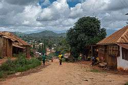
Muheza District
| Muheza District Wilaya ya Muheza (Swahili) | |
|---|---|
| District | |
 | |
 Location in Tanzania (dark green) | |
| Country | Tanzania |
| Zone | Northern |
| Region | Tanga |
| Government | |
| • District Commissioner | Mathew Nasei |
| Area | |
| • Total | 1,497.96 km2 (578.37 sq mi) |
| Population (2012) | |
| • Total | 204,461 |
| • Density | 140/km2 (350/sq mi) |
| Time zone | EAT (UTC+3) |
| Postcode | 214xx |
| Area code(s) | 027 |
| Website |
tanga |
Muheza is one of the eight districts of Tanga Region in Tanzania. It is bordered to the north by Kenya, to the east by the Tanga and the Indian Ocean, to the south by the Pangani District, and to the west by the Lushoto and Korogwe Districts.
According to the 2002 Tanzania National Census, the population of the Muheza District was 279,423.
Wards
The Muheza District is administratively divided into 35 wards:
- Bwembwera
- Daluni
- Duga
- Gombero
- Kicheba
- Kigongoi
- Lusanga
- Kigombe
- Kilulu
- Kisiwani (English Meaning: on the island)
- Kwafungo
- Kwale
- Magila
- Magoroto
- Majengo (English Meaning: buildings)
- Manza
- Maramba
- Masuguru
- Mbaramo
- Mhinduro
- Misilai
- Misozwe
- Mkinga
- Mkuzi
- Moa
- Mtimbwane
- Mtindiro
- Mwakijembe
- Ngomeni
- Nkumba
- Pande
- Potwe
- Songa
- Tingeni
- Zirai
- Mkumbi
- Enzi
Sources
Coordinates: 5°00′S 38°55′E / 5.000°S 38.917°E
This article is issued from Wikipedia - version of the 3/10/2016. The text is available under the Creative Commons Attribution/Share Alike but additional terms may apply for the media files.