Mu (lost continent)
| Mu | |
|---|---|
|
Map of Mu by James Churchward | |
| Lost Continent of Mu Motherland of Men location | |
| Created by | Augustus Le Plongeon |
| Genre | Pseudoscience |
| Type | Hypothetical lost continent |

Mu is the name of a suggested lost continent whose concept and name were proposed by 19th-century traveler and writer Augustus Le Plongeon, who claimed that several ancient civilizations, such as those of Egypt and Mesoamerica, were created by refugees from Mu—which he located in the Atlantic Ocean.[1] This concept was popularized and expanded by James Churchward, who asserted that Mu was once located in the Pacific.[2]
The existence of Mu was already being disputed in Le Plongeon's time. Today scientists dismiss the concept of Mu (and of other alleged lost continents such as Lemuria) as physically impossible, arguing that a continent can neither sink nor be destroyed in the short period of time required by this premise.[3][4] Mu's existence is now considered to have no factual basis.[5][6]
History of the concept
Augustus Le Plongeon
The mythical idea of Mu first appeared in the works of Augustus Le Plongeon (1825–1908), after his investigations of the Maya ruins in Yucatán.[1] He claimed that he had translated ancient Mayan writings which supposedly showed that the Maya civilization of the Yucatán was older than those of Greece and Egypt, and told the story of an even older continent.
Le Plongeon actually got the name "Mu" from Charles Étienne Brasseur de Bourbourg, who in 1864 mistranslated what was then called the Troano Codex using the de Landa alphabet. Brasseur believed that a word which he read as Mu referred to a land which had been submerged by a catastrophe.[7] Le Plongeon then identified this lost land with Atlantis, and turned it into a continent which had supposedly sunk into the Atlantic Ocean:
In our journey westward across the Atlantic we shall pass in sight of that spot where once existed the pride and life of the ocean, the Land of Mu, which, at the epoch that we have been considering, had not yet been visited by the wrath of Human, that lord of volcanic fires to whose fury it afterward fell a victim. The description of that land given to Solon by Sonchis, priest at Sais; its destruction by earthquakes, and submergence, recorded by Plato in his Timaeus, have been told and retold so many times that it is useless to encumber these pages with a repetition of it.[1]:ch. VI, p. 66
Le Plongeon claimed that the civilization of ancient Egypt was founded by Queen Moo, a refugee from the land's demise. Other refugees supposedly fled to Central America and became the Maya.[4]
James Churchward

Mu, as a lost Pacific Ocean continent, was later popularised by James Churchward (1851–1936) in a series of books, beginning with Lost Continent of Mu, the Motherland of Man (1926),[2] re-edited later as The Lost Continent Mu (1931).[8] Other popular books in the series are The Children of Mu (1931), and The Sacred Symbols of Mu (1933).
Churchward claimed that "more than fifty years ago," while he was a soldier in India, he befriended a high-ranking temple priest who showed him a set of ancient "sunburnt" clay tablets, supposedly in a long lost "Naga-Maya language" which only two other people in India could read. Having mastered the language himself, Churchward found out that they originated from "the place where [man] first appeared—Mu." The 1931 edition states that “all matter of science in this work are based on translations of two sets of ancient tablets:” the clay tables he read in India, and a collection of 2,500 stone tablets that had been uncovered by William Niven in Mexico.[8]:7
Churchward gave a vivid description of Mu as the home of an advanced civilization, the Naacal, which flourished between 50,000 and 12,000 years ago, was dominated by a “white race,"[8]:48 and was "superior in many respects to our own"[8]:17 At the time of its demise, about 12,000 years ago, Mu had 64,000,000 inhabitants and many large cities, and colonies on the other continents.
Churchward claimed that the landmass of Mu was located in the Pacific Ocean, and stretched east–west from the Marianas to Easter Island, and north–south from Hawaii to Mangaia. He claimed that according to the creation myth he read in the Indian tablets, Mu had been lifted above sea level by the expansion of underground volcanic gases. Eventually Mu “was completely obliterated in almost a single night”:[8]:44 after a series of earthquakes and volcanic eruptions, "the broken land fell into that great abyss of fire" and was covered by "fifty millions of square miles of water."[8]:50
Churchward claimed that Mu was the common origin of the great civilizations of Egypt, Greece, Central America, India, Burma and others, including Easter Island, and was in particular the source of ancient megalithic architecture. As evidence for his claims, he pointed to symbols from throughout the world, in which he saw common themes of birds, the relation of the Earth and the sky, and especially the Sun. Churchward claims that the king of Mu was named Ra and he relates this to the Egyptian god of the sun, Ra, and the Rapa Nui word for Sun, ra’a, which he incorrectly spells "raa."[8]:48 He claimed to have found symbols of the Sun in "Egypt, Babylonia, Peru and all ancient lands and countries – it was a universal symbol."[8]:138
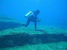
Churchward attributed all megalithic art in Polynesia to the people of Mu. He claimed that symbols of the sun are found “depicted on stones of Polynesian ruins,” such as the stone hats (pukao) on top of the giant moai statues of Easter Island. Citing W.J. Johnson, Churchward describes the cylindrical hats as "spheres" that "seem to show red in the distance”, and asserts that they “represent the Sun as Ra.”[8]:138 He also incorrectly claimed that some of them are made of "red sandstone"[8]:89 which does not exist on the island. The platforms on which the statues rest (ahu) are described by Churchward as being “platform-like accumulations of cut and dressed stone,” which were supposedly left in their current positions “awaiting shipment to some other part of the continent for the building of temples and palaces.”[8]:89 He also cites the pillars “erected by the Māori of New Zealand” as an example of this lost civilization’s handiwork.[8]:158 In Churchward's view, the present-day Polynesians are not descendants of the dominant members of the lost civilization of Mu, responsible for these great works, but are instead descendants of survivors of the cataclysm that adopted “the first cannibalism and savagery” in the world.[8]:54
Modern claims
James Bramwell and William Scott-Elliott claimed that the cataclysmic events on Mu began 800,000 years ago[9]:194 and went on until the last catastrophe, which occurred in precisely 9564 BC.[9]:195
In the 1930s, Atatürk, founder of the Turkish Republic, was interested in Churchward's work and considered Mu as a possible location of the original homeland of the Turks.[10]
Masaaki Kimura has suggested that certain underwater features located off the coast of Yonaguni Island, Japan (popularly known as the Yonaguni Monument) are ruins of Mu[11][12] (or "ruins of the lost world of Muin" according to CNN[13]).
Criticisms
Geological arguments
Modern geological knowledge rules out "lost continents" of any significant size. According to the theory of plate tectonics, which has been extensively confirmed over the past 40 years, the Earth's crust consists of lighter "sial" rocks (continental crust rich in aluminium silicates) that float on heavier "sima" rocks (oceanic crust richer in magnesium silicates). The sial is generally absent in the ocean floor where the crust is a few kilometers thick, while the continents are huge solid blocks tens of kilometers thick. Since continents float on the sima much like icebergs float on water, a continent cannot simply "sink" under the ocean.
It is true that continental drift and seafloor spreading can change the shape and position of continents and occasionally break a continent into two or more pieces (as happened to Pangaea). However, these are very slow processes that occur in geological time scales (hundreds of millions of years). Over the scale of history (tens of thousands of years), the sima under the continental crust can be considered solid, and the continents are basically anchored on it. It is almost certain that the continents and ocean floors have retained their present position and shape for the whole span of human existence.
There is also no conceivable event that could have "destroyed" a continent, since its huge mass of sial rocks would have to end up somewhere—and there is no trace of it at the bottom of the oceans. The Pacific Ocean islands are not part of a submerged landmass but rather the tips of isolated volcanoes.
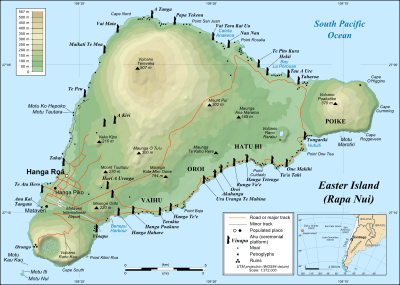
This is the case, in particular, of Easter Island, which is a recent volcanic peak surrounded by deep ocean (3,000 m deep at 30 km off the island). After visiting the island in the 1930s, Alfred Metraux observed that the moai platforms are concentrated along the current coast of the island, which implies that the island's shape has changed little since they were built. Moreover, the "Triumphal Road" that Pierre Loti had reported ran from the island to the submerged lands below, is actually a natural lava flow.[14] Furthermore, while Churchward was correct in his claim that the island has no sandstone or sedimentary rocks, the point is moot because the pukao are all made of native volcanic scoria.
Archaeological and genetic evidence
The historical details and implications of the Mu theory, which from the start were even more controversial than the physical ones, have been thoroughly discredited by archaeological and genetic research.
There is evidence that the civilizations of the Americas and the Old World developed independently of each other[15]:62 and, in fact, agriculture and urban societies probably first developed after the end of the Ice Age, somewhere in the Levant some 10,000 years ago and gradually spread outwards from there to the rest of the Old World. The development of the oldest known cities, such as Çatalhöyük, can more easily be attributed to local and gradual evolution than to the coming of refugees from a "superior civilization".
Easter Island was first settled around 300 AD[16] and the pukao on the moai are regarded as ceremonial,[16] or traditional headdresses.[16] There is no evidence of a highly advanced civilisation on the island.[17]
Troano Codex
Other researchers who have tried to use the de Landa alphabet have reported that it produces only gibberish. Recent research into the Mayan "alphabet" has shown it to not consist of letters but logograms. Recent translations of the Troano Codex have shown it to be a treatise on astrology.[18]
In popular culture
- In the French-Japanese animated series The Mysterious Cities of Gold, Tao is the last living descendant of the sunken empire of Mu (Hiva in the English dub).
- Mu is heavily referenced throughout the 2001 anime RahXephon.
- Tom Robbins' novel Still Life with Woodpecker (1980) makes extensive reference to Mu.
- H. P. Lovecraft (1890–1937) featured the lost continent in his revision of Hazel Heald's short story "Out of the Aeons" (1935).[19] Mu appears in numerous Cthulhu mythos stories, including many written by Lin Carter.[20]
- In the movie Atragon Mu is an undersea kingdom.
- One of the levels in 1993 the DuckTales 2 videogame is set on the island of Mu.[21]
- Mega Man Starforce The second game features a whole story of Mu, the lost FM technology that past civilizations built was found here.
- Robert Plant, of Led Zeppelin, used the feather symbol of Mu on the sleeve of some of his albums, including Swan Song, and others.
- In the anime Super Dimension Century Orguss, the main antagonists are robots that were built by the ancient civilization of the Mu that turned on their creators and tried to annihilate all remaining life on Earth. Throughout the series, the robots are referred to as the Mu.
- In the City of Heroes, Mu was a patron land of one of the ancient pantheons who opposed the Orenbegans, a civilization of magic users under the protection of a rival goddess. These civilisations destroyed each other in war, but descendants of the Mu were found and forced into service to the modern criminal organisation, Arachnos.
- The 1967 Andre Norton novel Operation Time Search features a modern-day protagonist cast back in time, where he participates in a war between Atlantis and Mu.
- In Marvel Comics, the continents of Mu and Atlantis were destroyed by the Celestials. Their evacuation was aided by the Eternals.
- MU Online is a 3D fantasy MMORPG developed in Korea and popular there, "based on the legendary Continent of MU".[22]
- In Illusion of Gaia, Mu is one of the ancient ruin sites visited by player character Will, modeled in part on Easter Island. Like the real-world island, the Muian civilization fell due to a collapse of all natural resources, though some escaped via an underwater tunnel to found the Village of Angels while those left behind were mutated into the monsters on Mu by the Chaos Comet. When Will arrives there, Mu is controlled by vampires.
- In the manga version of Shaman King the final rounds of the Shaman Tournament, as well as the Great Spirit ceremony, are held on the island (which is submerged and hidden by Patch Tribe rituals).
- The rock band MU (1971-1974), created by American rock guitar musicians Jeff Cotton and Merrell Wayne Fankhauser, took its name from the book The Lost Continent Mu (1931).
- "The Justified Ancients of Mu Mu", a fictional secret society in Eye in the Pyramid, the first book in the 1975 trilogy The Illuminatus! Trilogy by Robert Anton Wilson and Robert Shea
- The Justified Ancients of Mu Mu, an early name of the British pop music group KLF
See also
References
- 1 2 3 Le Plongeon, Augustus (1896). Queen Móo & The Egyptian Sphinx. The Author. pp. 277 pages.
- 1 2 Churchward, James (1926). Lost Continent of Mu, the Motherland of Man. United States: Kessinger Publishing. ISBN 0-7661-4680-4.
- ↑ Haugton, Brian (2007). Hidden History. New Page Books. ISBN 978-1-56414-897-1. Page 60.
- 1 2 De Camp, Lyon Sprague (1971) [1954]. Lost Continents: Atlantis Theme in History, Science and Literature. Dover Publications. ISBN 978-0-486-22668-2.
- ↑ Brennan, Louis A. (1959). No Stone Unturned: An Almanac of North American Pre-history. Random House. Page 228.
- ↑ Witzel, Michael (2006). Garrett G. Fagan Routledge, ed. Archaeological Fantasies. London: Routledge. ISBN 978-0-415-30593-8. Page 220.
- ↑ John Sladek, The New Apocrypha (New York: Stein and day, 1974) 65–66.
- 1 2 3 4 5 6 7 8 9 10 11 12 13 Churchward, James (1931). The Lost Continent of Mu. New York: Ives Washburn. Re-published by Adventures Unlimited Press (2007)
- 1 2 Bramwell, James (1939). Lost Atlantis.
- ↑ Kayıp Kıta Mu, presentation, Ege-Meta Yayınları, İzmir, 2000, ISBN 975-7089-20-6
- ↑ Kimura, Masaaki (1991). Mu tairiku wa Ryukyu ni atta (The Continent of Mu was in Ryukyu) (in Japanese). Tokyo: Tokuma Shoten.
- ↑ Schoch, Robert M. "Ancient underwater pyramid structure off the coast of Yonaguni-jima".
- ↑ "Japan's Underwater Ruins (video)". CNN.
- ↑ Metraux, Alfred. Mysteries of Easter Island (PDF).
- ↑ Abramyan, Evgeny (2009). Civilization in the 21st Century (PDF). Russia: How to Save the Future?.
- 1 2 3 Danver, Steven L. Popular controversies in world history : investigating history's intriguing questions. Santa Barbara, Calif.: ABC-CLIO. ISBN 978-1-59884-077-3.;:222
- ↑ "The Ryukyuanist" (PDF). The Ryukyuanist (57). Autumn 2002. Retrieved 1 January 2012.
- ↑ Citadels of Mystery, L Sprague deCamp and C decamp, Fontana Books 1969, page 10
- ↑ Lovecraft, Howard P. and Hazel Heald. "Out of the Aeons" (1935) in The Horror in the Museum and Other Revisions, S.T. Joshi (ed.), 1989. Sauk City, WI: Arkham House Publishers, Inc. ISBN 0-87054-040-8.
- ↑ Harms, Daniel. "Mu" in The Encyclopedia Cthulhiana (2nd ed.), pp. 200–202. Chaosium, Inc., 1998. ISBN 1-56882-119-0.
- ↑ "Duck Tales 2". Retroplay. 1993. Retrieved 1 September 2014.
- ↑ "MU Introduction".
External links

Continents of the world | ||||||
|---|---|---|---|---|---|---|
| ||||||
.svg.png)
.svg.png)
.svg.png)
.svg.png)

.svg.png)
.svg.png)
.svg.png)
.svg.png)
.svg.png)