Mount Pleasant, South Carolina
| Mount Pleasant, South Carolina | ||
|---|---|---|
| Suburban town | ||
| Town of Mount Pleasant | ||
|
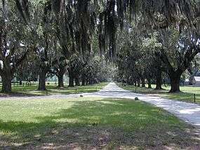
Boone Hall in Mount Pleasant | ||
| ||
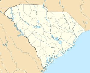 Location of Mount Pleasant in South Carolina | ||
| Coordinates: 32°47′13″N 79°52′35″W / 32.78694°N 79.87639°WCoordinates: 32°47′13″N 79°52′35″W / 32.78694°N 79.87639°W | ||
| Country | United States | |
| State | South Carolina | |
| County | Charleston | |
| Government | ||
| • Mayor | Linda Page | |
| Area | ||
| • Total | 52.6 sq mi (136.2 km2) | |
| • Land | 45.1 sq mi (116.8 km2) | |
| • Water | 7.5 sq mi (19.5 km2) | |
| Elevation | 16 ft (5 m) | |
| Population (2010)[1] | ||
| • Total | 67,843 | |
| • Estimate (2015)[2] | 81,317 | |
| • Rank | US: 446th | |
| • Density | 1,505/sq mi (581.0/km2) | |
| Time zone | EST (UTC-5) | |
| • Summer (DST) | EDT (UTC-4) | |
| ZIP codes | 29464-29466 | |
| Area code | 843 | |
| FIPS code | 45-48535[3] | |
| GNIS feature ID | 1224770[4] | |
| Website |
www | |

Mount Pleasant is a large suburban town in Charleston County, South Carolina, United States. It is the fourth-largest municipality in South Carolina, and for several years it was one of the state's fastest-growing areas, doubling in population between 1990 and 2000. The population was 67,843 at the 2010 census,[1] and the estimated population in 2014 was 77,796.[2] It is the third-largest municipality in the Charleston – North Charleston – Summerville metropolitan area, behind Charleston and North Charleston.
At the foot of the Arthur Ravenel Bridge is Patriots Point, a naval and maritime museum, home to the World War II aircraft carrier USS Yorktown, which is now a museum ship. The Ravenel Bridge, an eight-lane highway that was completed in 2005, spans the Cooper River and links Mount Pleasant with the city of Charleston.[5]
History
The site of Mount Pleasant was originally occupied by the Sewee people, an Algonquian language-speaking tribe. The first white settlers arrived from England on July 6, 1680, under the leadership of Captain Florentia O'Sullivan. Captain O'Sullivan had been granted 2,340 acres (950 ha), which included not only the island that bears his name, but also the land that was to become Mount Pleasant. On the earliest map of the time this area was called "North Point".[6]
In 1696, 51 new settlers arrived. Each family was allotted several hundred acres in the area that became known as Christ Church parish. In 1706 the Province of Carolina withstood several attacks by the Spanish and the French from their settlements to the south and were victorious in defeating French invaders in an area known as "Abcaw".
The area of "Abcaw" was Hobcaw Plantation, located between Shem Creek and the Wando River. Later, it was also known as Shipyard Plantation because its deep water and abundance of good timber made it ideal for a prosperous shipbuilding enterprise. Lands adjacent to Hobcaw Point were owned at different times by several different families, many of which maintained ferries which served Mount Pleasant.

On September 24, 1860, a public meeting was held in Mount Pleasant that produced the first secession resolution of the state. The secession convention met in Charleston on December 20, 1860. With the advent of the Civil War, Battery Guerry and an adjacent floating battery between Mount Pleasant and Sullivan's Island were instrumental in defense of the town, as well as attacks on Fort Sumter. The town was also defended by a line of fortifications from Elliot's Creek at Boone Hall to Copahee Sound. Mount Pleasant was the secret training ground for the nine-man crew of the Confederate submarine H. L. Hunley. It was from Breach Inlet in 1864 that this small vessel was launched to attack and sink the USS Housatonic.

The original plank-and-barrel constructed footbidge, later known as the Pitt Street Bridge at the foot of the Old Village area in Mount Pleasant, is the point where the crew of the H.L. Hunley crossed en route to Breach Inlet to test-pilot the famous submarine. The original plank bridge was replaced by a trolley bridge in 1899, before a steel drawbridge was built for vehicle access between Sullivan's Island and Mount Pleasant in 1929. The Pitt Street bridge was dismantled in 1945, and the remains can still be seen in the Intracostal Waterway. The area has been maintained since then as the Pickett Bridge Recreation Area,[7] named after the town's doctor Otis Pickett.
The "Old Village" is Mount Pleasant's oldest neighborhood; the oldest home, 111 Hibben Street (the Hibben House) was constructed in 1755 by Jacob Motte, a French Huguenot.[8] The Old Village is centered on the Pitt Street Shops at the northwestern end of Pitt Street, home to the Pitt Street Pharmacy which was featured on the Food Network[9] and has been in business at this location for more than 60 years.
As a result of the Civil War, slaves were freed who had worked the area plantations; in 1875 in Charleston County, 73% of the population was African American.[10] Some developed Scanlonville, one of the first African-American communities to be formed in the Charleston area after the Civil War, and which still exists today within Mount Pleasant. Robert Scanlon, a former slave and freedman carpenter, purchased the 614-acre (248 ha) property known as Remley's Plantation, bordering Charleston harbor along the Wando River in Mount Pleasant. Robert Scanlon was the president and founder of the Charleston Land Company, formed by 100 poor African-American men of Charleston who pooled their resources and paid $10 per share to purchase large tracts of land in the area. The Charleston Land Company divided it into lots for freedmen seeking to own their own land. Remley's Plantation was divided into farm lots and town lots (which were smaller) to form the community of Scanlonville. The Charleston Land Company and Scanlonville are one of four known cooperative real estate development ventures among African-American freedmen after the Civil War.

West of Scanlonville is Riverside, formerly the largest and oldest of five black beaches in Charleston County, established when public facilities were segregated under state law. Riverside officially opened in 1930 and featured a dance pavilion, athletics field, bathhouse, playground and a boardwalk along the Wando River. Riverside Pavilion was the only venue for black Charlestonians to see musical legends like Duke Ellington, Count Basie, Louis Armstrong, B.B. King, and Ivory Joe Hunter. Music performances at the Pavilion spawned juke joints, or night clubs, in Scanlonville and eventually a hotel called White's Paradise – where James Brown was known to have frequented. After the original park owner died in 1975, operations of the Riverside property were taken over by Charleston County. It eventually sold the property to a real estate company that developed the land as a private gated community.[11]
On September 21, 1989, Mount Pleasant was hit by Hurricane Hugo, a Category Four hurricane. While the town was spared from the worst of the storm (Category 4 conditions were suffered by areas further north of the town), the town and its neighboring barrier islands were still hard-hit. Children who lived through the storm were featured in an early episode of Nickelodeon's Nick News, along with children from Hurricane Andrew. The town experienced its largest growth spurt a year after the storm as more people moved to the area, increasing in a decade from a population of roughly 23,000 in 1990 to one of roughly 47,000 in 2000.
Mount Pleasant is separated from Charleston by the Cooper River. For many years, the town was primarily populated seasonally by Charleston residents wealthy enough to afford summer homes across the river from the Charleston peninsula. The population of Mount Pleasant was centered in an area of the town now known as the "Old Village".[6]
The county seat for Berkeley County was located in Mount Pleasant from 1882 until 1895, when it was moved to Moncks Corner.
In 1928, a bridge from the Charleston Peninsula to Mount Pleasant was built. Spanning Town Creek and the Cooper River and crossing the uninhabited Drum Island, the two-lane Grace Memorial Bridge was opened as a toll bridge. A second and larger bridge, the Silas N. Pearman Bridge, opened in 1966.
On July 16, 2005, the eight-lane Arthur Ravenel Bridge opened for automotive traffic, replacing the two aging bridges. A week before the new bridge, one of the longest cable-stayed bridges in the Western Hemisphere, officially opened, pedestrians were allowed to cross the bridge, and commemorative coins were distributed. Also, a fireworks display was a part of the ceremonies leading up to the actual opening of the bridge. Several cars from the same time period as the Grace Memorial Bridge, including several restored Model A Fords, made a final crossing of the old bridges.[6] The remaining portions of the old bridges were demolished. Local residents watched as the bridges were explosively demolished over several weeks, through the summer of 2006.
In 2004, Mount Pleasant became one of the first cities in the United States to pass a "pay-before-you-pump" gas ordinance.[12]
The Auld Mound, Buzzard's Island Site, Christ Church, Cook's Old Field Cemetery, Long Point Plantation (38CH321), Lucas Family Cemetery, Mount Pleasant Historic District, Oakland Plantation House, Old Berkeley County Courthouse, Paul Pritchard Shipyard, Remley Point Cemetery, Slave Street, Smokehouse, and Allee, Boone Hall Plantation, Charles Pinckney National Historic Site, USS Clamagore (SS-343), USS Laffey (DD-724), and USS Yorktown (CV-10) are listed on the National Register of Historic Places.[13]
Geography
Mount Pleasant is located in central Charleston County at 32°49′23″N 79°50′44″W / 32.82306°N 79.84556°W (32.823189, -79.845477), on the east side of Charleston Harbor and the tidal Wando River. It is bordered to the south by the town of Sullivan's Island and to the west and northwest, across the harbor and river, by the city of Charleston. Over time, the town limits have pushed northeastward from the Old Village area 24 miles (39 km) along U.S. Route 17, nearly as far as Awendaw.
According to the United States Census Bureau, the town has a total area of 52.6 square miles (136.2 km2), of which 45.1 square miles (116.8 km2) is land and 7.5 square miles (19.5 km2), or 14.30%, is water.[1]
Airport
The town of Mount Pleasant is served by the Charleston International Airport. It is located in the City of North Charleston and is about 12 miles (20 km) northwest of Mount Pleasant. It is the busiest passenger airport in South Carolina (IATA: CHS, ICAO: KCHS). The airport shares runways with the adjacent Charleston Air Force Base. Charleston Executive Airport is a smaller airport located in the John's Island section of the city of Charleston and is used by noncommercial aircraft. Both airports are owned and operated by the Charleston County Aviation Authority.
Demographics
| Historical population | |||
|---|---|---|---|
| Census | Pop. | %± | |
| 1880 | 783 | — | |
| 1890 | 1,138 | 45.3% | |
| 1900 | 2,252 | 97.9% | |
| 1910 | 1,346 | −40.2% | |
| 1920 | 1,575 | 17.0% | |
| 1930 | 1,415 | −10.2% | |
| 1940 | 1,698 | 20.0% | |
| 1950 | 1,857 | 9.4% | |
| 1960 | 5,116 | 175.5% | |
| 1970 | 6,155 | 20.3% | |
| 1980 | 14,464 | 135.0% | |
| 1990 | 30,108 | 108.2% | |
| 2000 | 47,609 | 58.1% | |
| 2010 | 67,843 | 42.5% | |
| Est. 2015 | 81,317 | [14] | 19.9% |
| U.S. Decennial Census[15] 2014 Estimate[2] | |||
As of the census of 2010,[3] there were 67,843 people, 19,025 households, and 12,860 families residing in the town. The population density was 1,136.5 people per square mile (438.8/km²). There were 20,197 housing units at an average density of 482.1 per square mile (186.2/km²). The racial makeup of the town was 90.17% White, 7.25% African American, 0.17% Native American, 1.18% Asian, 0.02% Pacific Islander, 0.39% from other races, and 0.82% from two or more races. Hispanic or Latino of any race were 1.33% of the population.
There were 19,025 households out of which 33.9% had children under the age of 18 living with them, 56.9% were married couples living together, 8.3% had a female householder with no husband present, and 32.4% were non-families. 24.1% of all households were made up of individuals and 6.0% had someone living alone who was 65 years of age or older. The average household size was 2.47 and the average family size was 2.99.
In the town the age distribution of the population shows 25.1% under the age of 18, 6.5% from 18 to 24, 35.3% from 25 to 44, 22.8% from 45 to 64, and 10.3% who were 65 years of age or older. The median age was 36 years. For every 100 females there were 92.0 males. For every 100 adult females, there were 88.3 adult males.
The median income for a household in the town was $61,054, and the median income for a family was $71,165. Males had a median income of $50,673 versus $31,640 for females. The per capita income for the town was $30,823. About 3.2% of families and 5.0% of the population were below the poverty line, including 5.3% of those under age 18 and 6.6% of those age 65 or over.
Broadcast television
These TV stations have studios in and broadcast from Mount Pleasant:
- WCBD-TV (2, NBC, CW): owned by Media General
- WCIV-TV (4, ABC, MeTV): owned by (Allbritton Communications)
Government
The town is run by an elected mayor–council government. The town council is composed of the mayor (Linda Page) and eight at-large council members (Bob Brimmer, Joe Bustos, Elton Carrier, Paul Gawrych, Will Haynie, Jim Owens, Gary Santos, Mark Smith).[16] The appointed town administrator is Eric DeMoura.[17]
Public safety
Fire and emergency services
The Mount Pleasant Fire Department has provided fire suppression and emergency services since 1837, initially as a volunteer agency, and today as a full-time fire department. Today, the fire department has 118 paid personnel augmented by 15 volunteers. It is internationally accredited by the Commission on Fire Accreditation International (CFAI). The Mt. Pleasant Fire Department was originally accredited in 2001 becoming the first accredited fire department in the state of South Carolina. Firefighters work twenty-four-hour rotating shifts. The corporate area and its surroundings are served by seven strategically located fire stations. The fire department administrative office is located within the Town Municipal Complex. Mount Pleasant fire stations are staffed daily by 33 personnel. In 2007, under the supervision of Chief Herb Williams and Captain Robert Wronski, the Mount Pleasant Fire Department established a "Paramedic Engine" program, in which firefighters trained as Paramedics will carry the same equipment on the fire engines as in the ambulances. Currently, all engines in Mt Pleasant are now operating as "Paramedic Engines". This means in the event Charleston County EMS is delayed, the Mount Pleasant Fire Department will be able to provide life-saving procedures until the ambulance arrives.
Police
The Mount Pleasant Police Department, a 2006 CALEA Flagship Award recipient,[18] employs 132 sworn officers and 43 civilian personnel, serving the entire municipal population. The police department, which is a nationally accredited agency, sanctioned by the Commission on Accreditation for Law Enforcement Agencies, has adopted the problem-oriented policing philosophy of service delivery, which requires officers to work together with citizens to identify community problems, determine the underlying cause, and develop solutions which address these causes in order to resolve the problem. Led by Chief Carl Ritchie, the police response time to the majority of the calls for service beats the national average. The department has divided the town of Mount Pleasant, which encompasses 52 square miles (135 km2), into seven patrol neighborhoods. Each patrol neighborhood is assigned to a specific officer on each shift, who is responsible for maintaining protection and problem resolution on a continuing basis. The Mount Pleasant Police Department was featured in the November 1996 issue of Good Housekeeping as one of the Top Eight Suburban Police Departments in the nation.
Climate
| Climate data for Mt. Pleasant, South Carolina (Airport), 1981–2010 normals | |||||||||||||
|---|---|---|---|---|---|---|---|---|---|---|---|---|---|
| Month | Jan | Feb | Mar | Apr | May | Jun | Jul | Aug | Sep | Oct | Nov | Dec | Year |
| Average high °F (°C) | 59.0 (15) |
62.8 (17.1) |
69.6 (20.9) |
76.5 (24.7) |
83.2 (28.4) |
88.4 (31.3) |
91.1 (32.8) |
89.6 (32) |
84.9 (29.4) |
77.1 (25.1) |
69.8 (21) |
61.6 (16.4) |
76.1 (24.5) |
| Average low °F (°C) | 38.1 (3.4) |
41.2 (5.1) |
47.2 (8.4) |
53.8 (12.1) |
62.4 (16.9) |
70.2 (21.2) |
73.6 (23.1) |
72.9 (22.7) |
67.8 (19.9) |
57.3 (14.1) |
48.1 (8.9) |
40.6 (4.8) |
56.1 (13.4) |
| Average precipitation inches (mm) | 3.70 (94) |
2.96 (75.2) |
3.71 (94.2) |
2.91 (73.9) |
3.02 (76.7) |
5.64 (143.3) |
6.52 (165.6) |
7.15 (181.6) |
6.10 (154.9) |
3.75 (95.3) |
2.43 (61.7) |
3.11 (79) |
50.99 (1,295.1) |
| Average snowfall inches (cm) | 0.1 (0.3) |
0.2 (0.5) |
0 (0) |
0 (0) |
0 (0) |
0 (0) |
0 (0) |
0 (0) |
0 (0) |
0 (0) |
0 (0) |
0.3 (0.8) |
0.6 (1.5) |
| Average precipitation days (≥ 0.01 in) | 9.5 | 8.6 | 7.9 | 7.7 | 7.8 | 11.9 | 13.0 | 13.2 | 10.0 | 7.3 | 7.0 | 8.7 | 112.6 |
| Average snowy days (≥ 0.1 in) | 0.1 | 0.1 | 0 | 0 | 0 | 0 | 0 | 0 | 0 | 0 | 0 | 0.2 | 0.4 |
| Mean monthly sunshine hours | 179.8 | 189.3 | 244.9 | 276.0 | 294.5 | 279.0 | 288.3 | 257.3 | 219.0 | 223.2 | 189.0 | 170.5 | 2,810.8 |
| Source: NOAA,[19] HKO (sun only, 1961–1990)[20] | |||||||||||||
Notable people
- Ben Bridwell, lead singer of Band of Horses
- Travis Jervey, former NFL player with the Green Bay Packers, San Francisco 49ers, and Atlanta Falcons, Super Bowl Champion 1996, Pro Bowl 1997
- Ronald Motley, trial lawyer
- Darius Rucker, country singer/songwriter
- Melanie Thornton, American/German R&B, pop, dance singer
- D. J. Trahan, PGA Tour golfer
- Abraham J. Turner, major general of the United States Army
- Steve Wood, Anglican bishop
Schools
Mount Pleasant's public schools are part of the Charleston County School District.[21]
Elementary schools (public)
- Belle Hall Elementary School
- Charles Pinckney Elementary School
- East Cooper Montessori Charter School
- James B. Edwards Elementary School
- Jennie Moore Elementary School
- Laurel Hill Primary School
- Mount Pleasant Academy
- Whitesides Elementary School
Middle schools (public)
- East Cooper Montessori Charter School
- Laing Middle School
- Moultrie Middle School
- Thomas Cario Middle School
Both Laing Middle School and Moultrie Middle School served as the town's high schools before Wando High School was built in 1973.
High schools (public)
Private schools
- Christ Our King-Stella Maris Catholic School (Catholic Diocese of Charleston)
- Grades K-8
- Coastal Christian Preparatory School (formerly First Baptist Church School of Mt. Pleasant)
- Grades K-12
- Crown Leadership Academy
- Preschool-12th grade
- Palmetto Christian Academy (operated by East Cooper Baptist Church)
- Preschool-12th grade
- Trident Academy
- University School of the Lowcountry
- Primrose School of Mount Pleasant (infant thru private Pre-K and afterschool)
County parks

The Charleston County Park and Recreation Commission (CCPRC) operates numerous facilities within Charleston County. The following are in Mount Pleasant.[22]
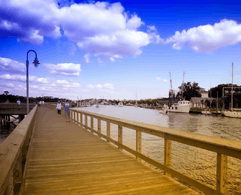
- Mt. Pleasant Pier- Cooper River
- Palmetto Islands County Park
- Splash Island at Palmetto Islands County Park
- Laurel Hill County Park
- Future Park—off of Rifle Range Road
- Shem Creek Pier- Shem Creek
Shopping
Mount Pleasant is growing in commercial retail stores, boutiques, including:
- Mount Pleasant Towne Centre
- Belle Hall Shopping Center
- The Market at Oakland
References
- 1 2 3 "Geographic Identifiers: 2010 Census Summary File 1 (G001): Mount Pleasant town, South Carolina". U.S. Census Bureau, American Factfinder. Retrieved June 29, 2015.
- 1 2 3 "Annual Estimates of the Resident Population: April 1, 2010 to July 1, 2014 (PEPANNRES): South Carolina Incorporated Places". United States Census Bureau. Retrieved June 29, 2015.
- 1 2 "American FactFinder". United States Census Bureau. Retrieved 2011-05-14.
- ↑ "US Board on Geographic Names". United States Geological Survey. 2007-10-25. Retrieved 2008-01-31.
- ↑ "The Pulse Real Estate Charleston, SC » Mt. Pleasant". thepulsecharleston.com.
- 1 2 3 "Mt. Pleasant". Charleston Private Boat Tours.
- ↑ "Crisp, Adam. Otis Picket Bridge Recreation Area (Pitt Street Bridge)"". mountpleasant-sc.patch.com. Retrieved 8 February 2013.
- ↑ "Eddleman, Joe. A Survey of Historic Homes & Building in the Old Village of Mt. Pleasant, SC". mountpleasant-sc.patch.com. Retrieved 8 February 2013.
- ↑ "Brown, Alton. The South Shall Fry Again, Episode AB0101". foodnetwork.com. Retrieved 29 July 2006.
- ↑ Melinda Meeks Hennessy, "Racial Violence During Reconstruction: The 1876 Riots in Charleston and Cainhoy", South Carolina Historical Magazine, Vol. 86, No. 2, (April 1985), 104-106 (subscription required)
- ↑ "Mount Pleasant, SC - Official Website - Scanlonville". tompsc.com.
- ↑ "Rising gas prices mean more thievery at pumps". Rutland Herald. June 5, 2005. Retrieved 2008-01-17.
- ↑ National Park Service (2010-07-09). "National Register Information System". National Register of Historic Places. National Park Service.
- ↑ "Annual Estimates of the Resident Population for Incorporated Places: April 1, 2010 to July 1, 2015". Retrieved July 2, 2016.
- ↑ "U.S. Decennial Census". Census.gov. Retrieved February 17, 2015.
- ↑ "Town Council". Town of Mount Pleasant. Retrieved January 2, 2015.
- ↑ "Town Administrator". Town of Mount Pleasant. Retrieved January 2, 2015.
- ↑ "Calea Flagship Agency Program". calea.org. Archived from the original on 24 June 2009.
- ↑ "NowData – NOAA Online Weather Data". National Oceanic and Atmospheric Administration. Retrieved February 12, 2012.
- ↑ "Climatological Normals of Charleston, South Carolina". Hong Kong Observatory. Retrieved June 9, 2010.
- ↑ "Schools directory". Charleston County School District. Archived from the original on 2007-08-29. Retrieved 2008-01-17.
- ↑ "Charleston County Parks and Recreation - Official Website". ccprc.com.
External links
| Wikimedia Commons has media related to Mount Pleasant, South Carolina. |
- Official website
- Real Estate Market
- The Post and Courier, Charleston Metro Area newspaper
- Patriot's Point Naval and Maritime Museum
- Mount Pleasant at DMOZ
- "Mount Pleasant Magazine", Mount Pleasant Magazine
Municipalities and communities of Charleston County, South Carolina, United States | ||
|---|---|---|
| Cities |  | |
| Towns | ||
| CDP | ||
| Unincorporated communities | ||
| Footnotes | ‡This populated place also has portions in an adjacent county or counties | |