Moura, Portugal
| Moura | |||
|---|---|---|---|
| Municipality | |||
 | |||
| |||
 | |||
| Coordinates: 38°08′N 7°27′W / 38.133°N 7.450°WCoordinates: 38°08′N 7°27′W / 38.133°N 7.450°W | |||
| Country |
| ||
| Region | Alentejo | ||
| Subregion | Baixo Alentejo | ||
| Intermunic. comm. | Baixo Alentejo | ||
| District | Beja | ||
| Parishes | 8 | ||
| Government | |||
| • President | José Pós de Mina (CDU) | ||
| Area | |||
| • Total | 958.46 km2 (370.06 sq mi) | ||
| Population (2011) | |||
| • Total | 15,167 | ||
| • Density | 16/km2 (41/sq mi) | ||
| Time zone | WET/WEST (UTC+0/+1) | ||
| Website | http://www.cm-moura.pt | ||


Moura (Portuguese pronunciation: [ˈmowɾɐ]) is a city and a municipality in the District of Beja in Portugal. The population in 2011 was 15,167,[1] in an area of 958.46 km².[2] The city itself had a population of 8,459 in 2001.[3]
The current Mayor is José Pós de Mina, elected by the Unitarian Democratic Coalition. The municipal holiday is 24 June.
It is home to Moura Photovoltaic Power Station, one of Europe's largest solar-power facilities.
It is also home to one of the best historical restaurants in the region of Alentejo (being featured in various international travel guides), The Fronteiro-Mor.
Parishes
Administratively, the municipality is divided into 5 civil parishes (freguesias):[4]
- Amareleja
- Moura (Santo Agostinho e São João Baptista) e Santo Amador
- Póvoa de São Miguel
- Safara e Santo Aleixo da Restauração
- Sobral da Adiça
Town Twinning
 Moura, Australia
Gallery
 Moura, Portugal
 Moura, Portugal
 Moura, Portugal
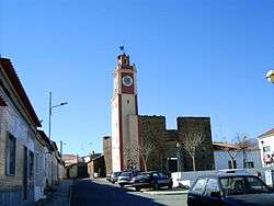 Moura, Portugal
 Moura, Portugal
See also
References
- ↑ Instituto Nacional de Estatística
- ↑ Direção-Geral do Território
- ↑ UMA POPULAÇÃO QUE SE URBANIZA, Uma avaliação recente - Cidades, 2004 Nuno Pires Soares, Instituto Geográfico Português (Geographic Institute of Portugal)
- ↑ Diário da República. "Law nr. 11-A/2013, page 552 79" (pdf) (in Portuguese). Retrieved 28 July 2014.
External links
This article is issued from Wikipedia - version of the 1/25/2016. The text is available under the Creative Commons Attribution/Share Alike but additional terms may apply for the media files.