Mount Umunhum
| Mount Umunhum | |
|---|---|
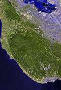
 Mount Umunhum from the northeast | |
| Highest point | |
| Elevation | 3,489 ft (1,063 m) NAVD 88[1] |
| Prominence | 586 ft (179 m) [1] |
| Coordinates | 37°09′38″N 121°53′55″W / 37.1605016°N 121.8985666°WCoordinates: 37°09′38″N 121°53′55″W / 37.1605016°N 121.8985666°W [2] |
| Geography | |
| Location | Santa Clara County, California, United States |
| Parent range | Santa Cruz Mountains |
| Topo map | USGS Los Gatos |
| Geology | |
| Age of rock | Oligocene |
| Climbing | |
| Easiest route | None (closed to public, restricted access) |
Mount Umunhum (Ohlone, meaning resting place of the hummingbird)[3] is the fourth-highest peak in California's Santa Cruz Mountains (after Loma Prieta, Crystal Peak, and Mt. Chual). The mountain is situated in Santa Clara County, south of San Jose. It is sometimes referred to as Mount Um by locals.[4] Most of the mountain is within the Sierra Azul Open Space Preserve.
The mountain is topped by a five-story concrete radar tower, known locally as "the Cube" or "the Box".[5] The tower was part of Almaden Air Force Station, a radar surveillance post which operated from 1958 to 1980.[6] The Cube, which housed an 85.5-ton AN/FPS-24 radar, was completed in 1962 and used to watch for hostile aircraft during the Cold War.
The summit is closed to the public due to hazardous materials and unsafe, partially demolished structures from the former Air Force station. Plans are underway to clean it up and restore it for public use.[7][8] The demolition of the cube was considered, but in May 2016, the Santa Clara County Board of Supervisors listed it on the County Heritage Resource Inventory, giving it official historic status and protecting it from demolition.[9] In summer 2017, a mountain biking and hiking trail to the summit will be opened, once facilities at the summit have been completed.[10] It will be a spur of the Bay Area Ridge Trail.[11]

The mountain is also the site of the Bay Area NEXRAD weather radar.[12] The high elevation is necessary for line of sight in the region's varied terrain, but it also limits the ability to detect storms with bases lower in the atmosphere.
References
- 1 2 "Mount Umunhum, California". Peakbagger.com.
- ↑ "Mount Umunhum". Geographic Names Information System. United States Geological Survey.
- ↑ "Sierra Azul Open Space Preserve". Midpeninsula Regional Open Space District. Retrieved 2008-04-11.
- ↑ Boxer, Barbara (2009-10-20). "Opinion: It's past time for federal government to clean up Mount Um". San Jose Mercury News. San Jose, California. ISSN 0747-2099. Retrieved 2014-03-05.
- ↑ Rogers, Paul (May 29, 2009). "Stalled plans for park on 'Mount Um' gaining ground". San Jose Mercury News. Retrieved March 1, 2012.
- ↑ "Almaden AFS, CA Site History". Radar Museum. Air Defense Radar Veterans Association. Retrieved February 27, 2012.
- ↑ "Mt. Umunhum Conservancy". Retrieved 2013-07-02.
- ↑ "Mt. Umunhum Cleanup and Restoration". Midpeninsula Regional Open Space District. Retrieved 2010-12-20.
- ↑ "Mount Umunhum cube to stay: Cold War relic gets historic designation". San Jose Mercury News. 10 May 2016. Retrieved 23 May 2016.
- ↑ "Midpeninsula Regional Open Space District - Mount Umunhum Summit Project Timeline". Retrieved 2016-09-21.
- ↑ "2015 annual report" (PDF). Bay Area Ridge Trail Council. Retrieved August 27, 2016.
- ↑ "NOAA Agencies Partner with the Private Sector" (PDF). National Oceanic and Atmospheric Administration.
External links
| Wikimedia Commons has media related to Mount Umunhum. |
- "Mt. Umunhum Clean Up and Restoration". Midpeninsula Regional Open Space District.
- Mount Umunhum: Return to the Summit. San Francisco, California: KQED QUEST. May 26, 2011. Retrieved 2012-01-12. 10m, 18s.
- "Almaden Air Force Station Veterans Association".
- "Umunhum Conservancy, Inc.".