Mount Pearl
| Mount Pearl | |||||
|---|---|---|---|---|---|
| City | |||||
| City of Mount Pearl | |||||
| |||||
|
Motto: "Omnia Ad Dei Gloriam" (Latin) "All things for the glory of God" | |||||
 | |||||
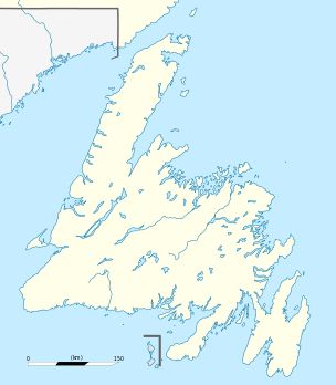 Mount Pearl Location of Mount Pearl in Newfoundland | |||||
| Coordinates: 47°31′08″N 52°48′21″W / 47.51889°N 52.80583°W | |||||
| Country |
| ||||
| Province |
| ||||
| Census division | 1 | ||||
| Settled | 1834 | ||||
| Incorporated (town) | January 11, 1955 | ||||
| Incorporated (city) | July 21, 1988 | ||||
| Government | |||||
| • Mayor | Randy Simms | ||||
| • MHA |
Steve Kent (PC) Paul Lane (Lib) | ||||
| • MP | Seamus O'Regan (Lib) | ||||
| Area[1] | |||||
| • Total | 15.76 km2 (6.08 sq mi) | ||||
| Population (2011) | |||||
| • Total | 24,284 | ||||
| • Density | 1,540.9/km2 (3,991/sq mi) | ||||
| Time zone | Newfoundland Time (UTC-3:30) | ||||
| • Summer (DST) | Newfoundland Daylight (UTC-2:30) | ||||
| Area code(s) | 709 | ||||
| Website | mountpearl.ca | ||||


Mount Pearl is the second-largest city in Newfoundland and Labrador, Canada. The city is located southwest of St. John's, on the eastern tip of the Avalon Peninsula on the island of Newfoundland. Mount Pearl is part of the St. John's metropolitan area, the 20th largest metropolitan area in Canada.
History
Mount Pearl dates back to 1829, when Commander James Pearl and his wife, Lady Anne Pearl, arrived in Newfoundland with a Crown grant of one thousand acres (4 km²) of land, a reward for Commander Pearl's 27 years of distinguished service in the Royal Navy. In 1830, Commander Pearl built a house upon the most elevated section of his estate and named it Mount Cochrane in honour of then-governor Sir Thomas Cochrane. After the governor left Newfoundland, Pearl renamed the site Mount Pearl. Pearl was made a Knight of the Royal Guelphic Order of Hanover and received the honour of Knight Bachelor from Queen Victoria. He died suddenly at his Mount Pearl estate on January 13, 1840, at the age of 50 years. In 1844, Sir James Pearl's wife, Lady Anne, moved to London, England. John Lester, who had come from Devonshire, England to work for James Pearl, continued working the Pearl Estate, leasing it from Lady Anne Pearl for another 14 years. In her will, she left John Lester 100 acres (0.40 km2) of land called "Anna Vale", (present day Glendale) which he later sold. The Pearl estate eventually came into the hands of Andrew Glendenning, who worked it as successful farmland well into the 1920s. John Lester purchased other land (124 acres opposite the Pearl Estate on Brookfield Road) from Edward Dunscomb and later inherited another 50 acres (200,000 m2) on Old Placentia Road (present day Admiralty Wood) from Pearl's sister, Eunice Blamey. John Lester died in 1893 leaving his estate, called "FairMead", to sons Ashton and James. Fairmead is the site of Lester's Market today.[2]
Development
In the 1930s and 1940s, Mount Pearl became the meeting place of affluent members of society and lovers of horseracing. A large open air gallery, with benches for spectators to view surrounding lands was erected on "The Mount" in the 1940s. Horseracing continued to be prominent and Mount Pearl began to develop into something of a summer resort for St. John’s residents. Increased population during summer months led to increased population year round and eventual residential and industrial development.[2]
Incorporation
With the population growing quickly, there was increased demand for municipal government. As a result, Mount Pearl held its first election in 1955 which resulted in Hayward Burrage becoming the first mayor of the Town of Mount Pearl. The town was incorporated on January 11, 1955 and had population of 1,979. On July 21, 1988, the Town of Mount Pearl became the third community in Newfoundland and Labrador to be granted city status. Today, it remains one of the largest cities within the province, with a population in 2011 of 24,284.[2][3]
Geography
Mount Pearl is located on the northeast coast of the Avalon Peninsula in southeast Newfoundland, and on the Atlantic Ocean.[4] The city is bounded on the north, south and east by the city of St. John's and on the west by the town of Paradise, which has led to the limited availability of undeveloped land and is causing the city to be a more dense urban centre by increasing its density.
Southlands, a neighbourhood in St. John's was a large part of Mount Pearl's future growth plans for filling in the area between its boundary and Cochrane Pond Provincial Park. In 1998, the Provincial Government granted the land to the City of St. John's.[5]
Climate
| Climate data for Mount Pearl | |||||||||||||
|---|---|---|---|---|---|---|---|---|---|---|---|---|---|
| Month | Jan | Feb | Mar | Apr | May | Jun | Jul | Aug | Sep | Oct | Nov | Dec | Year |
| Record high °C (°F) | 18 (64) |
15 (59) |
17 (63) |
25 (77) |
29 (84) |
32 (90) |
33 (91) |
31 (88) |
30 (86) |
26 (79) |
22 (72) |
19 (66) |
33 (91) |
| Average high °C (°F) | 0.6 (33.1) |
0.1 (32.2) |
2.2 (36) |
7.0 (44.6) |
12.3 (54.1) |
17.2 (63) |
23.1 (73.6) |
22.2 (72) |
18.4 (65.1) |
12.2 (54) |
7.6 (45.7) |
3.1 (37.6) |
10.5 (50.92) |
| Average low °C (°F) | −6.3 (20.7) |
−6.6 (20.1) |
−4.5 (23.9) |
−0.4 (31.3) |
3.1 (37.6) |
7.8 (46) |
13.0 (55.4) |
13.7 (56.7) |
10.2 (50.4) |
6.1 (43) |
1.4 (34.5) |
−3.2 (26.2) |
2.86 (37.15) |
| Record low °C (°F) | −20.3 (−4.5) |
−21 (−6) |
−19.5 (−3.1) |
−13 (9) |
−5.2 (22.6) |
−2.4 (27.7) |
2.1 (35.8) |
2.6 (36.7) |
1.7 (35.1) |
−4.6 (23.7) |
−11.5 (11.3) |
−18.6 (−1.5) |
−21 (−6) |
| Source: Environment Canada[6] | |||||||||||||
Demographics
| Historical populations | ||
|---|---|---|
| Year | Pop. | ±% |
| 1961 | 2,785 | — |
| 1971 | 7,211 | +158.9% |
| 1981 | 11,543 | +60.1% |
| 1991 | 23,689 | +105.2% |
| 1996 | 25,531 | +7.8% |
| 2001 | 24,964 | −2.2% |
| 2006 | 24,671 | −1.2% |
| 2011 | 24,284 | −1.6% |
The city is located within Newfoundland's census Division 1.
According to the Canada 2011 Census:
- Population: 24,284
- % Change (2006–2011): -1.6
- Dwellings: 9,645
- Area (km²): 15.76
- Density (persons per km²): 1,540.9
In 2011, Mount Pearl was 98.0% White 1.3% Aboriginal, and 0.7% Other.
Government
Municipal
The city is represented by a mayor, deputy mayor and five councillors. Elections in Mount Pearl are held every four years on the last Tuesday in September, the last election was held on September 24, 2013. The current mayor is Randy Simms. He became mayor in 2007 after then-Mayor Steve Kent was elected to the Newfoundland and Labrador House of Assembly.[7]
References
- ↑ Statistics Canada. "Population and dwelling counts, for Canada, provinces and territories, and census subdivisions (municipalities), 2011 and 2006 censuses". Retrieved 2015-06-21.
- 1 2 3 http://www.mountpearl.ca/downloads/economic_dev/community_review.pdf
- ↑ http://www12.statcan.ca/census-recensement/2006/dp-pd/prof/92-591/details/page.cfm?Lang=E&Geo1=CSD&Code1=1001542&Geo2=PR&Code2=59&Data=Count&SearchText=mount pearl&SearchType=Begins&SearchPR=01&B1=All&Custom=
- ↑ Mount Pearl - The Canadian Encyclopedia
- ↑ http://www.cbc.ca/news/canada/newfoundland-labrador/land-ahoy-wells-urges-province-to-amalgamate-cities-1.669093
- ↑ Environment Canada—, accessed 28 November 2009
- ↑ CBC Newfoundland and Labrador | Municipal Election 2009 | Mount Pearl
External links
 |
St. John's | | ||
| Paradise | |
St. John's | ||
| ||||
| | ||||
| St. John's |
| Population over 100,000 | |
|---|---|
| Population over 20,000 | |
| Population over 10,000 | |
| Population under 10,000 | |
| |
| Census divisions | |
|---|---|
| Cities | |
| Other communities |
|
| |
Coordinates: 47°31′08″N 52°48′21″W / 47.51889°N 52.80583°W